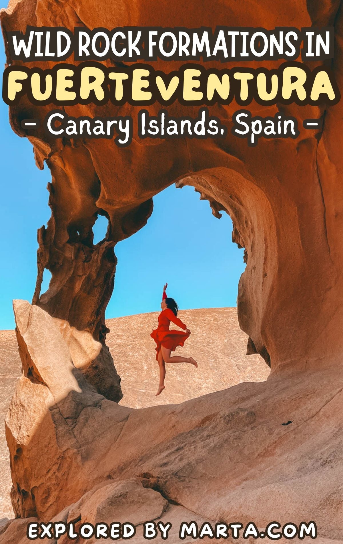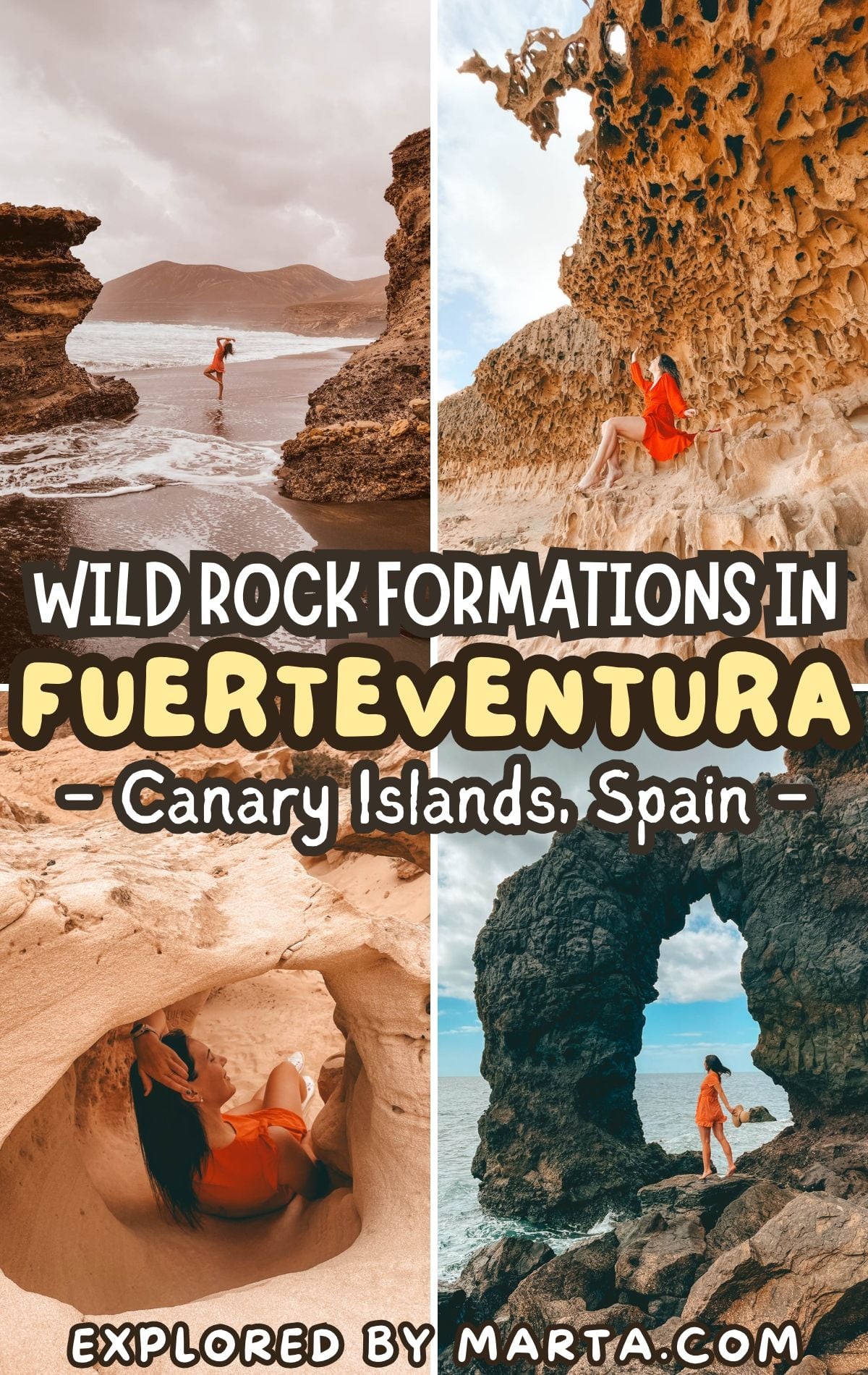
15 bizarre rock formations in Fuerteventura, Spain
This post may contain affiliate links. If you use these links to make a purchase or booking, I may earn a small commission at no extra cost to you! Thank you for your support!
Fuerteventura is the oldest of the Canary Islands, and you can see it in its rocks. Millions of years of wind, waves, and salt have turned the rock formations in Fuerteventura into some of the strangest shapes I’ve ever seen.
A rock that looks like a crocodile, a beach covered in “popcorn,” cliffs full of honeycomb holes… But most of these spots have no signs at all, and a few are really hard to find without exact directions.
We spent four weeks exploring the island, often on bumpy gravel roads in our tiny Fiat 500, hunting down these bizarre shapes. For every spot, I’m sharing where it is, how we got there, and what to watch out for. Let’s go rock hunting! 🪨
1. Arco de las Peñitas
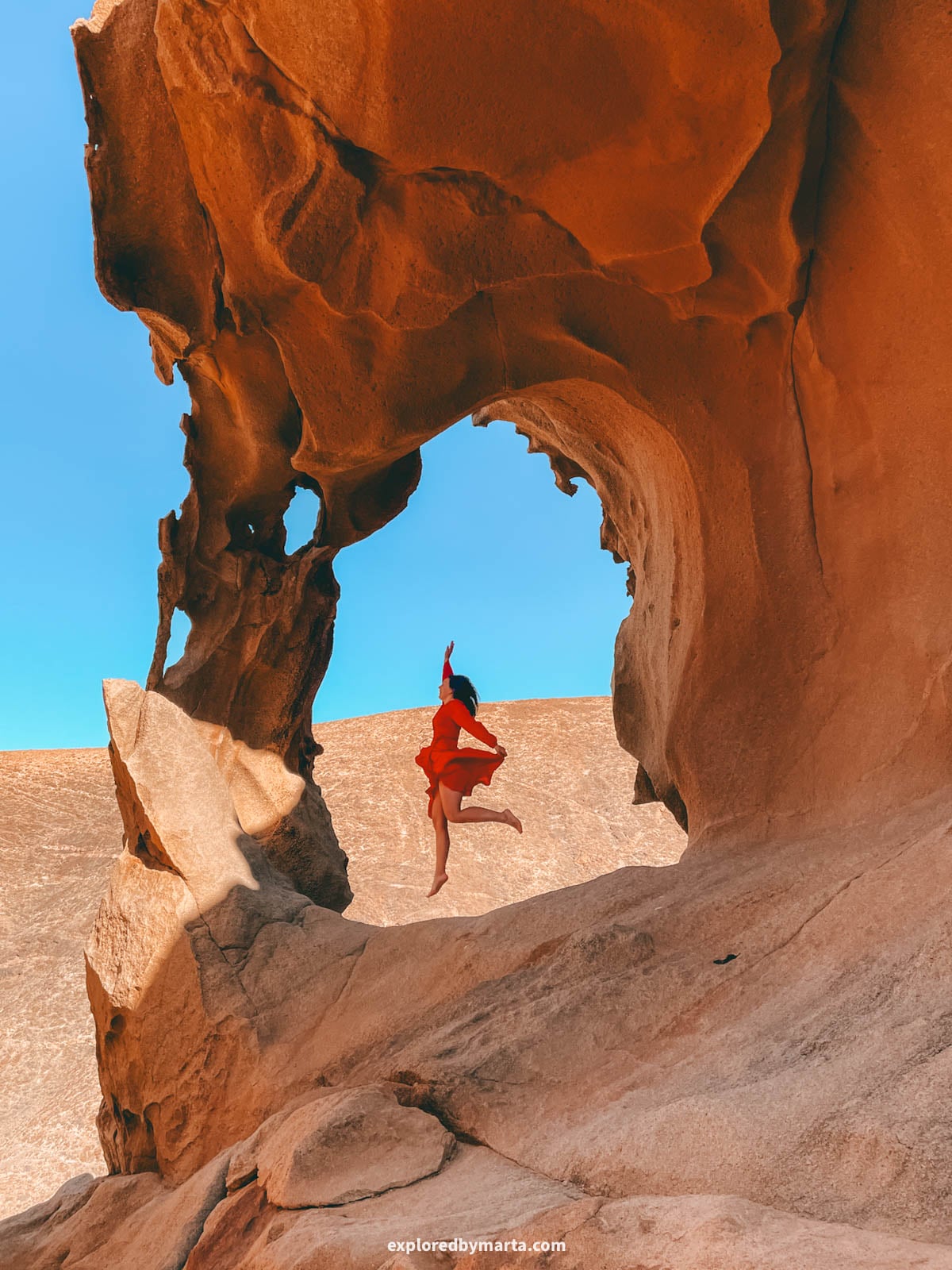
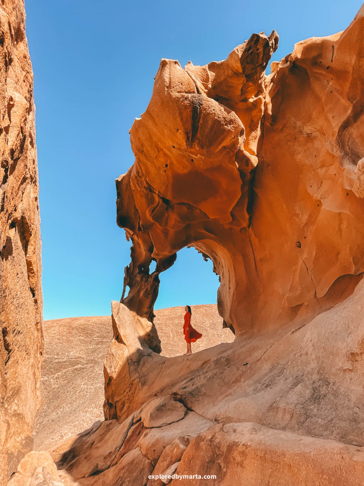
Arco de las Peñitas is one of the most famous rock formations in Fuerteventura, and rightly so. It was one of my favorite places on the whole island – we even went there twice.
The arch sits above Barranco de las Peñitas, a ravine full of huge boulders of syenite, a hard rock that looks a lot like granite.
It’s not an official tourist attraction, so there are no signposts or info boards. But because of its beauty, the arch has become one of the most visited spots in Fuerteventura for anyone who doesn’t mind a little uphill hike. I certainly don’t mind one!
To get there, leave your car at the big gravel parking area at the bottom of the ravine (exact location below), walk toward a country house, and keep following the road past it. On your right, you’ll see the ravine with big boulders and palm trees.
After the ravine, a path heads uphill toward the arch. At first, it’s easy to follow, but later it splits in many directions. Just keep your map open and keep heading toward the arch along one of the dirt trails leading there!
The last part is a bit steep, and right before we reached the arch, we had to climb up a massive boulder. It’s a bit tricky, but nothing too difficult or dangerous, even for active kids.
Right after the boulders, the arch appears on your left. The whole climb takes about 20-30 minutes. Standing inside the arch with the whole ravine below you is such a cool feeling!
Tip! Bring water (it gets hot!), wear good shoes (lots of climbing, uneven surface!), and take your time on the way down (the loose gravel can be slippery!).
Location: Arco de las Peñitas – Parking area
2. Barranco de los Enamorados
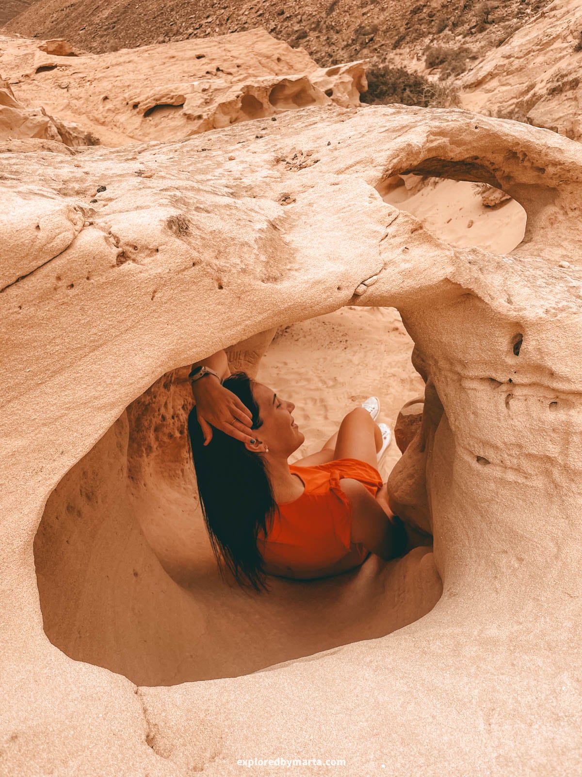
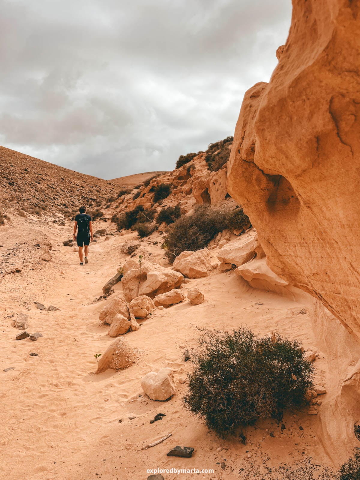
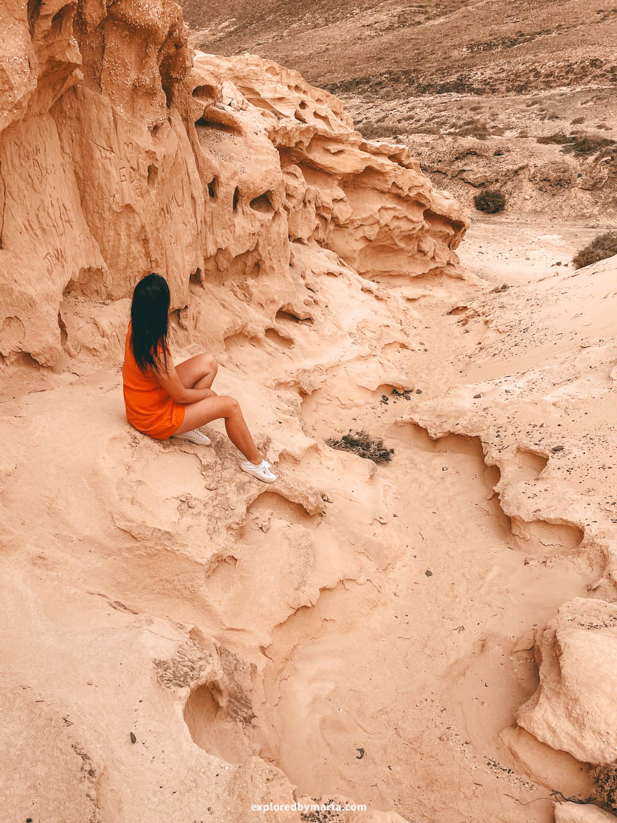
Barranco de los Enamorados, also called Barranco de los Encantados, is an easy hike through a ravine full of bizarre sandstone shapes. The ravine is located in the north of the island, just south of the village of El Cotillo.
I learned that these formations are fossilized sand dunes that formed over 135,000 years ago, when the sea level dropped, and the wind blew sand from the seabed inland. Wind and rain have been carving them ever since!
The beginning of the trail is quite boring. If you want to get to the best part of the ravine with the most beautiful sandstone rock formations, you’ll need to get about 2 kilometers (1.2 miles) into the hike. That’s where all the crazy shapes are.
Although the ravine continues for about another kilometer (0.6 miles), we decided to turn around there and walk back. So unless you enjoy hiking in the middle of nowhere, there’s no real reason to go further than 2 to 2.5 kilometers (1.2 to 1.6 miles).
Tip! As soon as you arrive at a cool spot with unique rocks, don’t forget to explore the side ravines in that area! We found some cool shapes in the side ravines! Also, please don’t carve anything into the rock. The ravine is protected as a site of cultural interest!
Exploring this barranco was one of my favorite adventures in Fuerteventura. Getting to the trailhead is not difficult at all, but it does require driving on a dirt road, just like nearly every wild spot in Fuerteventura. 😅
Location: Barranco de los Enamorados trailhead – Photo location
3. Crocodile Rock
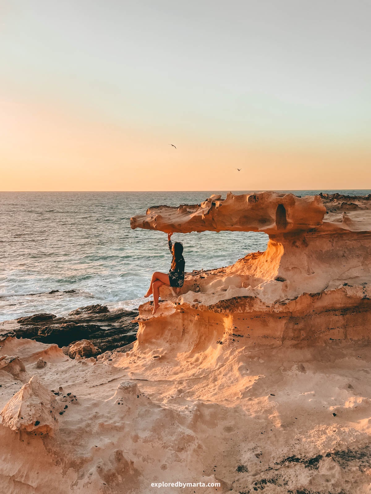
The Crocodile Rock is one of the most fun rocks in Fuerteventura. It’s a sandstone rock formation on the west coast that looks just like the head of a crocodile with its mouth wide open.
The Crocodile Rock sits on the coastal cliffs just north of Playa de las Hermosas, a small beach near La Pared town. It’s about a 1-hour drive from Puerto del Rosario and 1.5 hours from Corralejo.
So, how to find the Crocodile Rock in Fuerteventura?
To get there, first navigate to Playa de las Hermosas beach. Almost the whole road is paved, except for the last couple of hundred meters, so even our small Fiat 500 made it just fine.
We parked on the cliffs right before the beach, but we saw some cars parked right on the beach, too.
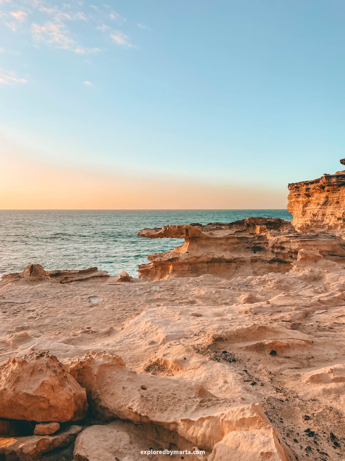
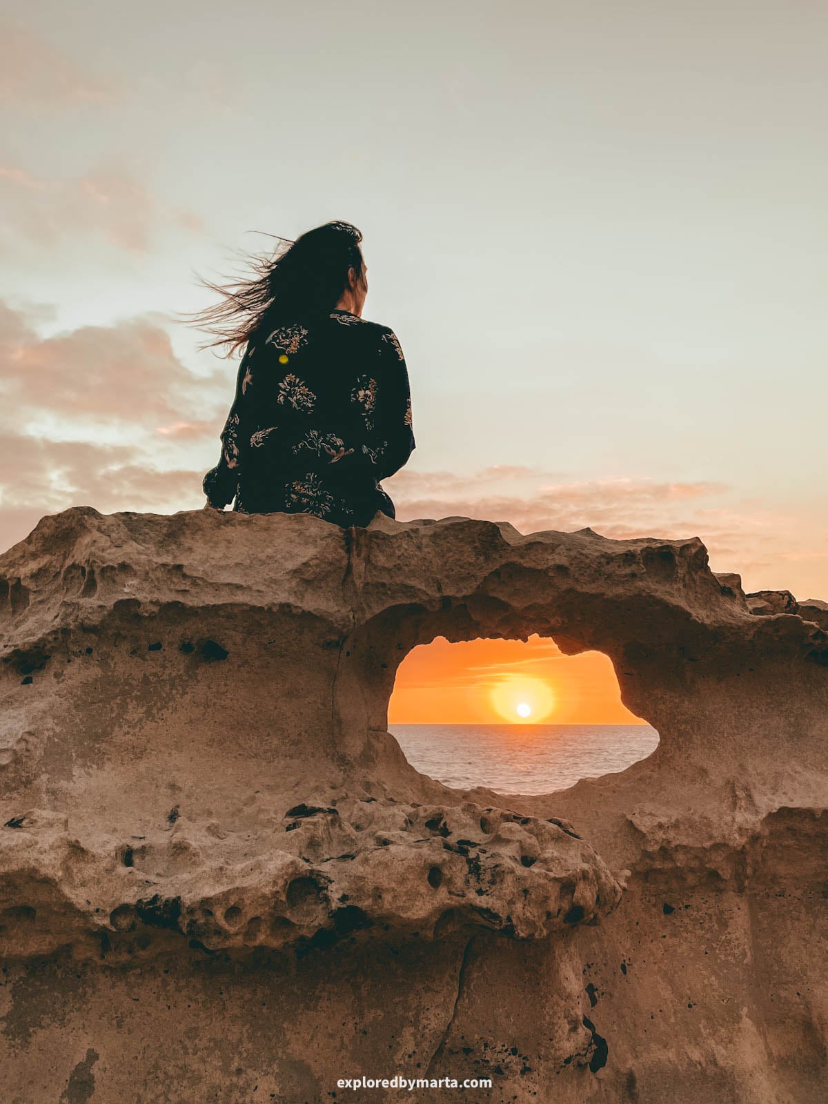
As you approach the beach, look for a small path on your right leading up the cliff. Climb to the top, then follow the coast north for about 300 to 400 meters (980 feet to 1,300 feet) until you reach the Crocodile Rock, as you see in the photo above.
The cliffs here are hard sandstone, so they’re easy to walk on. You’ll pass some cool rock shapes on the way, but the Crocodile Rock stands out, sitting in a small dip below the rest of the coastline.
It’s probably one of the coolest photo spots on the island, but please don’t climb on the upper part of the rock. It’s more fragile than it looks and could break under someone’s weight.
For me, it was one of my favorite discoveries in Fuerteventura. We stayed here for the sunset, too.
Location: Crocodile Rock – Parking area
4. Popcorn rocks at Playa del Bajo de la Burra
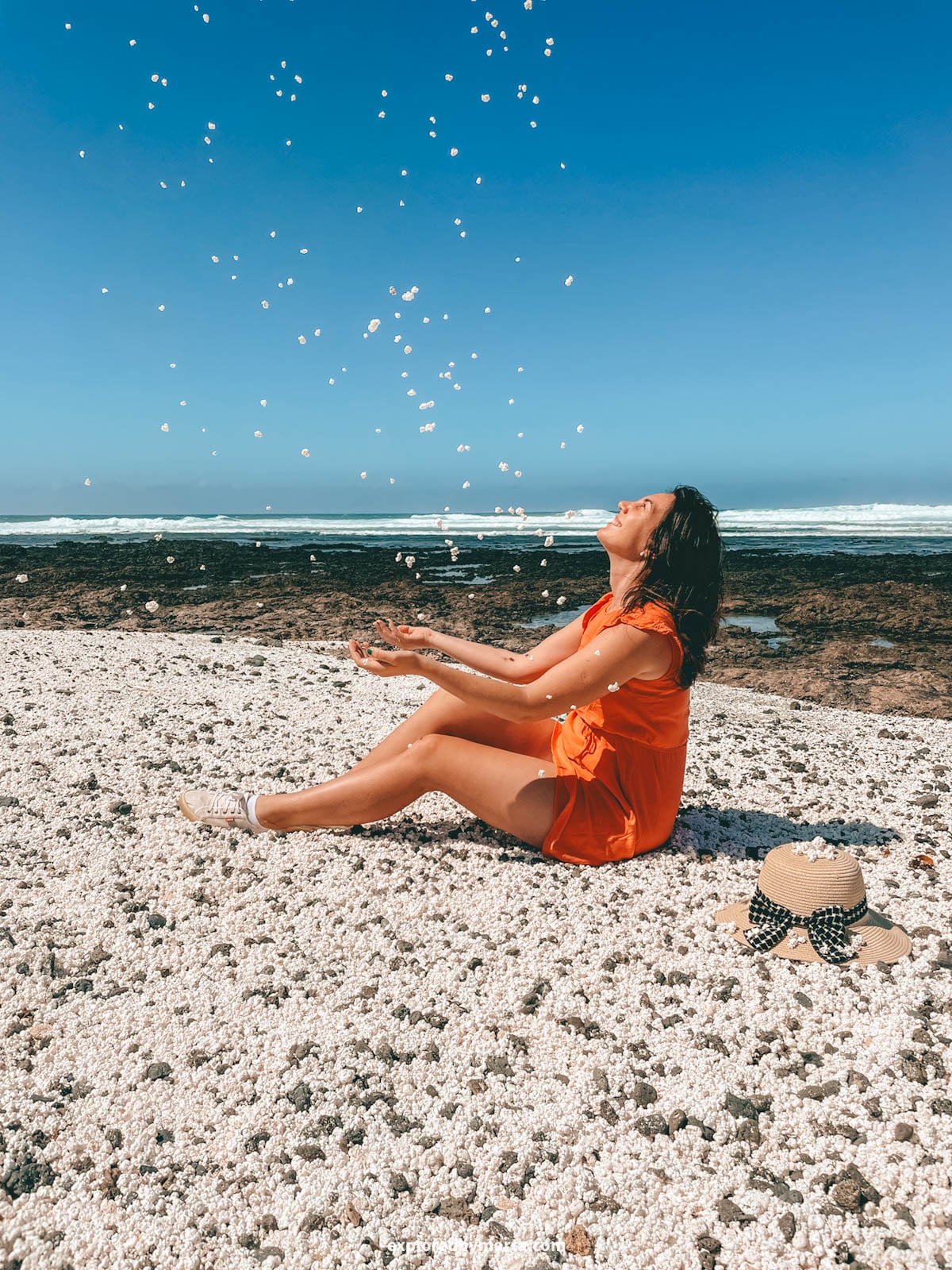
Have you ever seen a beach full of popcorn?
It sounds more like a fantasy than reality, haha. But at Playa del Bajo de la Burra on the north coast of Fuerteventura (a short drive west of Corralejo), the whole shore is covered in small white pieces that look exactly like popcorn.
Of course, it’s not real popcorn, and it’s not even rock. They’re rhodoliths, a type of red algae that grows only about 1 millimeter (0.04 inches) per year. Once they wash ashore, the sun bleaches them white.
I learned that some of these little pieces can be thousands of years old. That made me look at them in a completely different way – every handful is a tiny piece of ocean history. 😍
Important notice to my fellow travelers! Taking the rocks home is forbidden and can get you a fine, so please leave them where they are. Just take your photos and videos and leave the rocks where their real home is.
This place is one of those rare places that is actually a quick stop and easy to include in any Fuerteventura itinerary. Don’t miss it!
Location: Popcorn Beach
5. La Columna de Jandía


La Columna de Jandía is a lonely sandstone column on the wild west coast of the Jandía isthmus, the narrow strip of land that connects the Jandía peninsula to the rest of the island.
These spots had no names, so I named them myself when I first wrote about them. About 200 meters (650 feet) away, there’s a narrow crack in the sandstone that I called La Grieta de Jandía.
The whole area, Istmo de Jandía en Barlovento, is one of the most remote places on the island. It’s a sandy, desert-like landscape with its own dunes and empty beaches. We met just one other person there the whole time.
Now, I have to be real with you: this is not an easy place to visit. It’s at least a half-day trip, and the last part means moving along a steep, crumbly sand dune slope by the coast.
The sandstone here is fragile, and we saw several sand slides along the coast. Only go on a calm, dry day, wear proper shoes, stay away from the cliff edges, and never climb on the formations.
We drove a gravel road from the FV-2 highway (it starts here) and used Barranco del Rinconcillo to cross the isthmus.
We parked around here, where the road gets too sandy to drive, and walked the last 2 kilometers (1.2 miles) to the coast.
You can also hike here from La Pared, but it’s about 10 kilometers (6.2 miles) one way. There’s no shade, no water, and patchy cell service, so download your map and bring plenty of water and snacks.
For me, this was one of the most special places we found in Fuerteventura. But it’s only for experienced hikers who are comfortable far off the beaten path.
Location: Istmo de Jandia en Barlovento · La Columna de Jandia · La Grieta de Jandia
6. Bee Cave and honeycomb rocks
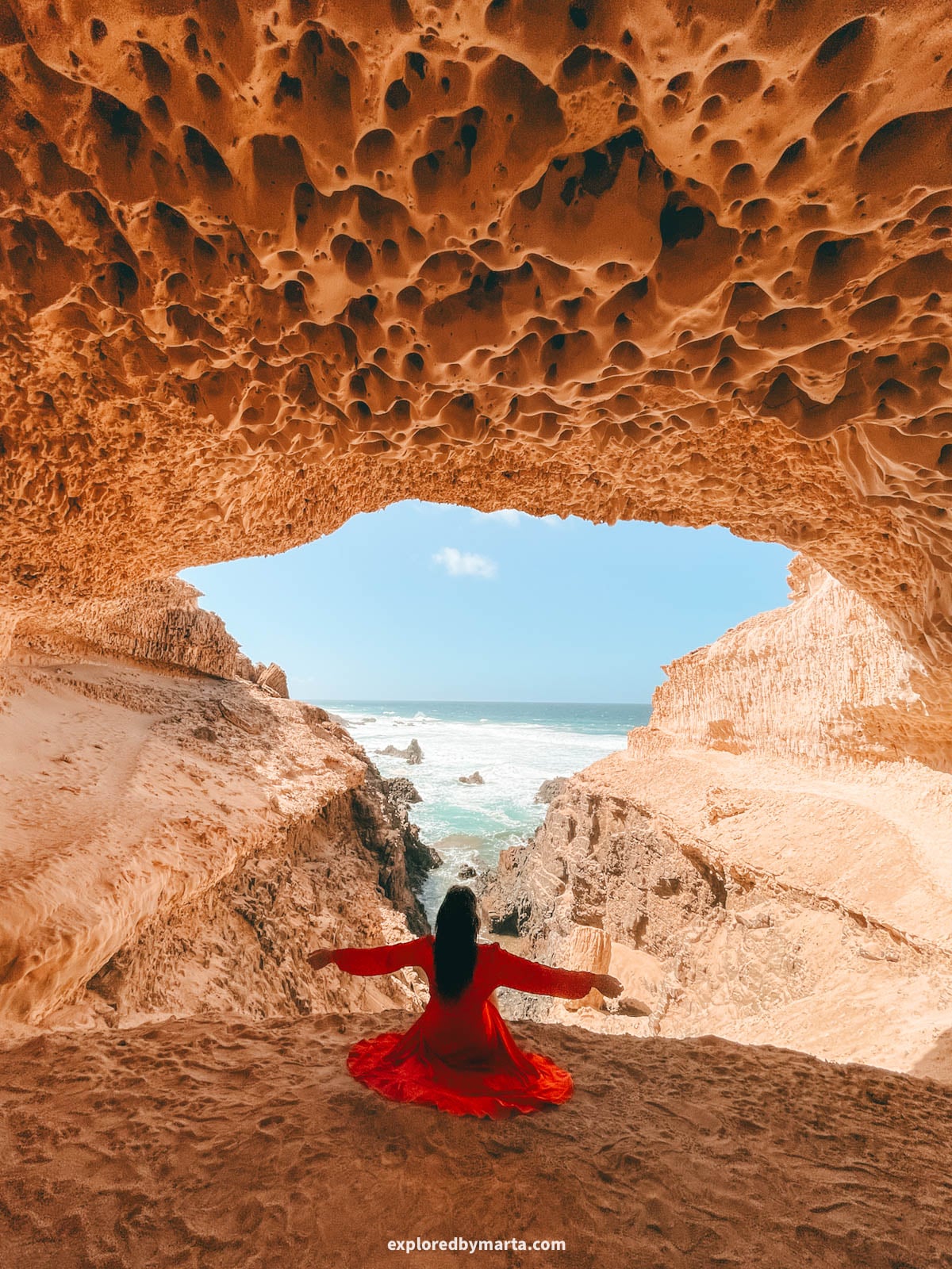
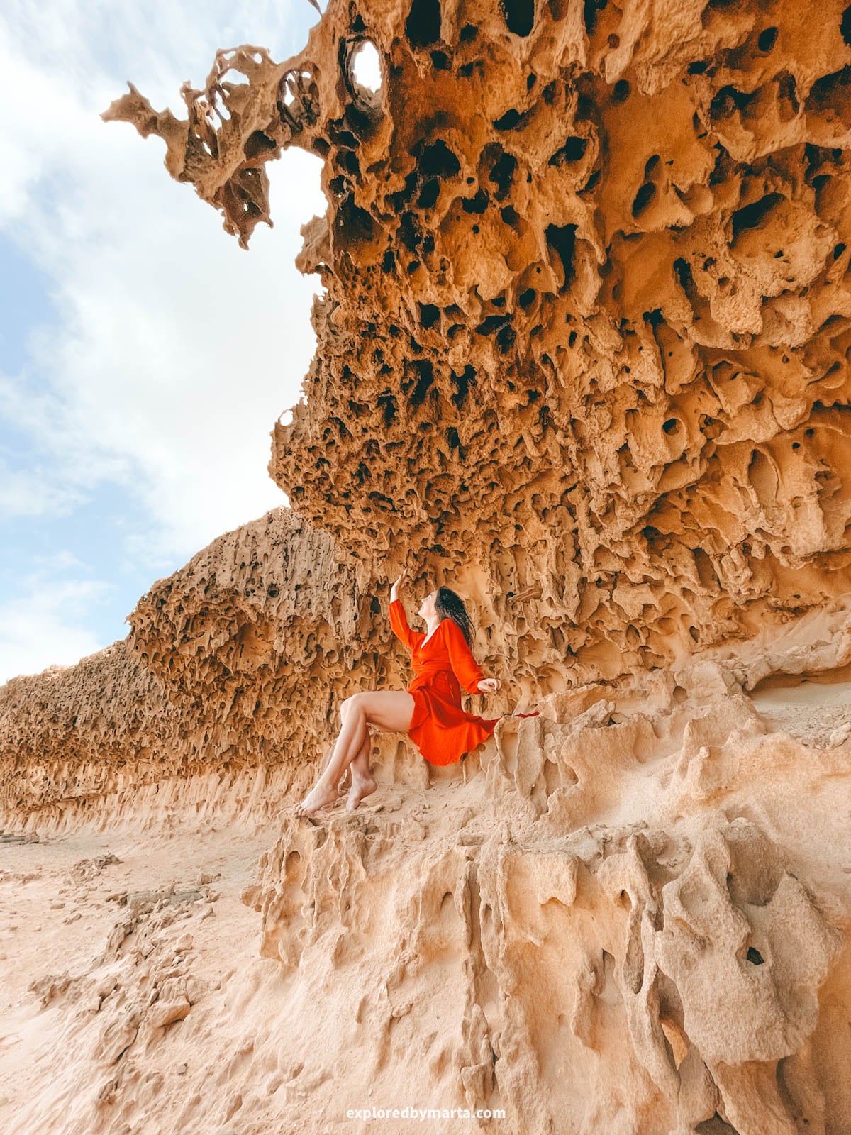
In a remote area south of Playa de Garcey, you’ll find some of the most unique rock formations in Fuerteventura: a coast covered in yellow sandstone full of holes, like giant honeycombs.🐝
Turns out, this pattern is called honeycomb weathering, and the bigger holes are known as tafoni. They form when sea spray soaks into the soft sandstone and the salt slowly breaks it apart, one tiny hole at a time.
The best find in this area is the Bee Cave, a small cave I named after its yellow honeycomb ceiling.
It’s hidden at the end of a narrow cove, and finding it felt like a real treasure hunt. We didn’t know exactly where it was, only that it had to be somewhere along the coastline, so we walked and walked until we found it.
The thing is – the Bee Cave is not an official tourist attraction. It’s just a cool spot in the middle of nowhere with no signs, no cell service, no paved roads, no official trails, so finding it is a bit of a challenge, not a quick stop.
I wrote a full guide on how to find the Bee Cave in Fuerteventura if you’d like more details.
Location: Bee Cave – Honeycomb rocks – Playa de Garcey
7. Arco de Gran Valle
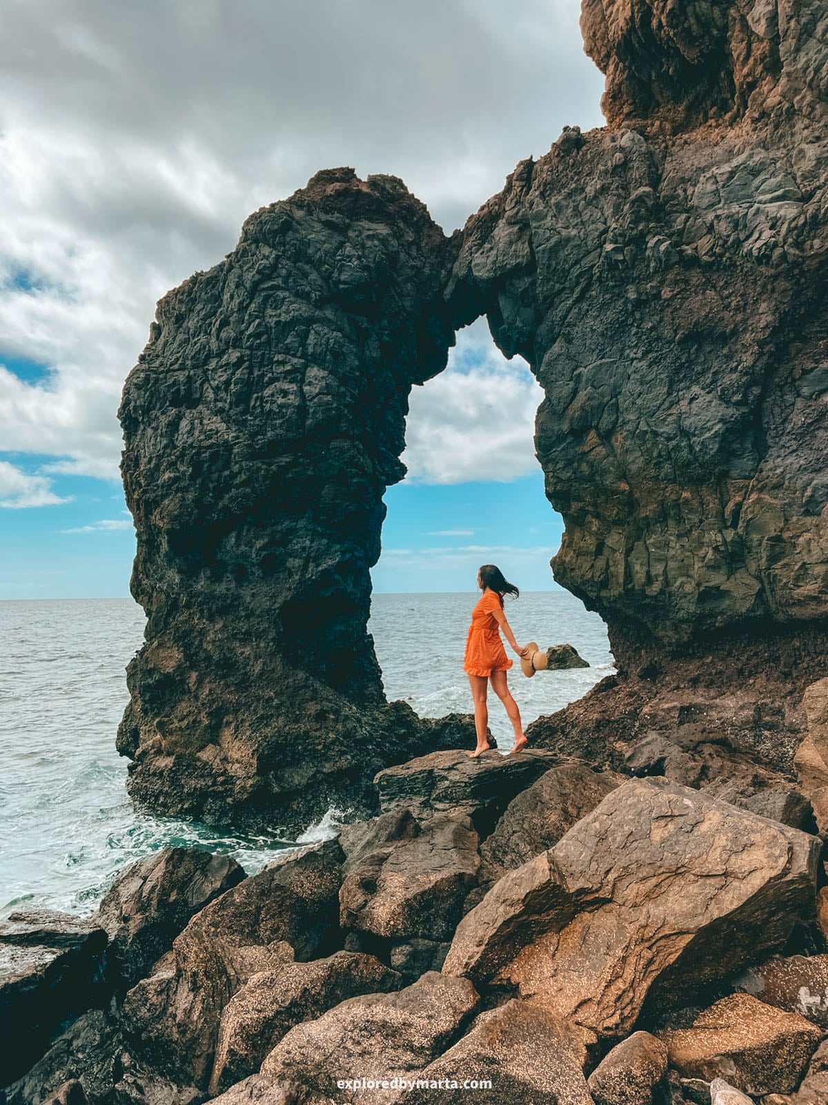
Arco de Gran Valle is a dark lava arch on a remote stretch of the east coast, not far from the Faro de la Entallada lighthouse. I just can’t help but love these kinds of cool rocks!
To be fair, it’s not really a must-visit place in Fuerteventura, and you can only visit the arch if you get there at low tide when the ocean is relatively calm.
The thing is, I like exactly these kinds of hidden and remote places, so there you go.
To get to the arch, we drove the gravel road from Tequital to Playa de Gran Valle and parked right before the beach. It’s a very remote area – we saw only one other person there the whole time.
Then we walked to the south end of the beach, climbed over the rocks, and followed the coast for about 100 meters (330 feet) until we reached the arch. It’s impossible to miss.
Walking those 100 meters along the coastal rocks is the tricky part. If the rocks are wet or the waves are too big, you will get wet and might slip into the ocean. That’s why we chose a calm, sunny day for this place.
Also, don’t forget to download your map before you go, since there’s no cell service at the beach. That’s how things just are in Fuerteventura sometimes, haha.
Location: Arco de Gran Valle – Playa de Gran Valle
8. Arco del Jurado (Peña Horadada)
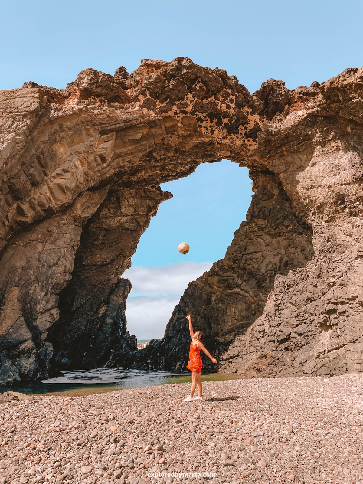
Now, here’s a rock arch that is much easier to find and visit than many other rock formations on this list – Arco del Jurado, also called Peña Horadada, a massive coastal cliff with a giant hole right through it, just a short distance from the famous Ajuy caves.
Horadada means “pierced” in Spanish, and the name fits perfectly. The ocean has punched straight through the rock, leaving an arch so big that people standing under it look tiny. Just look at me and that giant arch!
I’m a sucker for arches and holes in rocks, so this was one of my favorite spots on the west coast. On windy days, the waves come crashing right through the hole, and it’s such a spectacle!
To get there, you have two options: you can drive all the way to the arch on a bumpy gravel road (we did it in our Fiat 500, and it was a bit stressful), or you can leave your car in Ajuy village and walk about 1.5 kilometers (0.9 miles) along the coast to the arch.
If you’re visiting the famous Ajuy caves and want to see more natural wonders in Fuerteventura, this arch is a great option to add to your road trip, whether you come here on foot or by car.
Location: Arco del Jurado
9. Rock formations at Playa de la Solapa
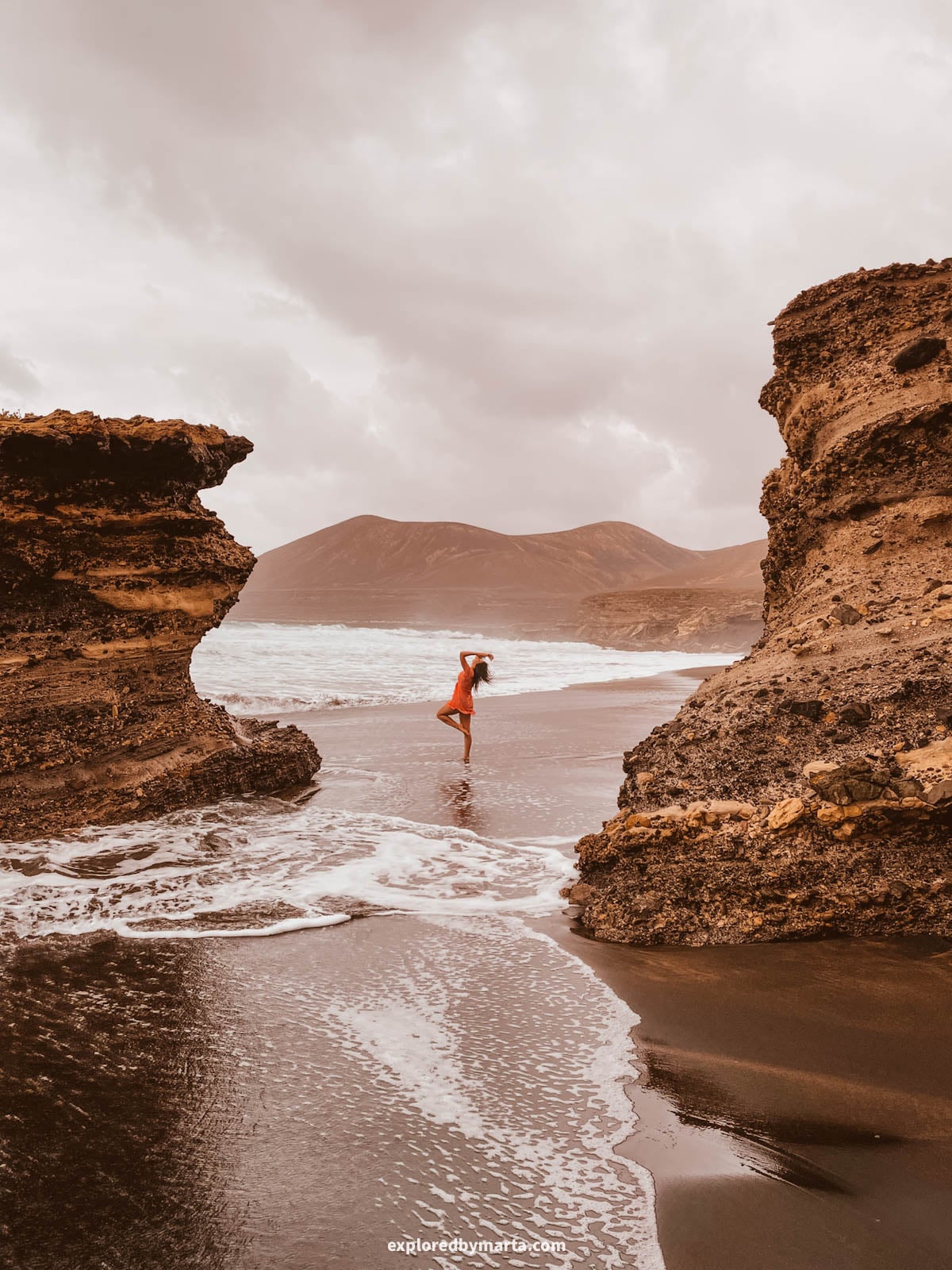
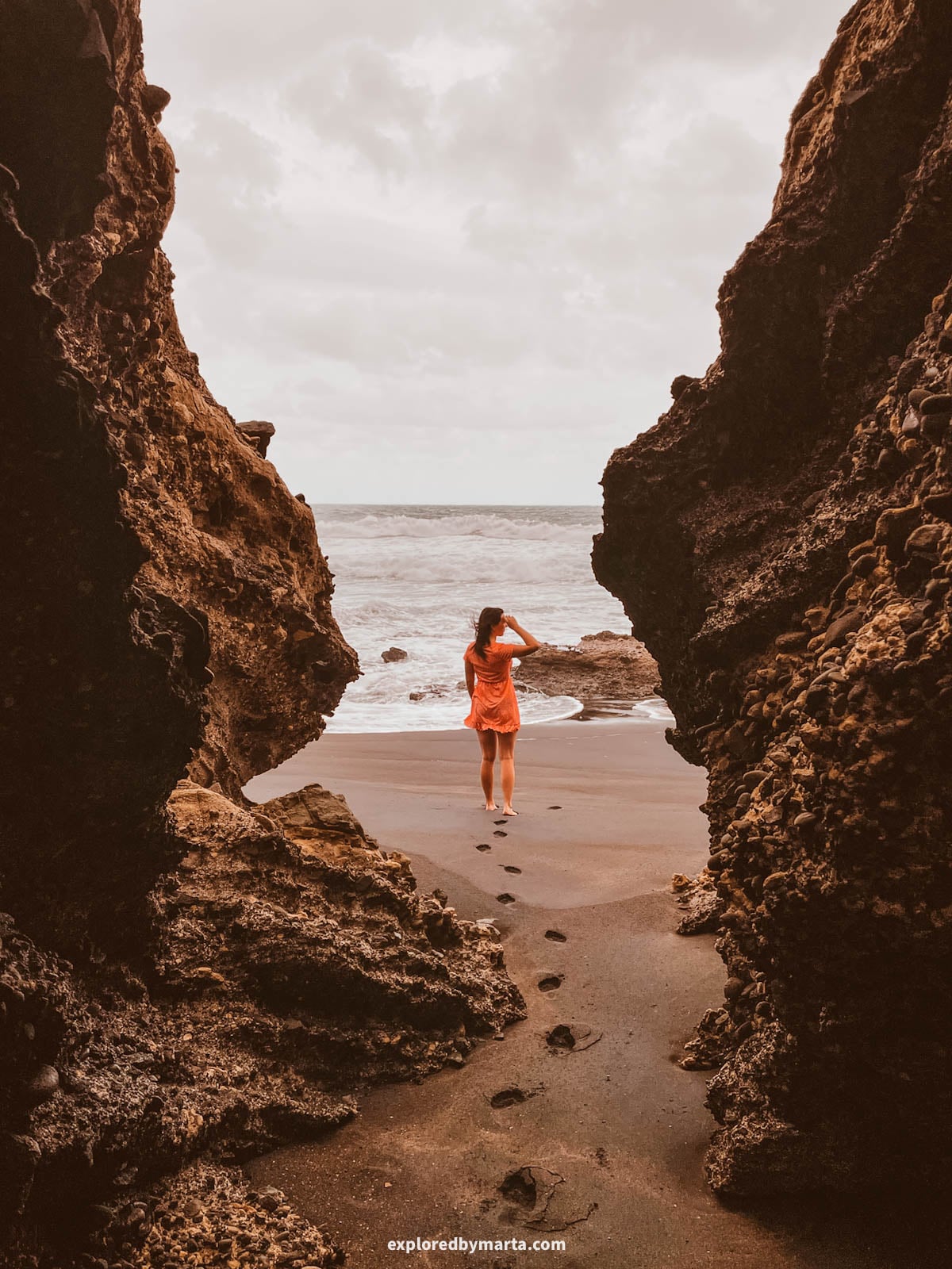
Playa de la Solapa is one of my favorite beaches in Fuerteventura – we loved it so much that we came here twice. It’s a wild black sand beach on the west coast, and it’s full of amazing rock formations.
Huge boulders are scattered across the sand on the south side of the beach, and they make perfect frames for moody photos. At low tide, you can wander right between them.
The dark sand, the giant rocks, and the wild waves give the whole place an otherworldly look. No wonder Marvel picked it as a filming location for Eternals – yes, Angelina Jolie was here!
Just past the boulders, the cliffs are full of sea caves you can walk into at low tide. We counted three or four bigger ones within a few minutes’ walk of the beach.
The last part of the road is gravel, but it was fine for our small Fiat 500. Park on the cliff, walk down to the sand, and head left (south) toward the rocks. Come at low tide, when everything is easier and safer to reach.
For me, Solapa is the best place on the island to see rock formations and sea caves in one visit. Plan at least a couple of hours here – you’ll want to explore every corner.
Location: Rock formations · Solapa beach · Parking at the beach
10. Circular rock near La Pared

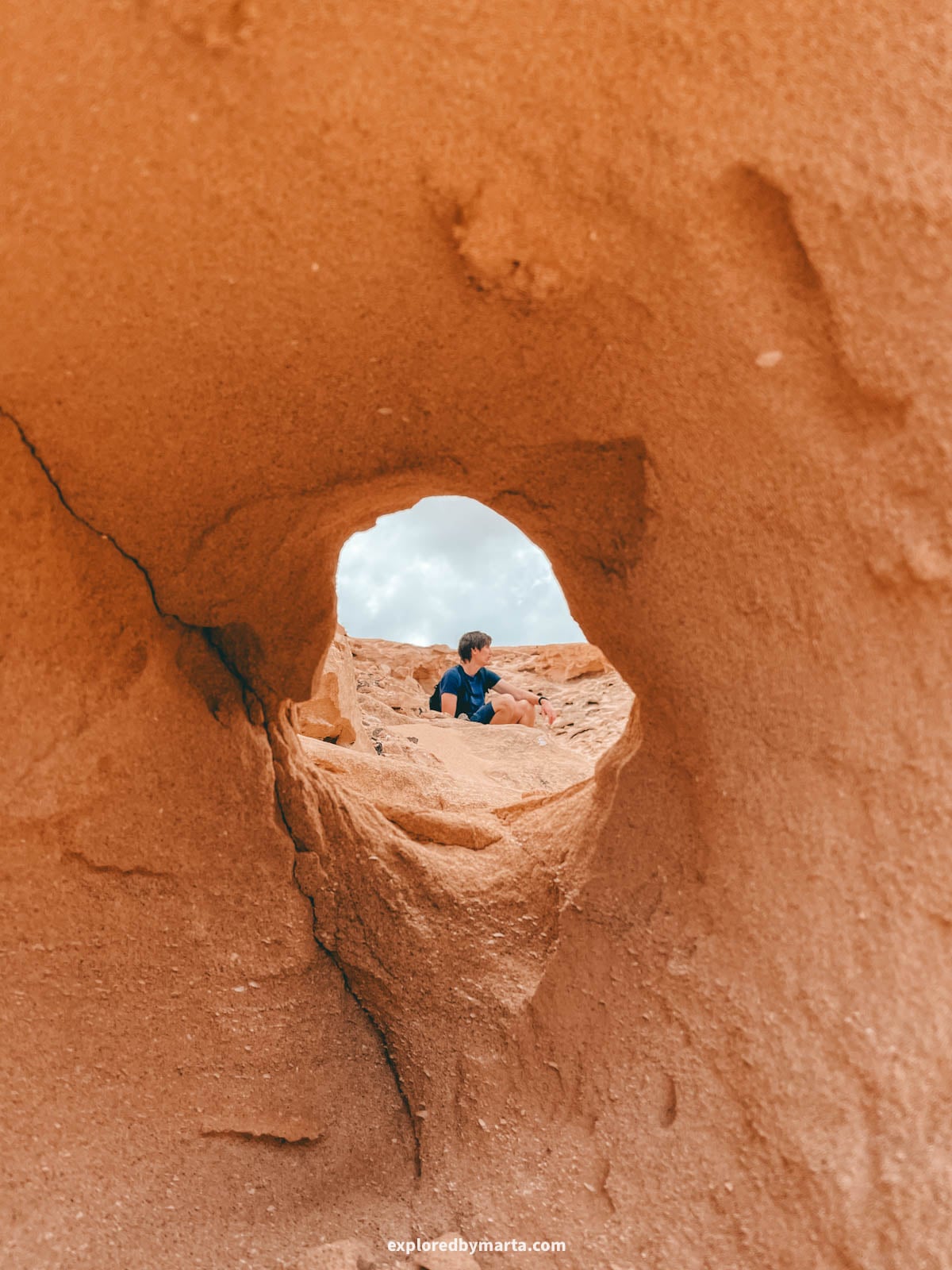
This rock with a circular hole is one of my favorite secret spots in Fuerteventura. It has an almost perfect round hole, big enough to sit inside, with a great view of the ocean and the coast.
It almost looks man-made, haha! It’s carved into the soft sandstone on the coast south of La Pared, where the wind and waves keep reshaping the cliffs.
Getting there isn’t easy. You can walk from the La Pared beach parking lot, which is about 2.8 kilometers (1.7 miles) one way, or try to drive closer.
There are no official roads, just some horrendous dirt and sand tracks. If you switch Google Maps to satellite view, you’ll see a few running parallel to the coast. With a 4×4, you can try them.
I’d walk, though. The coastline here is simply beautiful, and you’ll pass more strange sandstone shapes along the way, including the snail rocks right next to the circular rock.
Location: Rock with a circular hole · Parking at La Pared beach
11. Snail rocks near La Pared
Right next to the circular rock, the sandstone curls into shapes that remind me of snail shells. I call them the snail rocks, and they’re some of the most bizarre shapes on this whole coast.
The wind shapes this soft sandstone by blasting it with sand, like natural sandpaper. The softer parts wear away faster, leaving these thin, curly edges sticking out into the air.
Keep walking south along the coast for about 1.5 kilometers (0.9 miles), and you’ll find even more. One of them curls up over the path like a giant wave frozen in stone – I couldn’t stop taking photos of it.
Be gentle here. The thin curls are fragile and can easily break, so admire them, but don’t climb or lean on them.
For me, this walk from La Pared was one of the best surprises of our trip. We came for one round hole in a rock and ended up finding a whole gallery of strange shapes.
Location: Snail rocks · More snail rocks further south
12. Roque del Moro and the striped sandstone at Cofete


Roque del Moro is a huge rock standing in the ocean at Playa de Cofete, one of the wildest beaches in Fuerteventura. The area is super remote, and there are hardly any people around.
But my favorite part was something else. A couple of hundred meters before you reach Roque del Moro, there’s a sandstone wall covered in wavy stripes. It looks like someone painted waves onto the rock. How cool is that?
Turns out, each stripe is a layer of old sand that was pressed into rock over time. Up close, you can follow the lines with your finger along the whole wall.
Getting there is a challenge, though. Driving to Cofete means about 20 kilometers (12 miles) of gravel road over the mountains. For Roque del Moro, leave your car at the parking spots uphill next to the road.
From there, a steep and very bumpy road leads down to the beach – definitely a no-go for regular cars. Unless you have a 4×4, walk the 2.5 kilometers (1.6 miles) to Roque del Moro. It’s a beautiful walk with mountain and ocean views.
Come early, bring water and snacks, and give yourself plenty of time. There’s nothing out here but nature, and that’s exactly the point.
Location: Roque del Moro · Striped sandstone rocks · Parking places uphill
13. Calderón Hondo volcano


Hiking a volcano may sound like an extreme activity, but not here. Calderón Hondo is a volcano in the north of Fuerteventura, between Corralejo and Lajares, and it’s so easy that even kids can do it.
Its crater is 70 meters (230 feet) deep and one of the best preserved on the island. Apparently, it’s part of a chain of volcanic cones near Lajares that formed around 50,000 years ago.
It took us only about 10 minutes to walk from the parking lot to the rim. A clear path leads up the volcano, and there’s a viewing platform at the top where you can look straight down into the crater.
If you crave a bit more action, you can walk all the way around the crater – lots of people do. Just be careful, because the wind up there can be really strong.
For me, it’s the perfect short adventure: a real volcano crater, big views over the north of the island, and almost no effort. Combine it with a coffee stop in nearby Lajares.
Location: Calderón Hondo · Parking lot
14. Punta Guadalupe at La Pared
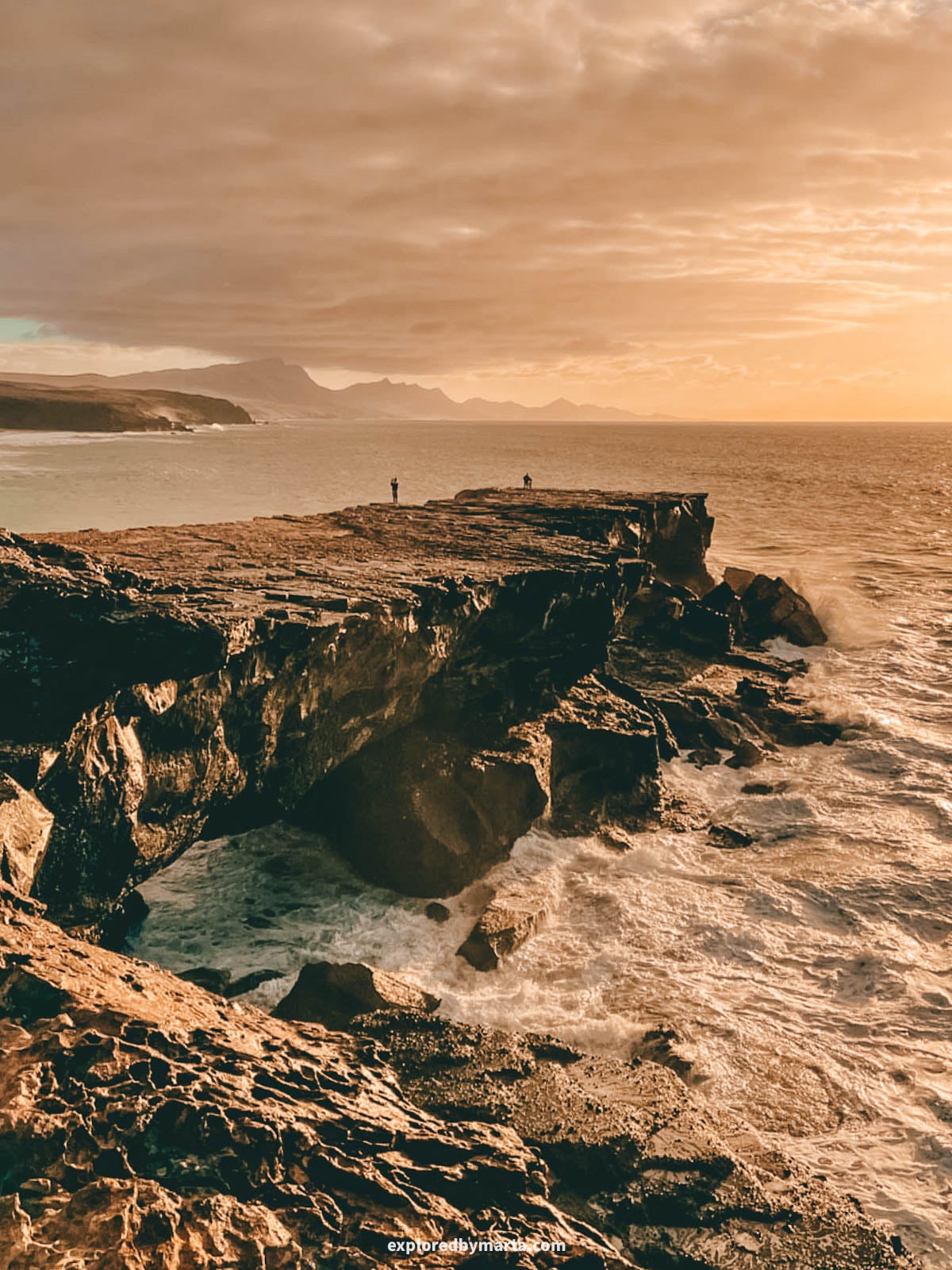
Punta Guadalupe is a rocky point at Playa de La Pared on the west coast, and it’s one of the most dramatic spots on this coast. It’s a big rock headland with viewpoints on top, right above the crashing waves.
On windy days, the waves smash into the rock so hard that the spray flies over the viewpoint. When we were there, it was literally raining seawater on us, haha.
It’s easy to reach. Drive to Playa de La Pared, park near the beach, and walk over to the rocks. Stay well back from the edge, since the rocks get wet and slippery.
This is also one of the best sunset spots in Fuerteventura. Come in the late afternoon, watch the surfers, and stay until the sun drops into the Atlantic.
And if you come in the morning, stop by Café Caveto, where the coffee and cakes were simply amazing. It’s the perfect fuel before exploring the coast.
For me, Punta Guadalupe is the perfect last stop after a day of exploring the circular rock and the snail rocks nearby. Bizarre rocks, wild waves, and a sunset. Worth it!
Location: Playa de La Pared
15. Cave tunnel at Playa de Vigocho


Right next to the Bee Cave area, Playa de Vigocho hides one of the biggest rock formations on this coast: a huge tunnel that goes straight through the cliff. It’s like a giant window to the ocean!
Is it a tunnel, an arch, or a cave? It’s hard to say. The waves carved through the rock from one side to the other, so one end opens onto the beach and the other straight onto the Atlantic.
A gravel road leads to Playa de Vigocho, and the tunnel is on the north side of the beach. We saw some people walking all the way through it, with waves crashing at the far end. I was happy to stay by the opening, haha.
We came here after hunting the Solapa caves, so it wasn’t low tide anymore, and the tunnel still looked reachable. Still, coming closer to low tide is the safer bet.
Since it’s so close to the honeycomb rocks and the Bee Cave, you can easily see all three in one walk. Add the Solapa boulders nearby, and you’ve got a full day of bizarre rocks on the west coast.
Location: Tunnel of Playa de Vigocho · Playa de Vigocho
FAQs about rock formations in Fuerteventura
Where are the best rock formations in Fuerteventura?
Most are on the wild west coast, around La Pared, Playa de Garcey, Playa de la Solapa, and Ajuy. Arco de las Peñitas and Barranco de los Enamorados are inland, and Calderón Hondo is in the north.
Is La Columna de Jandía easy to visit?
No. It’s in the remote Jandía isthmus, reached by a gravel road and a 2-kilometer (1.2-mile) walk, with a crumbly dune slope at the end. Only go on a calm, dry day if you’re an experienced hiker.
Can you take popcorn rocks home from Fuerteventura?
No. The popcorn pieces are protected rhodoliths, and taking them is forbidden. Visitors can be fined, so take photos instead and leave them on the beach.
What is the easiest rock formation to visit in Fuerteventura?
Calderón Hondo is the easiest, with just a short walk from the parking lot to the crater rim. The Crocodile Rock is also only a few minutes’ walk from Playa de las Hermosas.
Why does Fuerteventura have so many unusual rock formations?
It’s the oldest of the Canary Islands, so wind, waves, and salt have had millions of years to shape its volcanic rock and old sand dunes into arches, holes, and other strange shapes.
Read more about traveling in the Canary Islands
Before this trip, I never thought I’d spend so much time staring at rocks. But Fuerteventura changed that. Every corner of the island seemed to have a strange new shape waiting to be found.
Some of these spots are easy, like Calderón Hondo or the Crocodile Rock, and some, like La Columna de Jandía, take real effort. Whatever you choose, take only photos and leave the rocks exactly as you found them.
Having visited every Canary Island, I can tell you no two are the same. Planning a trip to Fuerteventura or one of the other Canaries? My travel guides below are full of tips for each island. Happy exploring!
Read more about Fuerteventura:
- The most epic caves in Fuerteventura (and how to find them)
- The best beaches in Fuerteventura, from famous to hidden
- How to find the secret Bee Cave in Fuerteventura
Read more about Lanzarote:
- 23 best things to do in Lanzarote, Spain (bucket list spots)
- 20 best photo spots in Lanzarote, Spain (& locations!)
- 15 unreal rock formations in Lanzarote, Spain
- 7 best caves in Lanzarote, Spain (lava tubes & sea caves)
PIN FOR LATER!