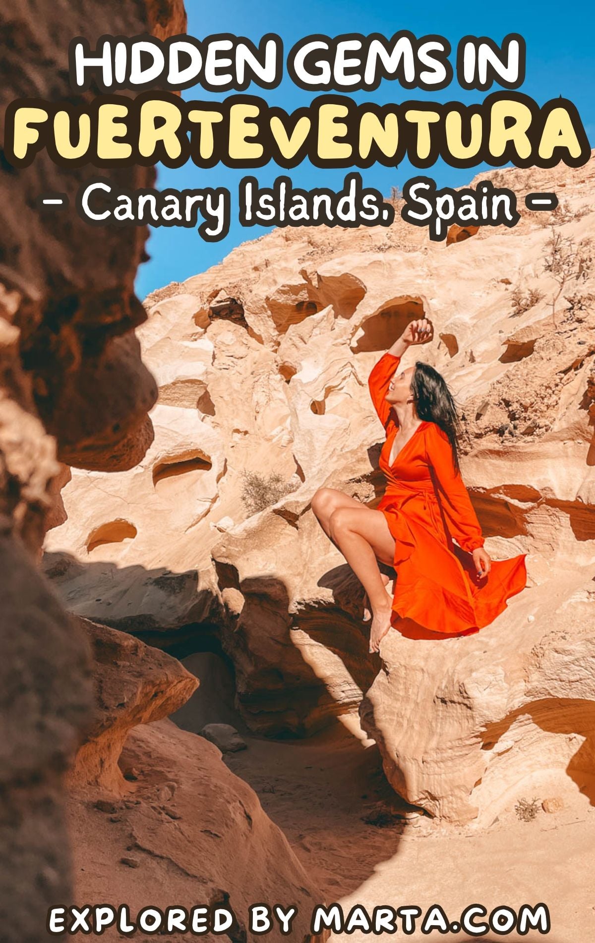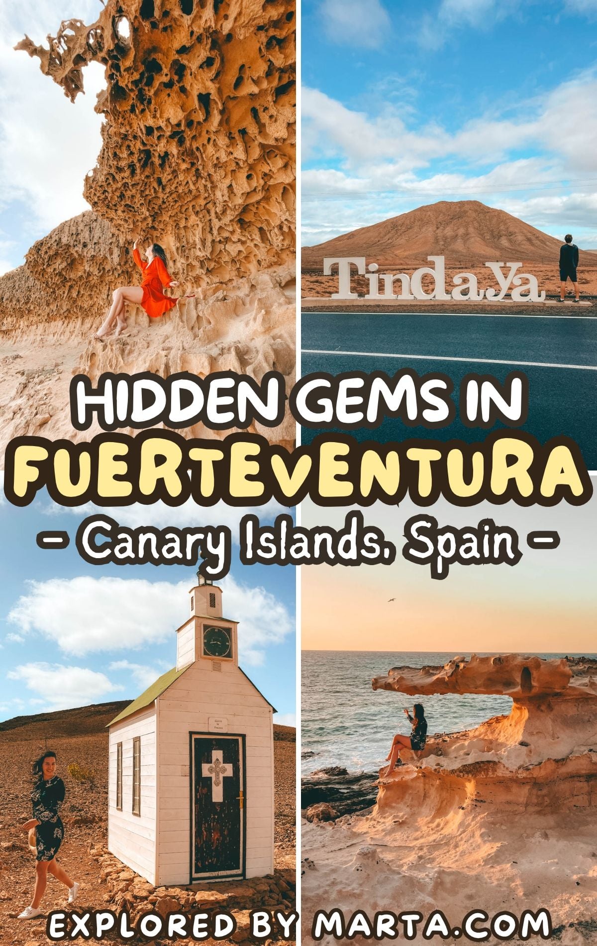
12 hidden gems in Fuerteventura (secret & unusual spots)
This post may contain affiliate links. If you use these links to make a purchase or booking, I may earn a small commission at no extra cost to you! Thank you for your support!
Did you know that the closest point to Africa in the Canary Islands is a lonely lighthouse in Fuerteventura? Yes, Africa is only about 100 kilometers (60 miles) away from Faro de la Entallada, one of many hidden gems in Fuerteventura that most visitors never see.
Most people come to Fuerteventura for the beaches (fair enough!), but beyond them, there’s a wilder side to the island: secret ravines, a sacred mountain, a tiny wooden chapel, and lonely lighthouses. Many of these places have no signs and are tricky to find.
We spent four weeks exploring the island from tip to tip, often on bumpy gravel roads with no cell service. So for every spot, I’m sharing exactly where it is, how to get there, and what to expect, plus a few easy ones if off-road adventures aren’t your thing.
If you’re after unusual things to do in Fuerteventura and secret places away from the crowds, this list is for you. Let’s go exploring! 🗺️
1. Barranco de Cho Cruz
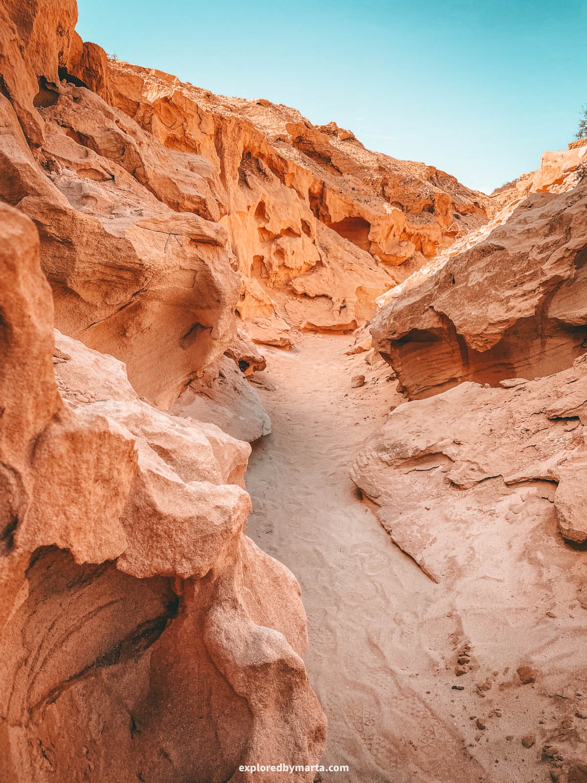
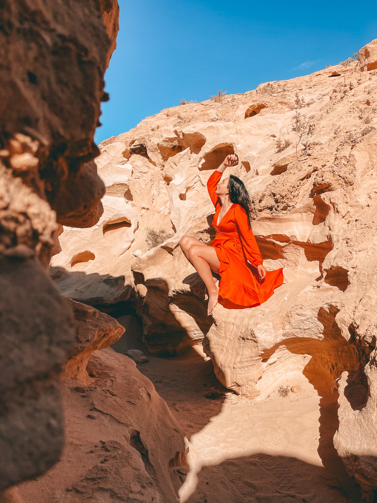
Barranco de Cho Cruz is a hidden ravine in the north of Fuerteventura, near the surfer village of Lajares, and it’s one of my favorite secret places on the whole island.
It is basically a secret sister to the more popular Barranco de los Enamorados ravine (one of the must-see places in Fuerteventura), but just as beautiful if you know where to look!
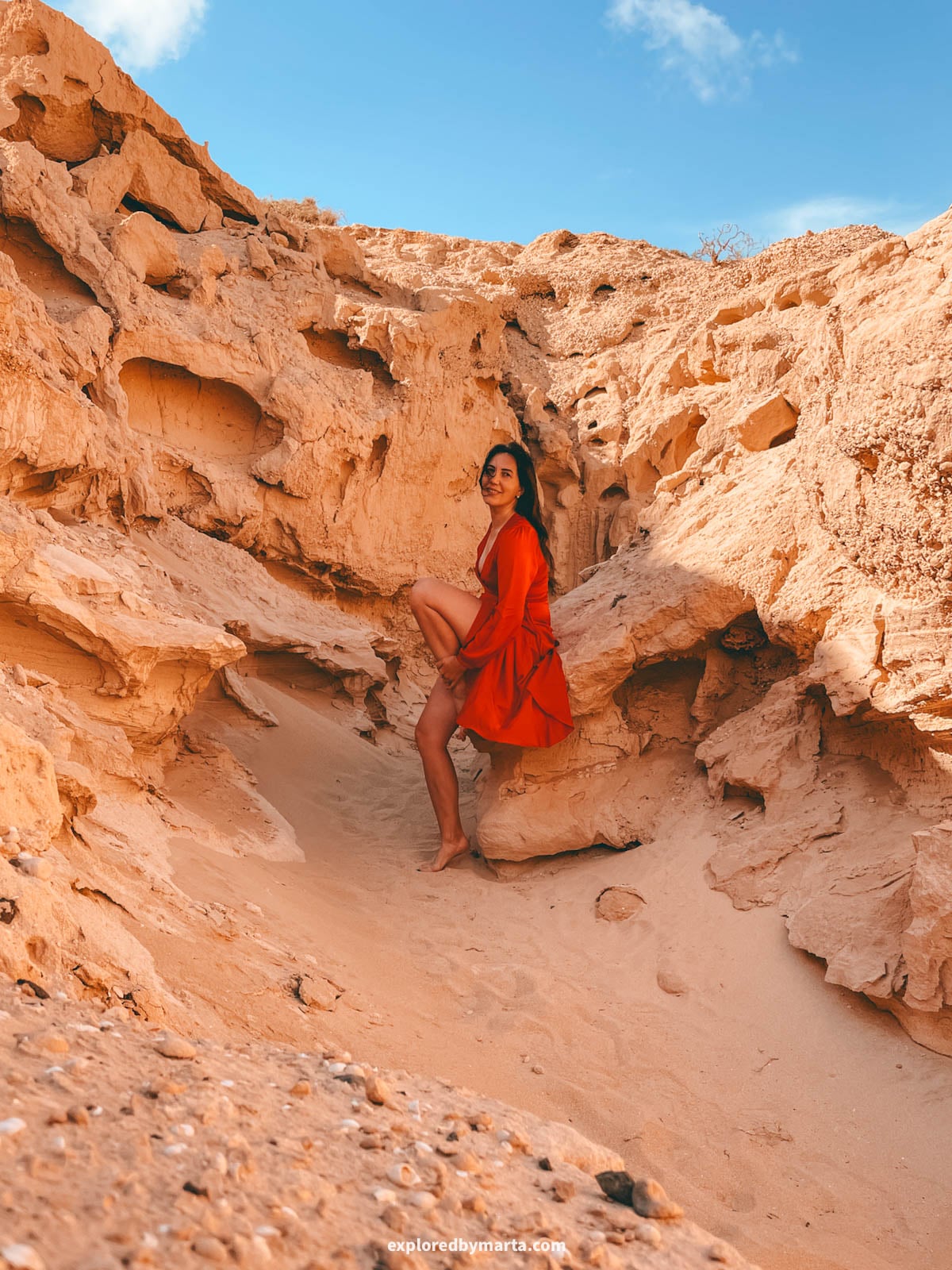
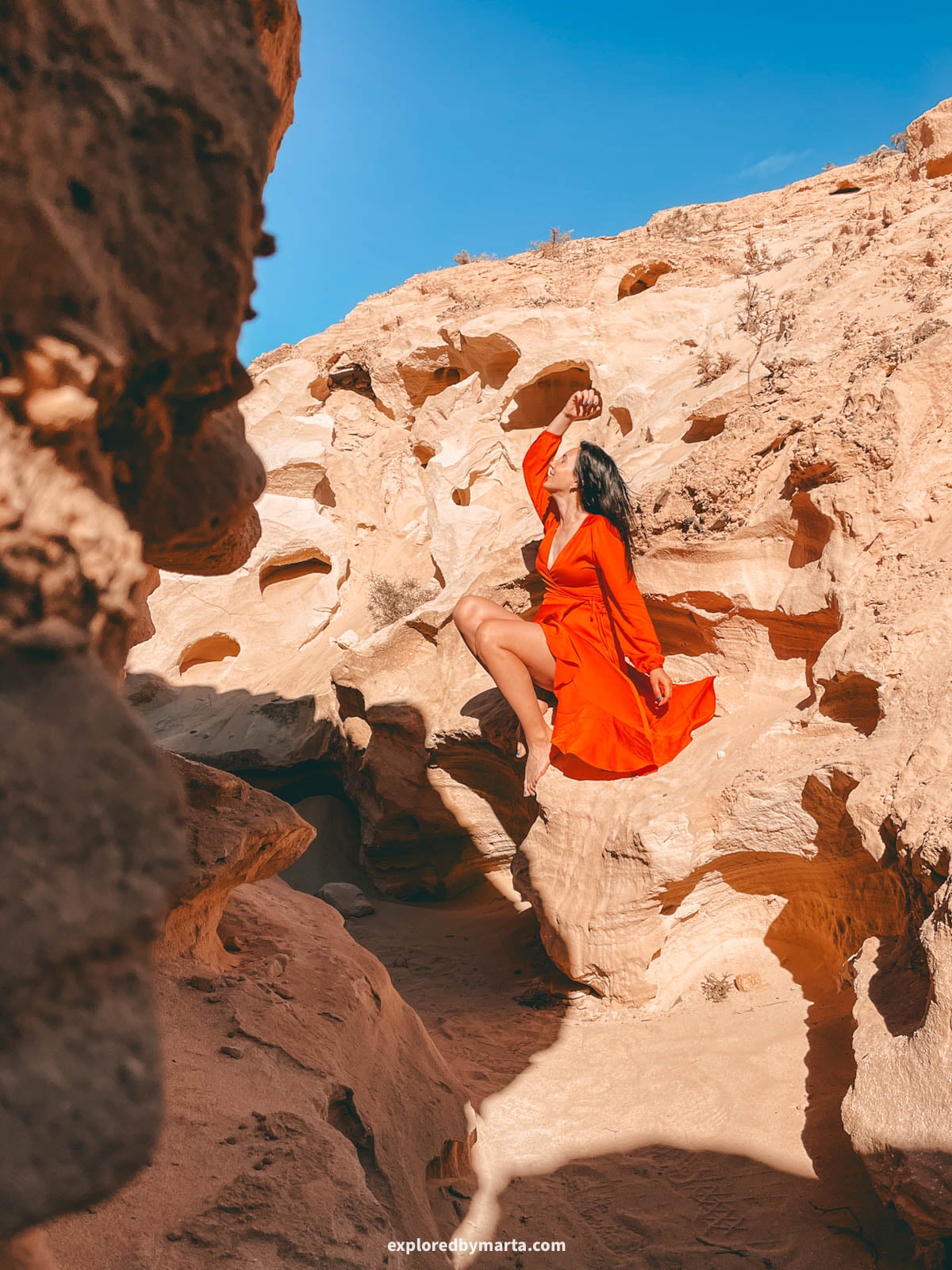
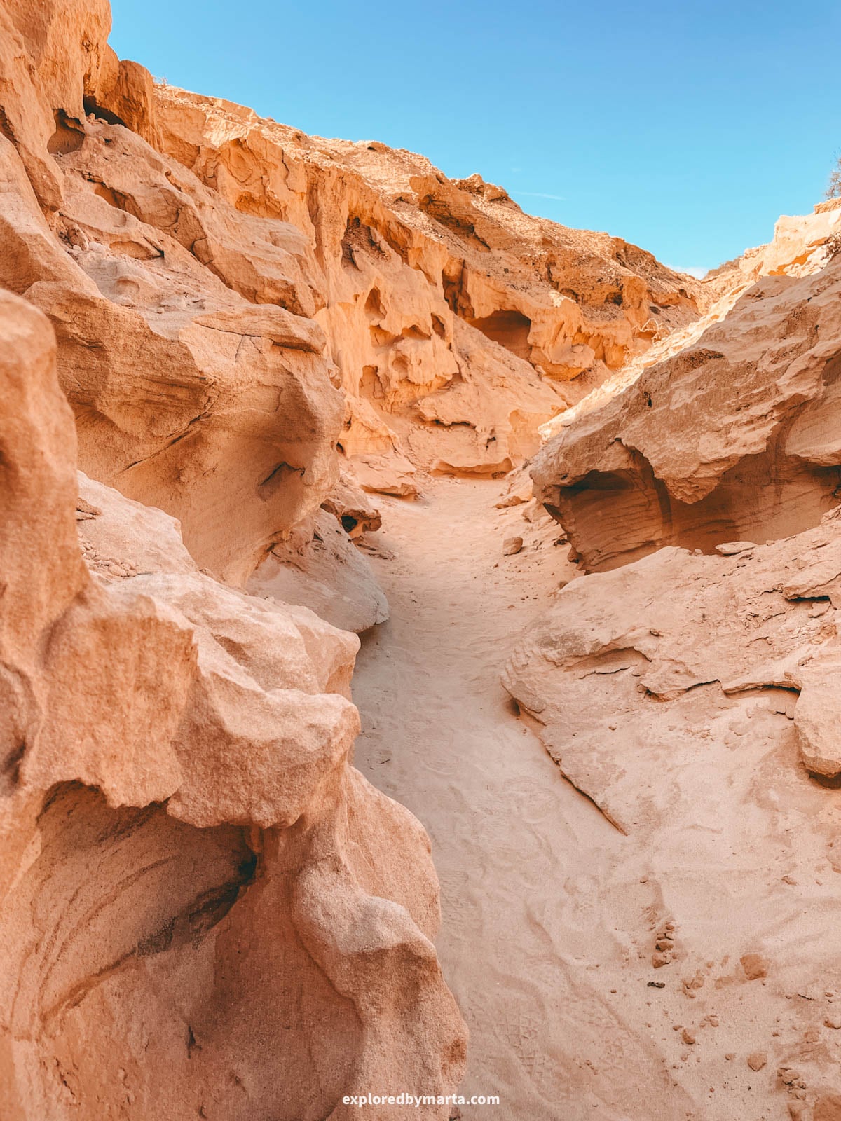
Barranco de Cho Cruz is full of narrow side ravines and wind-carved sandstone in crazy shapes. Some of the rock walls look like arches, faces, or even animals, and every turn shows you something new.
To get there, drive to Lajares and turn onto the Cañada de Melián dirt road, which branches off from the FV-10 road. Follow it for about 2.4 kilometers (1.5 miles) until the start of the Barranco de Cho Cruz trail (click the links for exact coordinates!).
From there, we hiked about 1.5 kilometers (0.9 miles) until we reached the best and most beautiful sandstone shapes you can see in my photos. We explored several side ravines that branch off the main path. They’re short, so you can explore one, come back, and try the next.
The ravine is a real maze, so download your map before you go.
Cell service is patchy or nonexistent here. If you take a wrong turn, climb up to the edge for a bird’s-eye view to find your way again, but always be careful with the sandstone – it’s more fragile than regular stone!
Exploring this area took us a few hours, so it’s definitely not a quick stop. But I really enjoyed that we had it almost completely to ourselves, while Los Enamorados ravine was busy with visitors – it is one of the most popular hikes on the island, after all.
Tip! There is no shade along the way, so bring water and sun protection with you!
Location: Barranco de Cho Cruz – Photo location
2. The sacred Tindaya Mountain
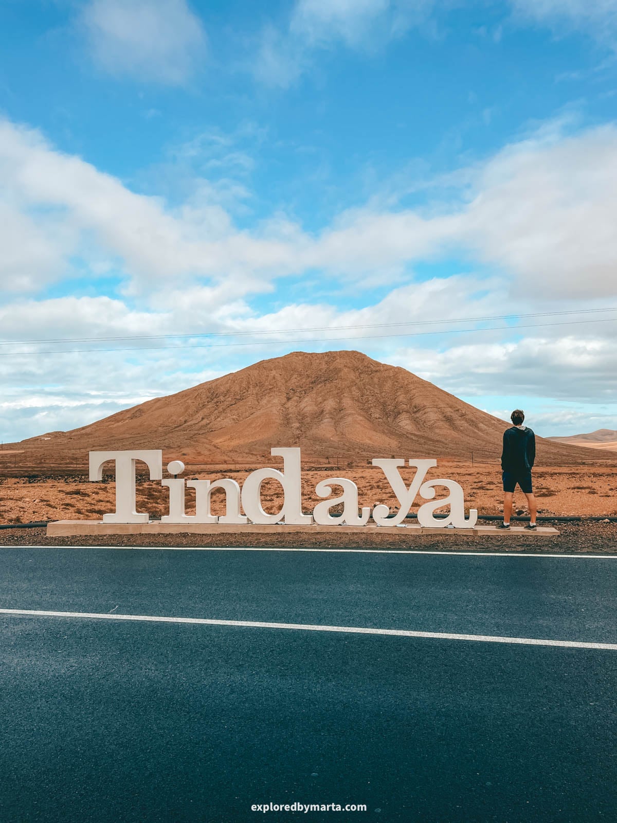
Tindaya is the sacred mountain of Fuerteventura. It rises alone from a flat plain in the north of the island, next to the village of the same name, and you can see it from far away.
For the Majos, the island’s ancient inhabitants, Tindaya was a sacred place. Around 300 podomorphs, or foot-shaped rock carvings, have been found near the summit, and today it’s protected as a natural monument.
Tindaya isn’t really a mountain for climbing. Access to the summit is restricted, and you would need a special permit from the Cabildo de Fuerteventura to access it, so it’s not a regular tourist spot.
But I highly recommend driving by the mountain and stopping by its roadside sign (location below!). We took a cool photo from there, and then we drove up to Mirador de Vallebrón, a viewpoint on a nearby mountain, to see the panoramic views of the whole area from above.
From up there, Tindaya looks even more striking, standing alone in the middle of the plain. It’s only about 400 meters (1,310 feet) high, but it’s the most famous mountain on the island, that’s for sure.
For me, admiring it from a distance felt right. It was a sacred place long before tourists arrived, and it’s good that it stays that way.
Location: Tindaya Mountain sign – Mirador de Vallebrón
3. Bee Cave and its honeycomb rock formations
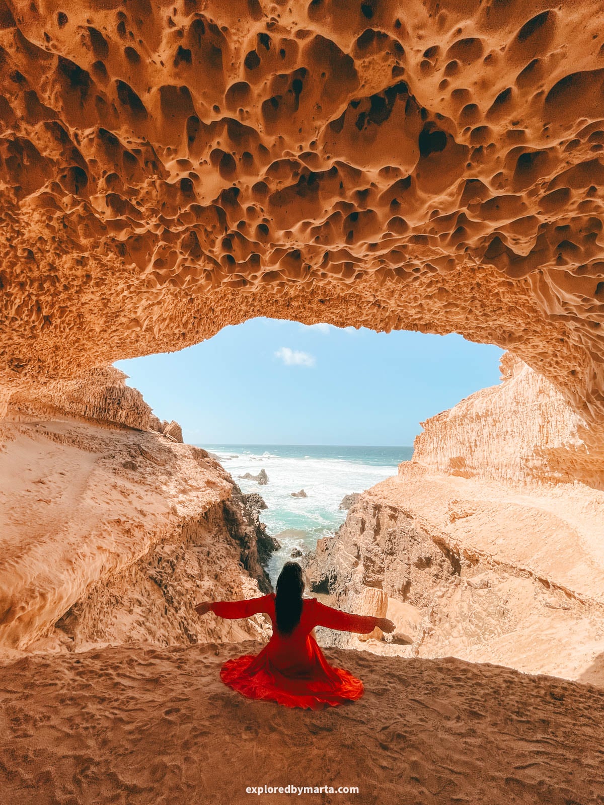
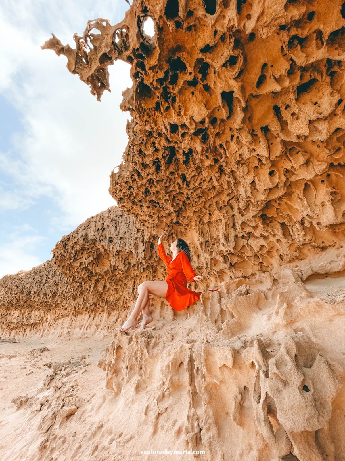
The Bee Cave is a small sandstone cave hidden at the end of a narrow cove on the west coast, about 1 kilometer (0.6 miles) south of Playa de Garcey. It’s not an official tourist attraction, so there are no signs or designated paths.
I called it the Bee Cave because its yellow ceiling is full of little holes, just like honeycomb cells in a beehive. This unique rock pattern is actually called honeycomb weathering, and we found it in many spots along the shore on our way to the Bee Cave.
To get there, drive the gravel road to Playa de Garcey, then hike south along the coast for about 1 kilometer (0.6 miles). There’s no marked path, and cell service is weak, so download your map before you go.
I wrote a full guide on how to find the Bee Cave in Fuerteventura if you’d like more details.
Location: Playa de Garcey – Bee Cave
4. The loneliest chapel on the island, Ermita de Violante
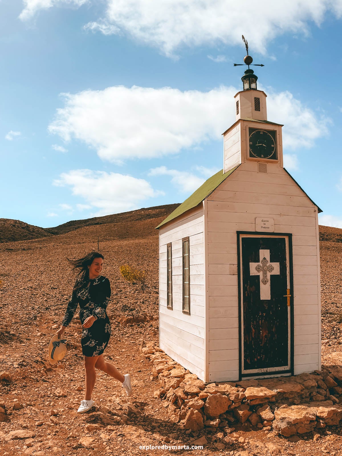
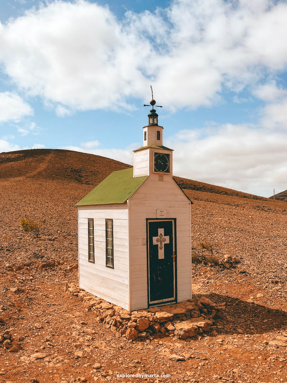
Ermita de Violante must be the tiniest and loneliest chapel in Fuerteventura.
It stands alone on top of a small hill next to the village of Violante, with nothing around it, so you can spot it from far away. This little wooden chapel is only about 2.5 meters (8 feet) tall, plus a tiny clock tower and a weathervane on top.
And just one person fits inside. Okay, maybe two or three. 😅
Turns out, its full name is Ermita Protestante de Violante, and it’s built in a Northern European style. That makes it quite unusual here, since the island’s chapels are made of stone or concrete.
To get there, we drove to Violante and parked our car at the bottom of the hill. From there, we continued on foot, a short walk of just 250 meters (820 feet) slightly uphill from the road to the chapel. Very easy to follow, and you’ll get there in no time.
For me, this tiny chapel next to a little village was one of the most unexpected finds of the trip – a hidden gem in the middle of nowhere! Perfect spot to add to your road trip itinerary!
Location: Ermita de Violante – Parking area
5. Crocodile Rock at Playa de las Hermosas
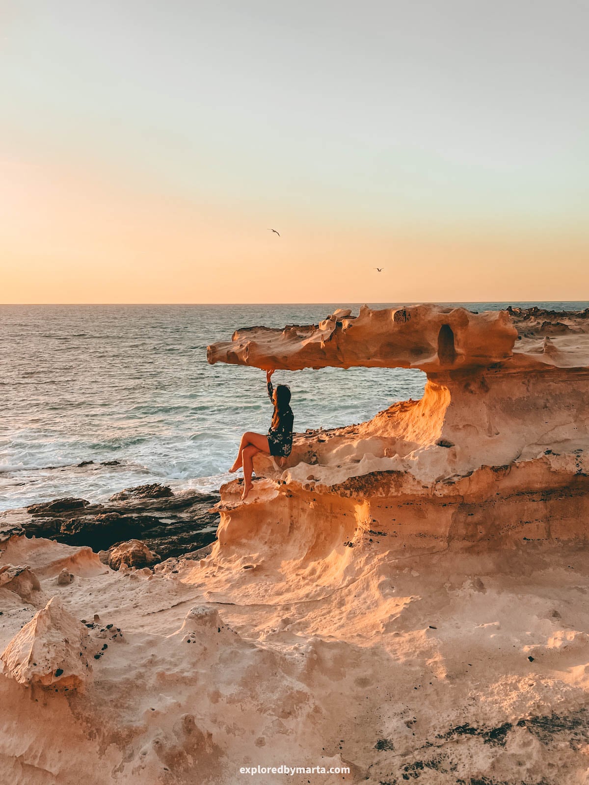
Playa de las Hermosas is a tiny black sand and rock beach on the west coast, just north of La Pared town. Cliffs rise on both sides, so it feels sheltered, quiet, and a little secret.
This beach is home to one of my favorite hidden gems in Fuerteventura – about 300 meters (980 feet) north of the beach, there is the Crocodile Rock, a unique rock formation that looks like a crocodile with its mouth wide open.
Getting there is easy. You’ll need a car, but the road is paved almost all the way to the beach.
From the beach, continue on foot: follow the small path up the cliff and walk north along the coast. It only takes a few minutes to reach the Crocodile Rock.
It’s a beautiful and unique spot for photos in Fuerteventura. Just please make sure not to stand on top of the rock, since it’s fragile and could break.
We arrived just before sunset, right at golden hour, so we sat down and waited for the sun to go down. It’s one of the most romantic spots on the island for couples, and one of my favorite memories from Fuerteventura!
Location: Crocodile Rock – Parking area
6. Faro de la Entallada, easternmost point in Canarias
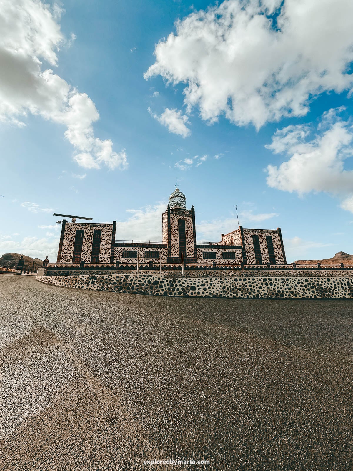
Faro de la Entallada is the most special lighthouse in Fuerteventura.
It sits high on the cliffs on the east coast, near the village of Las Playitas. Around it rise the Cuchillos de Vigán – long, sharp ridges named after knives (“cuchillos” in Spanish).
The Cuchillos de Vigán are protected as a natural monument covering more than 6,000 hectares (14,800 acres). The lighthouse marks one end of this area, so you’ll see the ridges around you on the way up and from the parking lot next to the lighthouse.
Why is this place so special? Most of Fuerteventura’s coastline is beaches, but here you get huge cliffs instead – Faro de la Entallada sits 196 meters (643 feet) above the sea, the third-highest lighthouse in the Canary Islands.
The lighthouse looks more like a little castle than a typical lighthouse. Architect Carlos Alcón completed it in 1955, mixing in Moorish elements, with dark stone walls outlined in white. It’s still in use, so you can only admire it from outside.
I also learned a fun fact! In 2011, it even appeared on a Spanish postage stamp, as one of six lighthouses in a special commemorative set!
Faro de la Entallada also marks the easternmost point of the Canary Islands – it’s the closest spot in the whole archipelago to the African continent.
But, to be fair, we couldn’t see Africa from the cliffs. It’s only about 100 kilometers (60 miles) away, so maybe you can spot it on a very clear day… 🤔
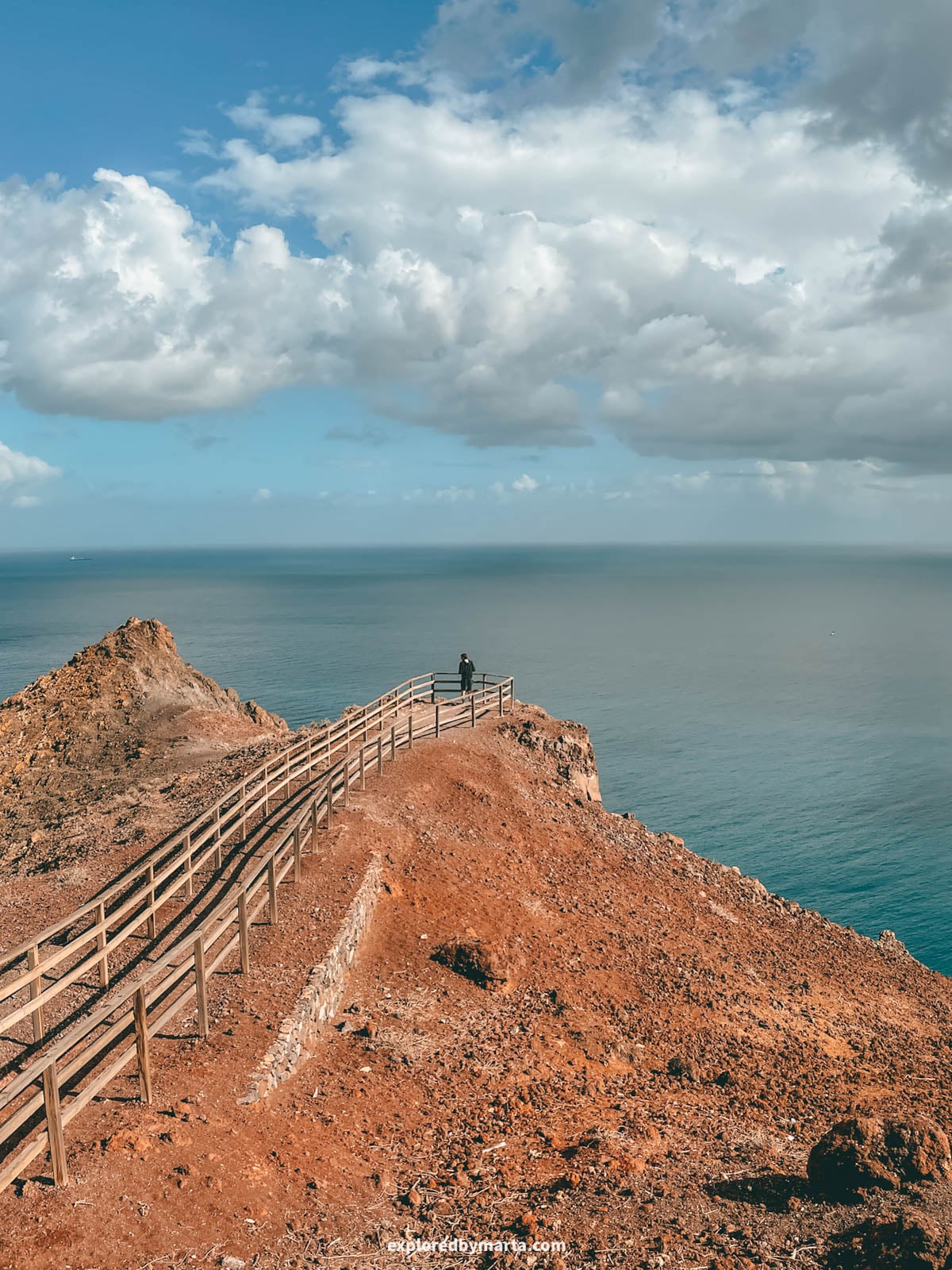
We stopped here on a road trip along the east coast, explored the area around the lighthouse, and then walked down to Mirador de la Entallada, a panoramic viewpoint right above the cliffs. It is one of the best spots to see Fuerteventura’s east coast from above!
The view of the massive cliffs dropping into the ocean was incredible. It was a bit windy, but nothing like the west coast, and there were only a few other people around, so it’s very much a hidden gem in Fuerteventura.
The best part? It’s very easy to access – there’s a paved road going all the way up to the lighthouse. Just be careful, because the last part of the road is narrow and winding!
Location: Faro de la Entallada – Mirador de La Entallada
7. Playa del Mal Nombre
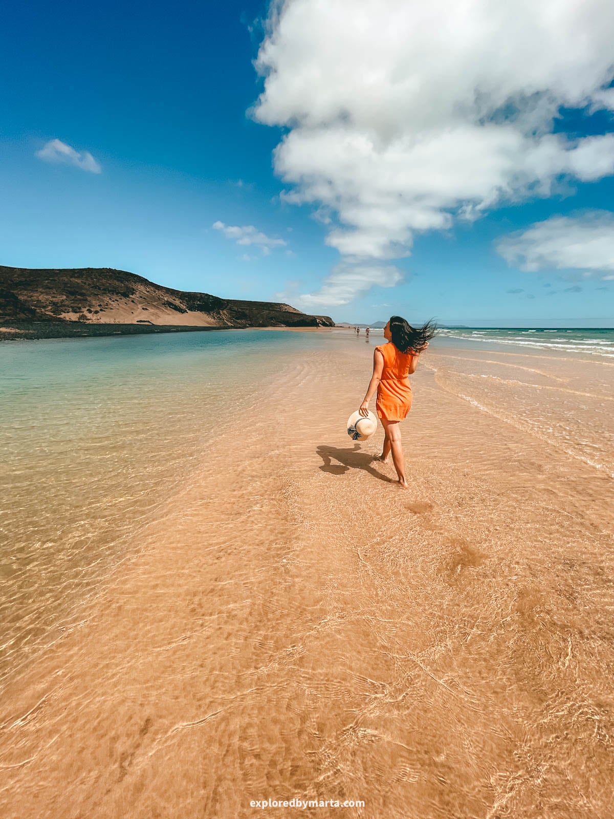
Playa del Mal Nombre, “the beach with the bad name,” is a quiet beach in the south of the island, close to Playa de Sotavento, one of the most famous beaches in Fuerteventura.
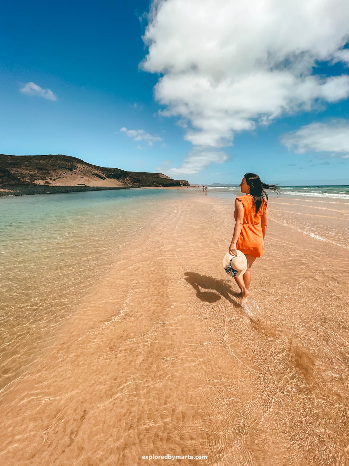
Most visitors head straight to Sotavento and never stop here. Their bad. Playa del Mal Nombre is like a smaller, calmer version of Playa de Sotavento, with turquoise shallows, fine white sand, and a sand strip in the water that you can walk along.
So basically it is the same beauty and turquoise waters you get at Sotavento Beach, but with easier access and smaller crowds. It’s a win in my books!
When we were there, the water was so shallow and warm we could relax there for hours. There’s also a café right next to the beach, making it the perfect spot for a relaxed beach day or an active day doing water sports on the east coast of Fuerteventura.
Location: Playa del Mal Nombre
8. Cuevas de Los Estancos (lava caves)
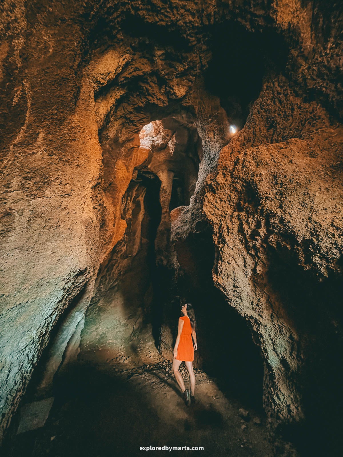
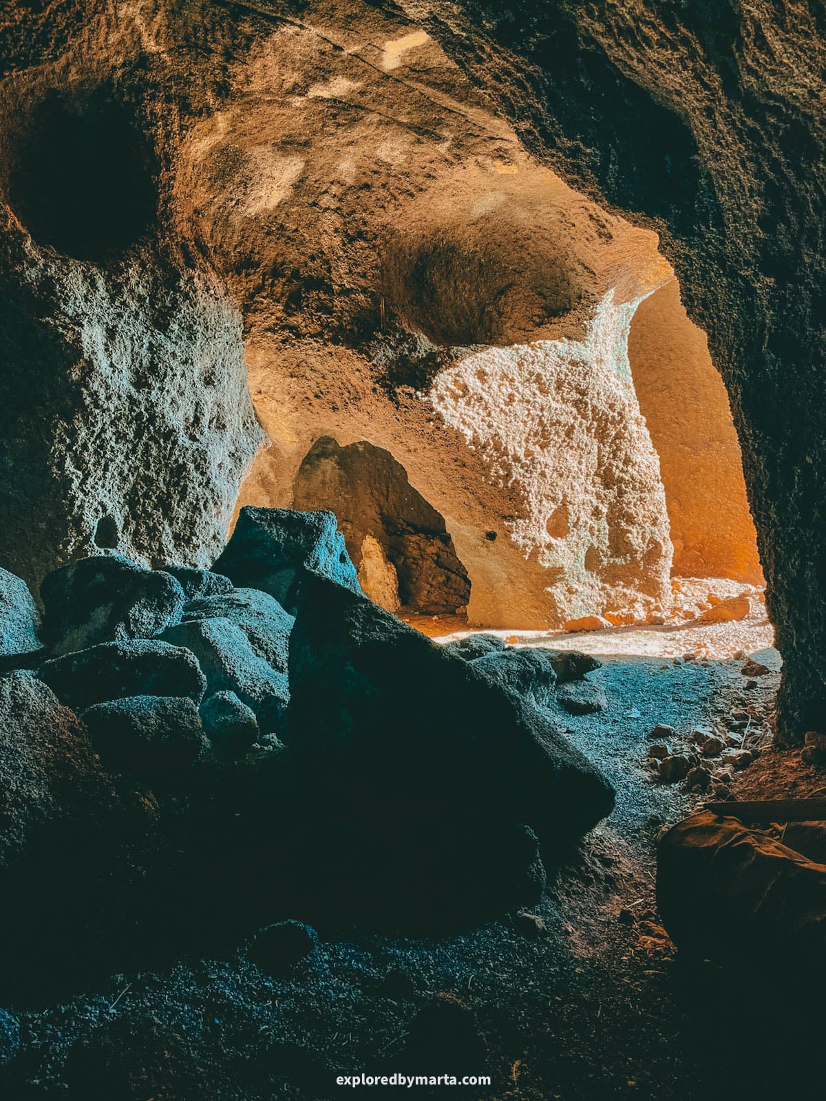
Cuevas de Los Estancos is a labyrinth of lava caves near Los Estancos, a short drive from Puerto del Rosario, the capital of Fuerteventura. One of my favorite caves we explored on the island!
The caves are hidden on the side of a small volcano. They’re not an official attraction, so there are no signs, and most people have no idea they exist, so it’s still very much a secret place in Fuerteventura.
The whole side of the volcano is full of these lava caves, and we spent a good 20 minutes peeking into one after another. Some of the bigger chambers are easy to walk into. So cool!
If you love exploring such hidden places, I recommend only going there in daylight and in dry weather, since the ground is pretty fragile and unstable.
Location: Cuevas de Los Estancos – Parking area
9. Faro de Punta Jandía & Puertito de la Cruz
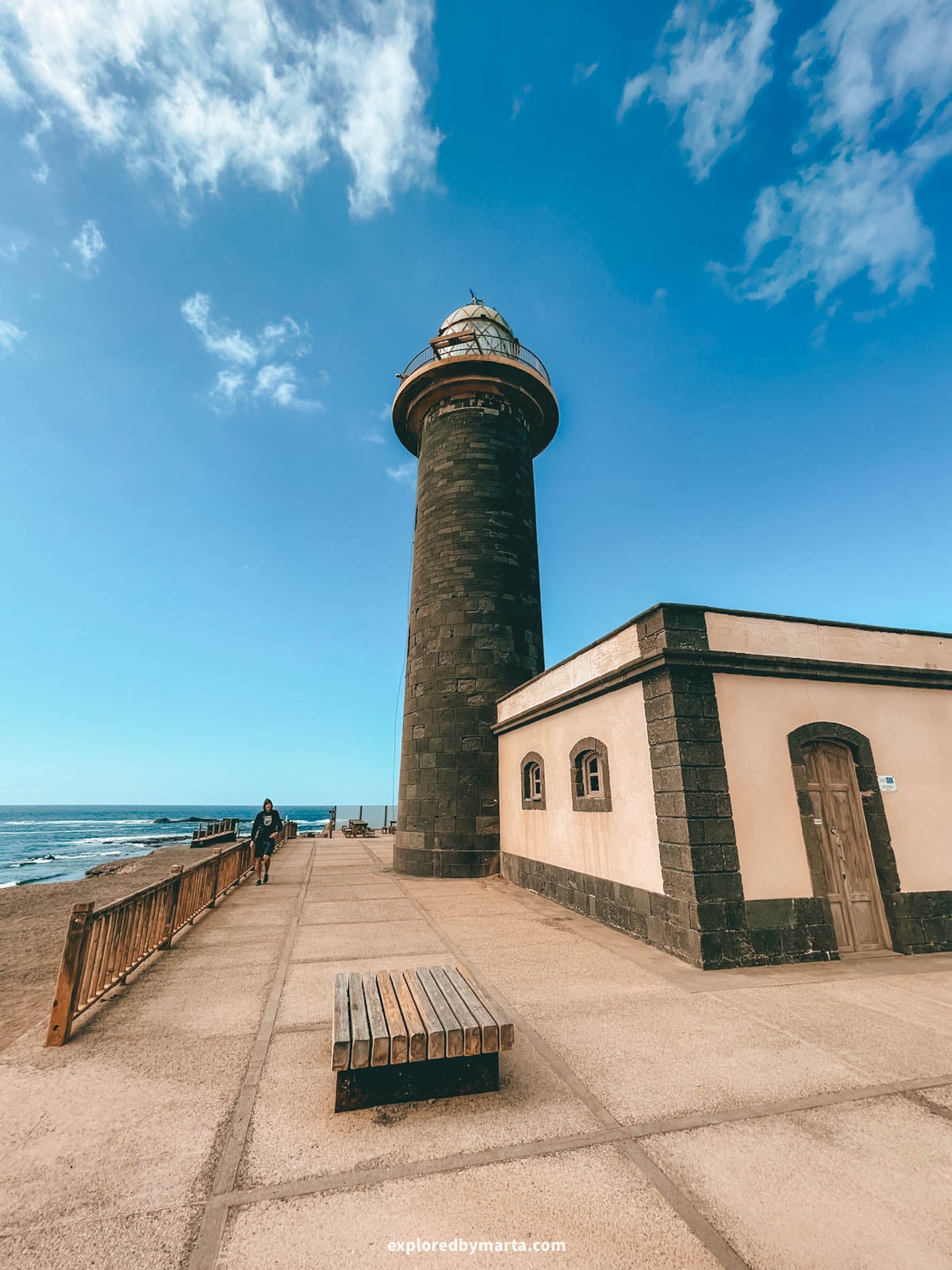
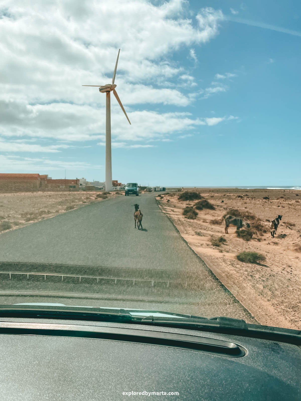
If you have a day to spare in Fuerteventura, I highly recommend doing a day trip to the remotest part of the island – the Jandía peninsula.
It’s best known as the home of the highest peak in Fuerteventura, Pico de la Zarza at 807 meters (2,648 feet), and the famous Playa de Cofete beach.
However, it is also home to some of the remotest and least visited places on the island, like Faro de Punta Jandía and Puertito de la Cruz.
Puertito de la Cruz is a tiny fishing hamlet on the far southwestern tip of the Jandía peninsula. Just past it stands Faro de Punta Jandía, the lighthouse at the end of all roads in Fuerteventura.
Puertito de la Cruz is just a handful of low houses, fishing boats, and a few small restaurants by the sea. As we approached the village, there were a couple of tax collectors meeting us by the border (local goats 😆).
We then pulled over and sat down for a coffee and toast for breakfast at one of its roadside cafés. It really felt like we had reached the end of the world in Fuerteventura.
The lighthouse is a short drive away, standing on the rocky point where the island ends. Built back in the 19th century, it is one of the oldest lighthouses in the Canary Islands, and the views of the wild Atlantic all around are worth the long drive.
Getting there means a long gravel road from Morro Jable, through the empty, wild landscape of the Jandía Natural Park – that is why only a few visitors ever wander this far. It takes a while, but that’s exactly why it feels so exciting. We loved this area and visited it twice!
Location: Faro de Punta Jandía – Puertito de la Cruz
10. Playa de la Solapa
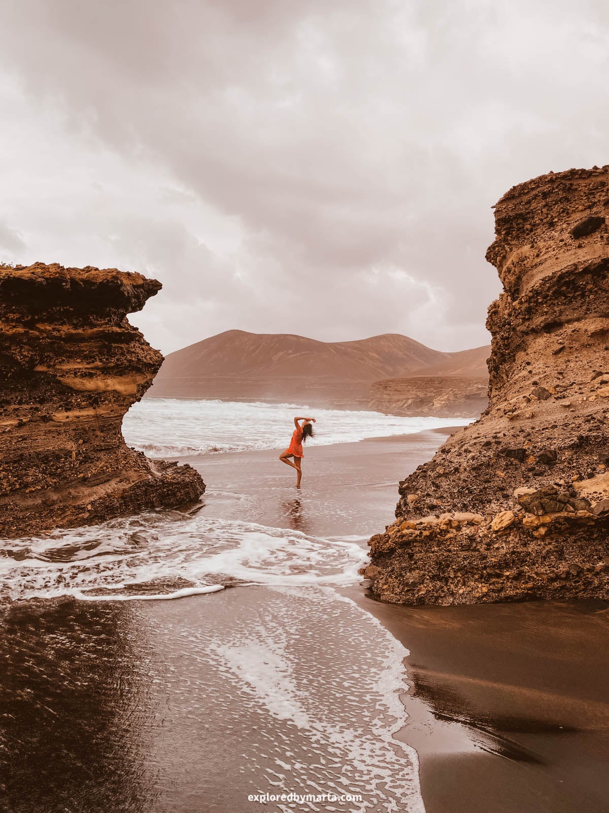
Playa de la Solapa is one of the most unique places in Fuerteventura.
It’s a wild black sand beach on the west coast. Dark sand, giant rock boulders, and huge waves in the Atlantic Ocean – this is the moodiest spot on the island in the best way!
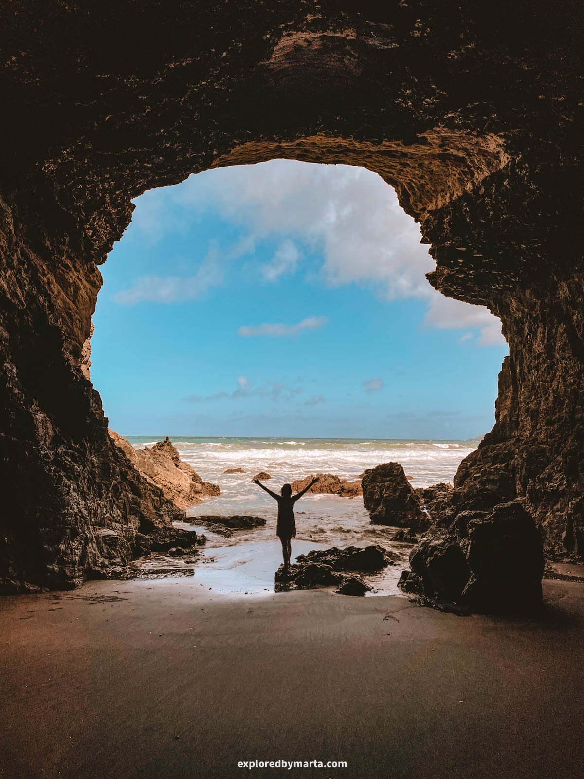
The best-kept secret of this beach is its sea caves. The trick is to arrive at low tide, walk down to the beach, and then follow the shoreline to the left (to the south).
Within just 100 to 200 meters (300 to 650 feet) of the beach, we counted multiple beautiful sea caves carved into the coastal rocks. None of them are accessible at high tide, so keep that in mind.
Beach access is not difficult at all, although the final 3.5 kilometers (2.2 miles) are a gravel road. But it’s far from the worst road we’ve seen in Fuerteventura, haha. It was totally fine for our small Fiat 500.
Location: Playa de la Solapa
11. Traditional windmills of Fuerteventura
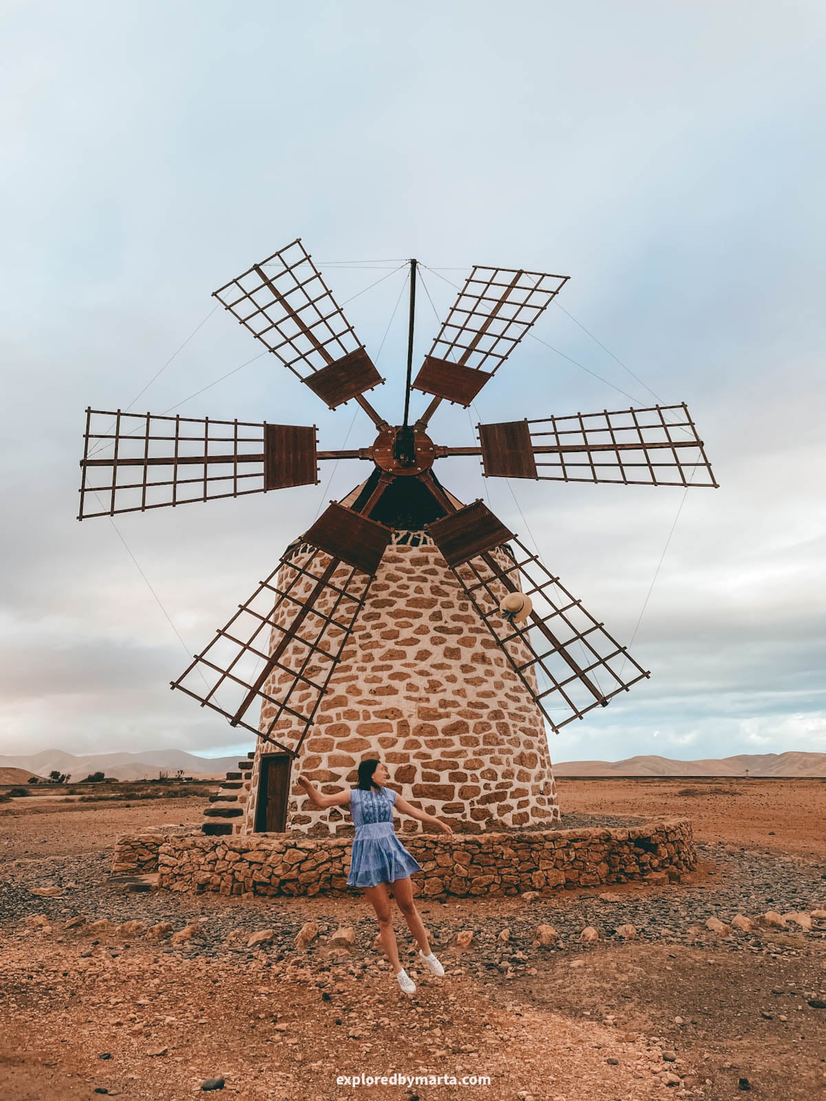
While driving through the dry countryside of Fuerteventura, you’ll spot old windmills standing alone on the hills. They’re easy to drive past without a second look, but they tell one of the most interesting stories on the island.
Fuerteventura was once known as the granary of the Canary Islands. I learned that windmills arrived here in the 18th century to grind the grain that grew in abundance, and at one point, the island had more than a thousand mills. 😮
They were used to make gofio, a toasted flour that’s still a staple of Canarian food today. Now, Canarians make all kinds of treats and dishes from gofio. If you haven’t tried it, then you should definitely make sure to try it before heading home!
Back to windmills. Fun fact: there are two types of windmills here. The classic molino is a tall round tower with sails, while the smaller molina has its machinery inside a low building.
During our stay in Fuerteventura, we stopped by multiple windmills on our drives through the north. My favorite ones were in Tefía and in Villaverde, a small village between La Oliva and Corralejo.
Both are easy to access, and you can visit them at any time of day, so you can add them to your itinerary when doing a road trip around the island. It only takes a couple of minutes to visit them!
If you want to learn more, the Centro de Interpretación de los Molinos in Tiscamanita is a small windmill museum about the island’s grain history, and you can even taste gofio there.
For me, these quiet windmills on the dusty hills are one of the most typical images of Fuerteventura. I’ve linked the most popular and beautiful windmills in Fuerteventura with their locations below.
Location: Molino de Tefía – Windmills of Villaverde – Molino de Lajares – Centro de Interpretación de los Molinos – Molino de Antigua
12. Arco del Jurado (Peña Horadada)
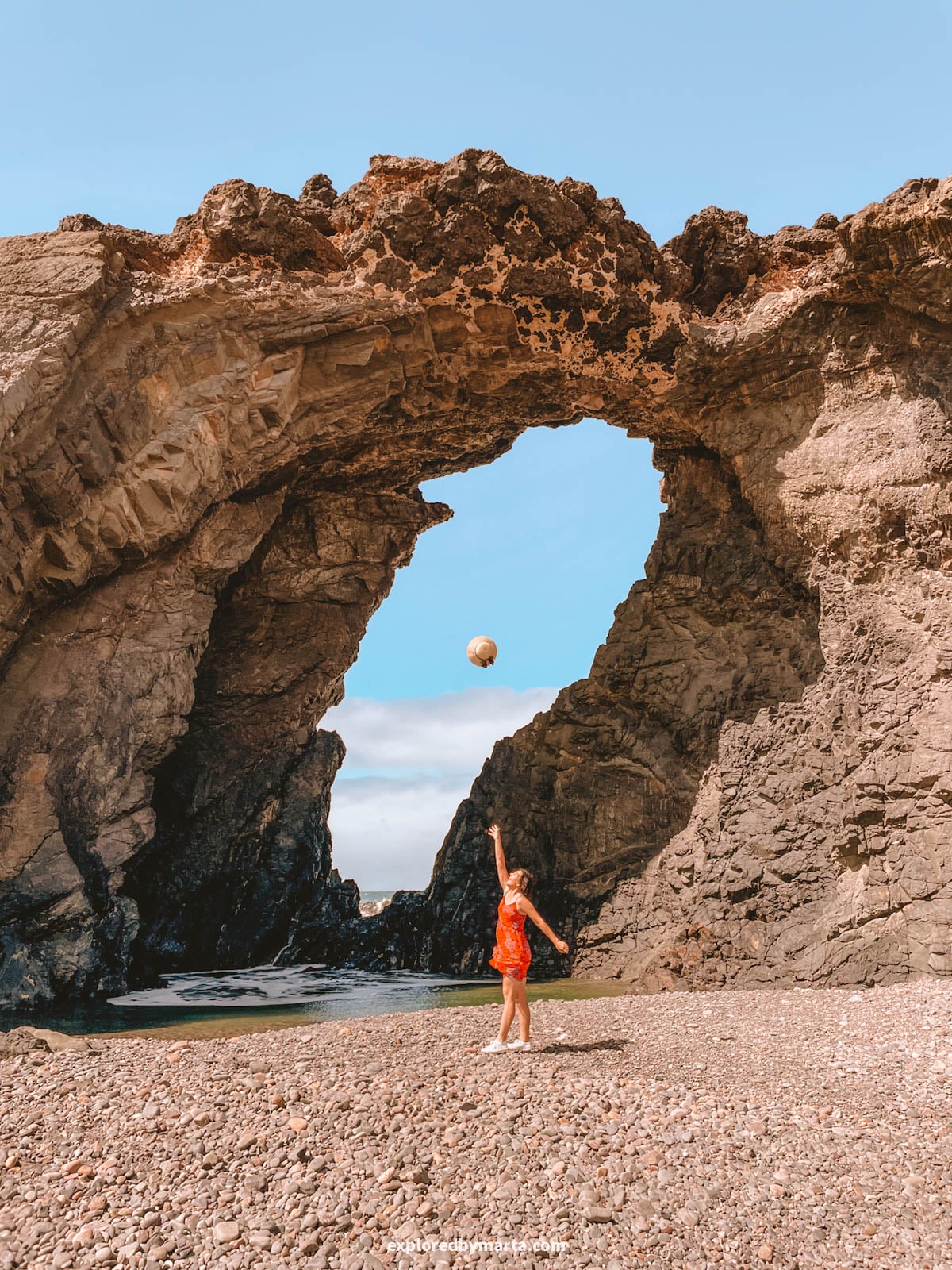
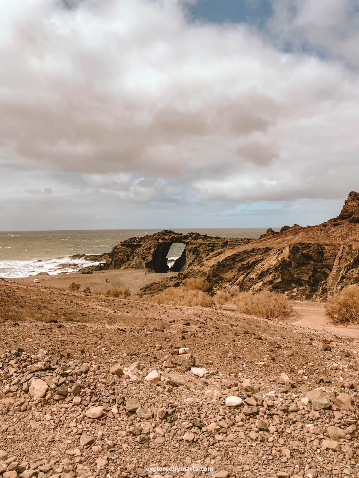
Arco del Jurado, also called Peña Horadada, is a huge seaside cliff with a giant hole right through it.
This is one of my favorite places to be on the west coast on windy days – the big ocean waves come crashing against the rock and splash right through the hole. Such a spectacle!
This massive arch is just a short distance along the coast from the famous Ajuy caves, so if you enjoy exploring unique rock formations, it’s easy to visit both on the same trip.
We drove all the way up to the arch and parked on the beach (the road is a bit bumpy, though). However, we saw some visitors hike along the coastline from Ajuy village. It’s about 1.5 kilometers (0.9 miles) one way from the village, so the choice is yours.
Location: Arco del Jurado
FAQs about hidden gems in Fuerteventura
What are the best hidden gems in Fuerteventura?
Some of the best are Barranco de Cho Cruz, a quiet ravine near Lajares, the tiny Ermita de Violante chapel, the cliffs at Faro de la Entallada, and the remote fishing hamlet of Puertito de la Cruz.
Can you climb Tindaya mountain?
Not really. Tindaya is a protected natural monument, and access to the summit is restricted and requires a special permit from the Cabildo de Fuerteventura. The best mountain views are from the roadside or from Mirador de Vallebrón.
Do you need a car to visit hidden gems in Fuerteventura?
Yes, for most of them. Many are reached by gravel roads, but we visited them all in a small Fiat 500. Drive slowly, and download your maps, since cell service can be weak.
Where is the closest point to Africa in the Canary Islands?
It’s Punta de la Entallada on Fuerteventura’s east coast, where Faro de la Entallada stands. Africa is only about 100 kilometers (60 miles) away.
Is Barranco de Cho Cruz hard to hike?
Not at all. It’s a fairly easy walk, but the ravine is a maze, so download a map first. Bring water and sun protection, since there’s no shade or cell service.
Read more about traveling in the Canary Islands
What surprised me most about Fuerteventura is how much there is beyond the white sand beaches. A sacred mountain, a tiny chapel on a hill, a hidden hamlet at the end of the road – these little secrets of Fuerteventura made the trip feel extra special.
Many of these places are quiet because they’re off the beaten track and take a little effort to reach. So rent a car, download your maps, and leave room in your plans to explore!
I’ve been to all the Canary Islands, and Fuerteventura is just one piece of the puzzle. If you’re planning a trip to Fuerteventura or the other islands, my travel guides below will help you find the best spots on each one of them. Happy exploring!
Read more about Fuerteventura:
- The best beaches in Fuerteventura, from famous to hidden
- The most epic caves in Fuerteventura (and how to find them)
- Bizarre rock formations in Fuerteventura
Read more about Lanzarote:
- 23 best things to do in Lanzarote, Spain (bucket list spots)
- 20 best photo spots in Lanzarote, Spain (& locations!)
- 15 unreal rock formations in Lanzarote, Spain
- 7 best caves in Lanzarote, Spain (lava tubes & sea caves)
PIN FOR LATER!