7 most beautiful hiking trails to do in La Palma island
This post may contain affiliate links. If you use these links to make a purchase or booking, I may earn a small commission at no extra cost to you! Thank you for your support!
Here are the best hiking trails in La Palma that everybody should do! Whether you are an experienced hiker or you are just a regular tourist, these are must-do trails in La Palma! In this blog post, you will find all the trails with routes, descriptions, possible route variations, and locations on Google Maps. Happy exploring!
Read more » 17 best Instagram spots for amazing photos of La Palma
Where to find hiking trails in La Palma?
First of all, there is some information you should know before finding out which hiking routes in La Palma are the best ones! And the ones you should definitely try to include in your travel itinerary!
You can find all the hiking trails in La Palma on this website – senderosdelapalma.es. There you will find the actual information about the trails and whether they are open, closed, or have some changes in the route.
You can open any of the trails and read more information about them. You can also find the map of La Palma with all the hiking trails and their respective numbers, in case you are looking for a hike nearby.
And remember to check this website the day you are planning to hike! Route closures are not uncommon! For example, the trails could be closed due to fire alerts, especially during the summer months!
1. Barranco de las Angustias
Barranco de Las Angustias is a part of the PR LP 13 hiking trail that goes from the Caldera de Taburiente parking lot to the famous Cascada de Colores waterfall and back.
The trail is easy to follow as it basically goes along the riverbed. It is 12 kilometers long (round trip) with 300 vertical meters. It took us 3 hours to finish (including time for photos).
How to hike Barranco de las Angustias?
This trail is of moderate difficulty as there is a stream along the riverbed that you will have to cross countless times. There are some points where you have to climb or jump over stones.
Sometimes the difficult part is that the surface is mostly deep gravel. It makes hiking more difficult, as your feet sink. Sometimes it feels like you are walking on deep sand on the beach.
There are some points on the trail where the official path goes off the riverbed and uphill. Instead of going there, we chose to skip those vertical meters and stayed on the riverbed. You can choose if you wish to go there!
Actually, those detours quickly connect back to the riverbed a couple of hundred meters later. It would make sense if the stream is too hard to cross, but that was not the case for us. We stayed on the riverbed all the time.
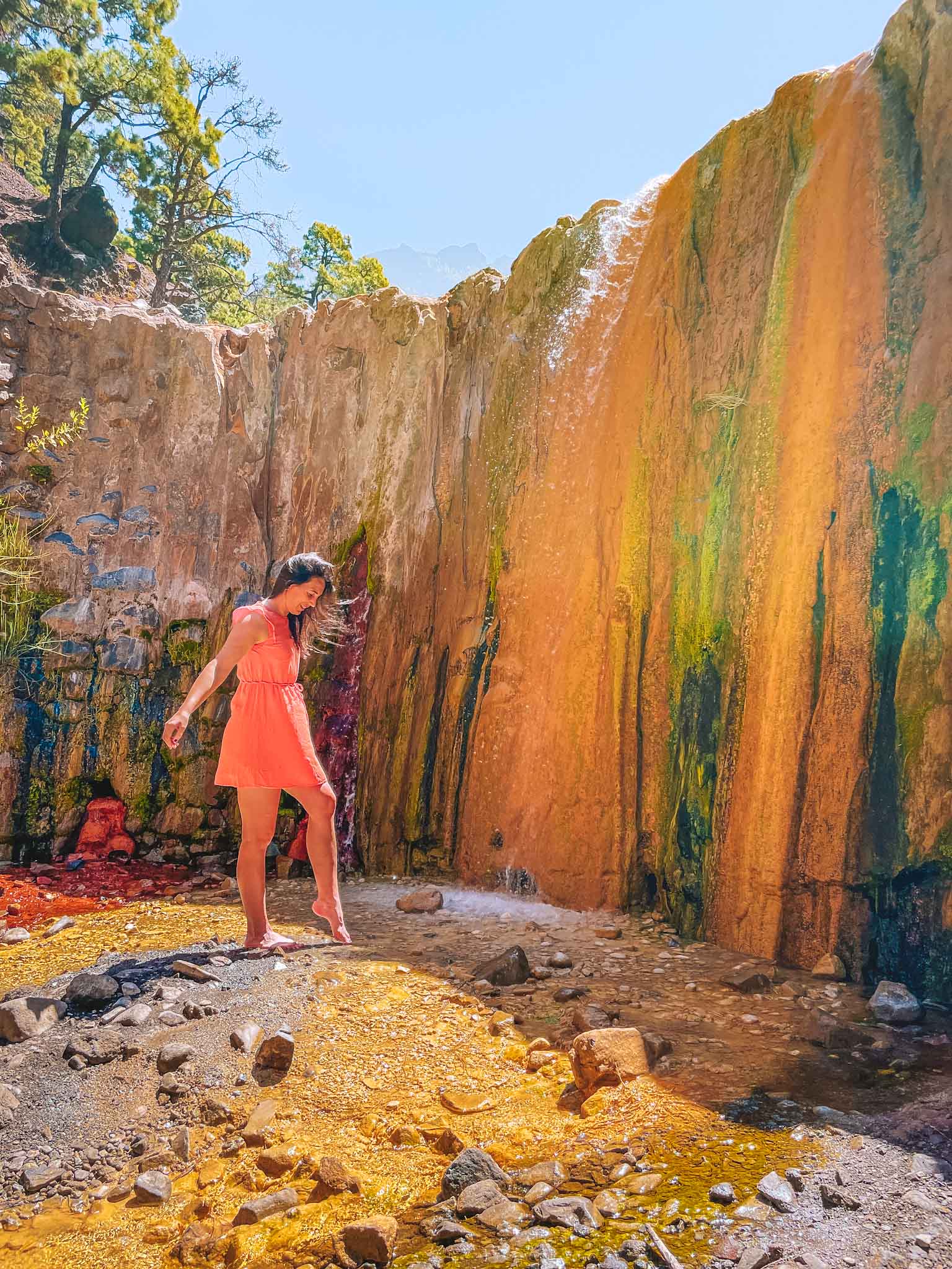
Cascada de Colores
At the end of the trail is the famous Cascada de Colores waterfall. It is an artificial wall where the water falls over and paints the wall in different colors – red, orange, yellow, green, and white.
The colors are either algae or moss, or those are sediments in the water that paint the wall. Make sure to bring drinks and snacks, and pre-download the map of the trail as there is bad service inside the Caldera de Taburiente crater.
Location: Caldera de Taburiente parking lot (start) · Cascada de Colores (finish)
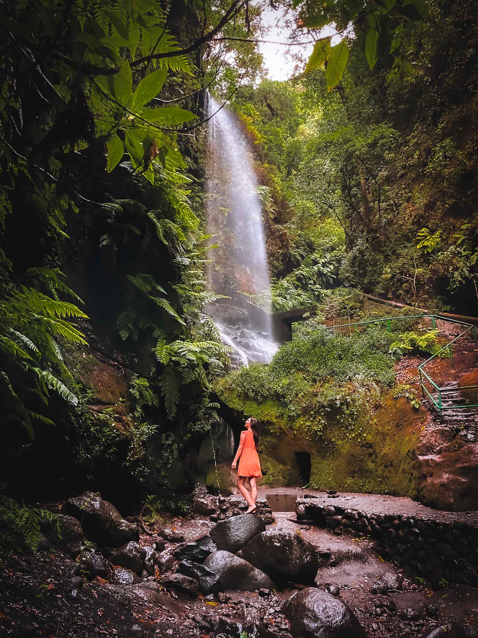
2. Cubo de La Galga
Cubo de La Galga is a must-do trail in La Palma. Basically, it is one of the most famous and busiest hiking trails in La Palma. And one of the most beautiful ones for sure! If you ever wonder, why La Palma is called ‘the green island’, then you will have no more questions about it after you walk this trail!
Read more about different versions of this hike or join this guided trekking tour to Cubo de La Galga for a hassle-free experience!
Officially, Cubo de La Galga is the trail PR LP 05.1. and it says it is 12.4 kilometers long, however, I have to tell you that almost nobody walks this route this way. Everybody skips the 4-kilometer-part that goes through the city where you have to walk on the street.
I really recommend you to skip that as well as there is nothing note-worthy. Instead, you can go straight to the forest part and go a circular route in nature.
Better alternative routes of Cubo de La Galga
Here is the recommended Cubo de La Galga route which is just about 8 kilometers long with 600+ vertical meters. For this trail, you have to drive to the official Cubo de La Galga parking lot next to LP-1 highway and start the trail from there.
You can walk in either direction because the start and the finish parts will be the same. I really recommend going early in the morning or later in the evening because this trail is very popular and parking places are limited.
Actually, there is another option of hiking Cubo de La Galga. In case the parking lot is full or you want an even shorter route (about 4.5 kilometers long), then I suggest parking your car here up the hill at the side of the road.
The start of the trail is located here where there is an information board with the route. This will take you straight into the forest and you will come back by the road where your car is parked.
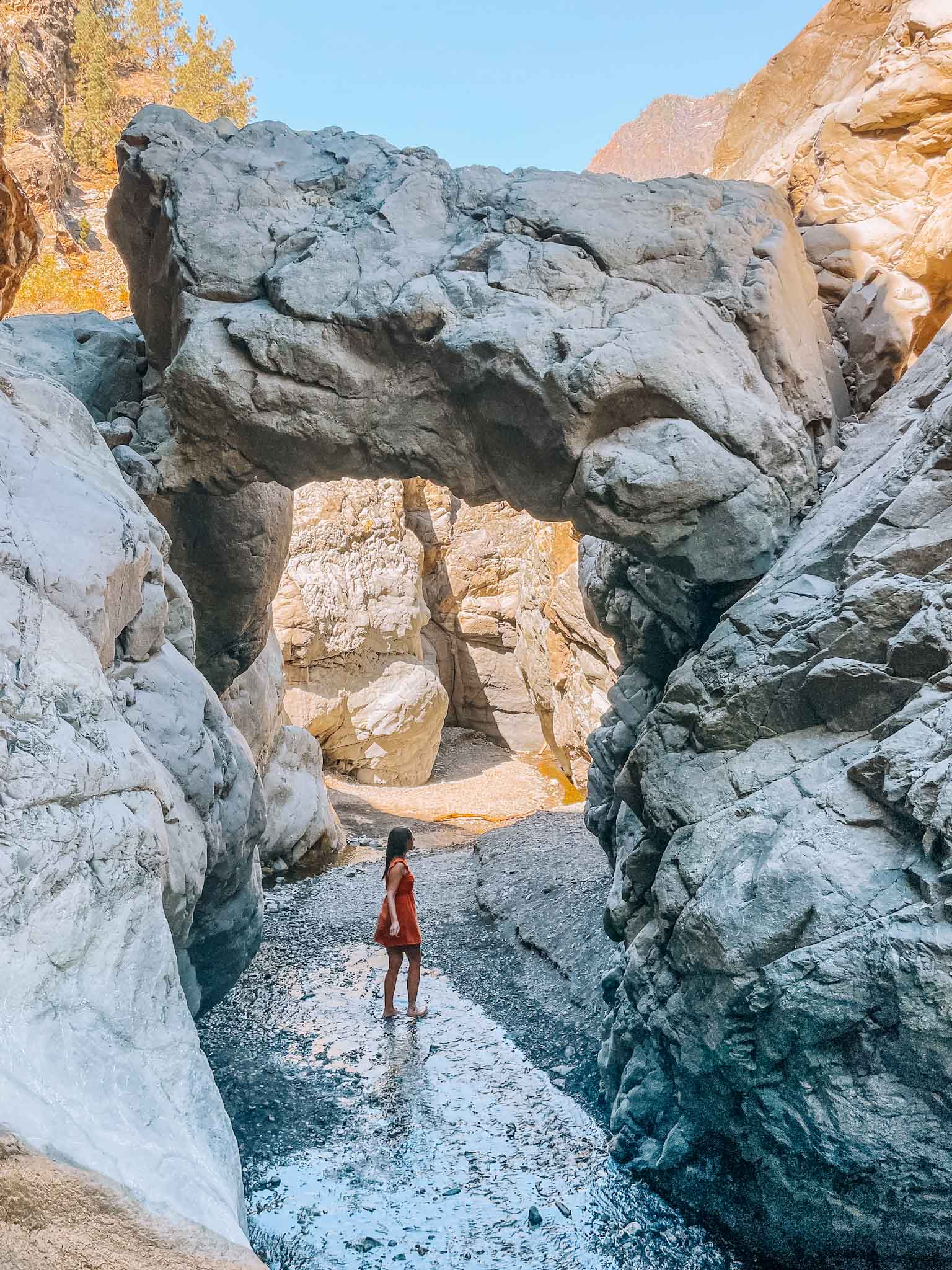
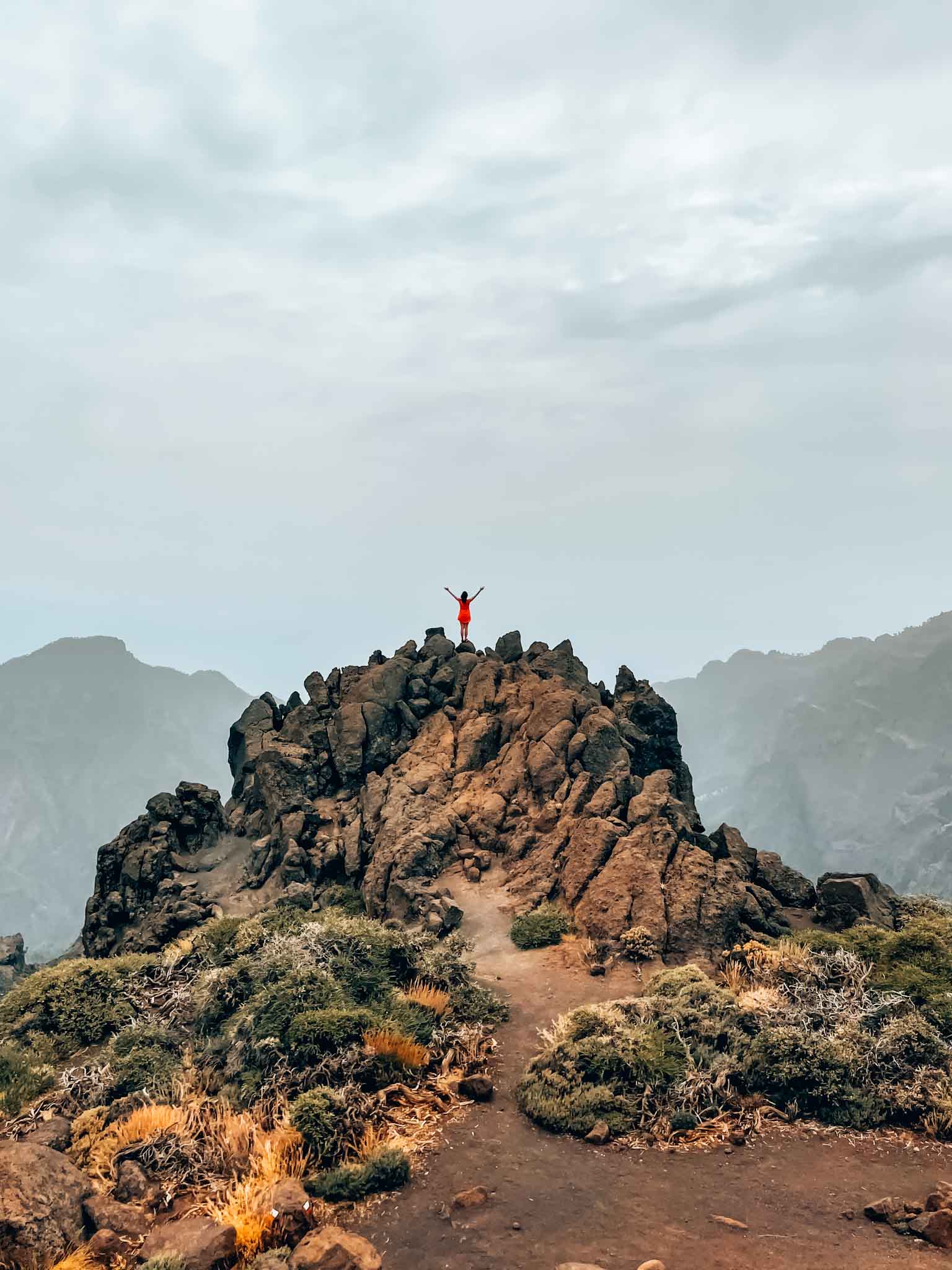
Can you enter the gorge of Cubo de La Galga?
If you are looking for a small adventure, then you will notice that the trail goes along a deep gorge. Actually, you can walk down there inside the gorge. This photo (see the one above with the orange dress!) was taken inside the gorge.
You just have to find this spot along the trail where there is a wooden pole with an X on it and then simply follow the path down. In case it seems safe, I really recommend exploring the gorge!
Location: Cubo de La Galga hiking route – Official parking lot – Guided tour to Cubo de La Galga
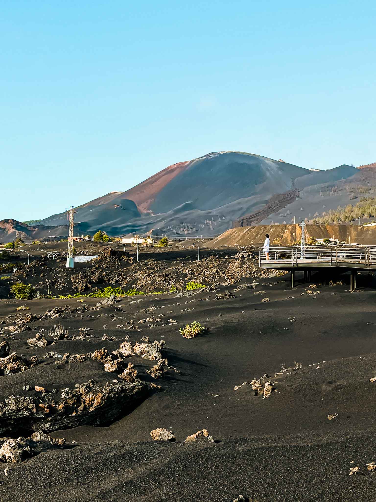
3. Ruta de los Volcanes
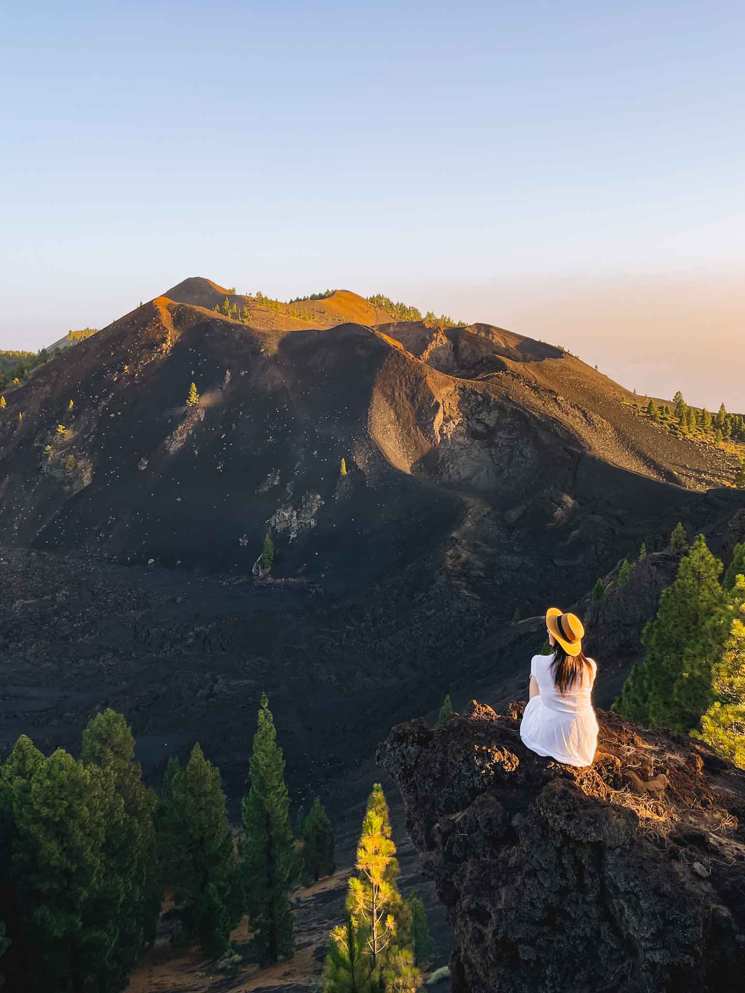
Ruta de los Volcanes is one of the landmark hikes in La Palma. Basically, it is a 24-kilometer route through the most apocalyptic part of La Palma.
The trail starts in the South at Fuencaliente going through bare lava fields and next to some of the most recent volcanoes and ends at the recreational area of El Pilar which is already in the forest. You can see the map of the route here.
How to hike Ruta de los Volcanes?
You can hike this trail in any direction. In order to have significantly fewer vertical meters, many people hike from El Pilar to Fuencaliente as it mostly goes downhill.
Furthermore, the trail is already challenging because there is no shade for the most part of the trail. Plus you have to carry all the things you need in a backpack.
As you understand, if you hike the trail one way, this means you don’t have a car at the finish. For this, there is an option to pre-order a taxi that will meet you at the finish line. It costs about 50 EUR to get a taxi at any end of the trail. You can book a taxi on this website.
Shorter routes of Ruta de los Volcanes
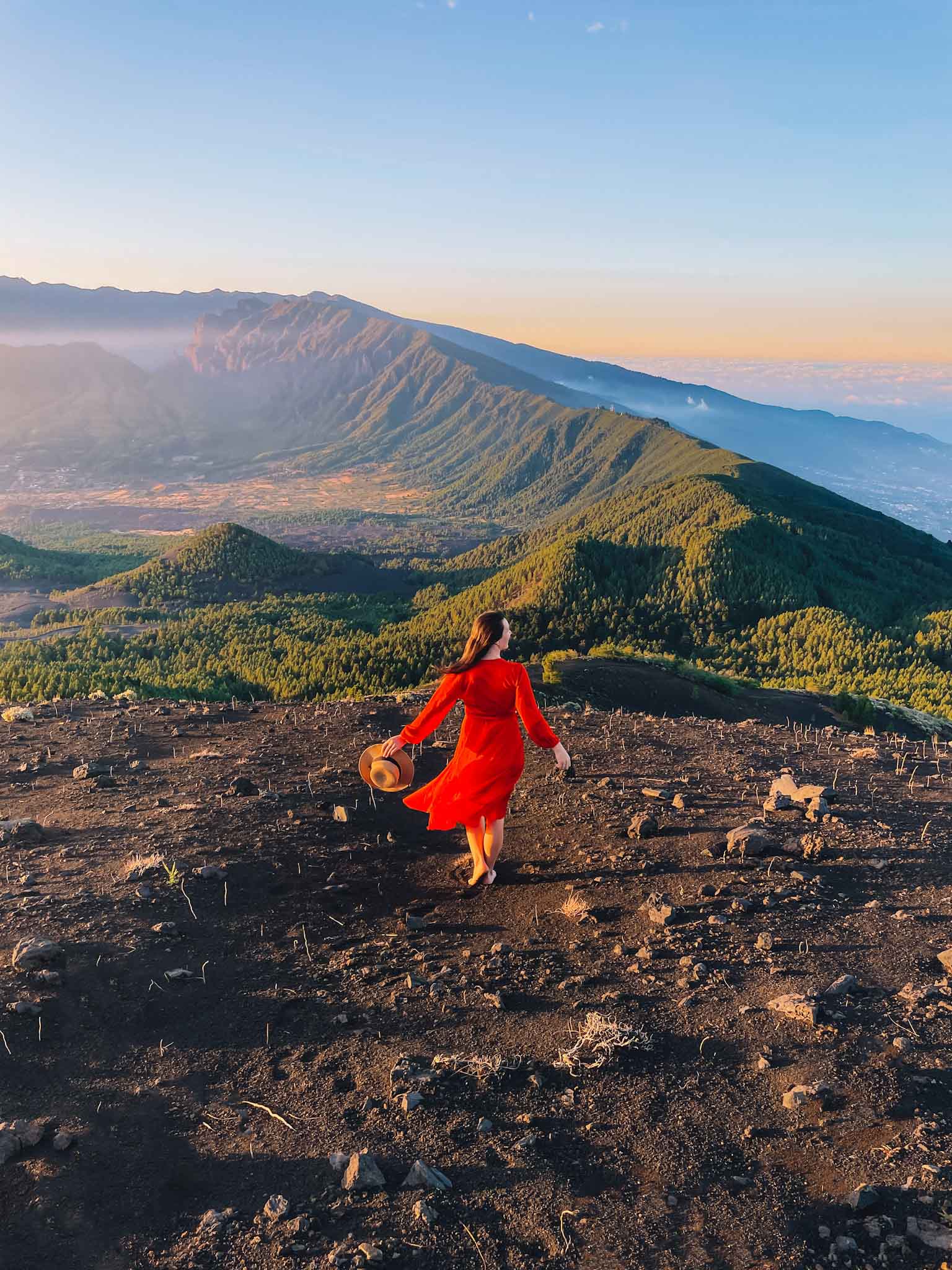
If you are not ready to spend the whole day on an exhausting hike and pay 50 EUR for the taxi to take you back to your car, there are other shorter options you can do. Like – you can hike shorter sections of the hike from either end of the trail and back!
We did a 12-kilometer round trip of the Volcano Route hiking trail starting from the El Pilar recreational area (where you can park your car) to El Duraznero volcano (pictured above). This impressive volcano is located at the 6-kilometer mark from the start. it was a beautiful hike!
You can also choose this Guided Volcano Trekking tour as an easier alternative! This will give you a good insight into the apocalyptic views of La Palma. In case you choose the guided tour, you will find out more about the area and volcanic eruptions that have taken place here not too long ago!
Location: Faro de Fuencaliente – El Pilar – El Duraznero
4. Roque de los Muchachos hike along the volcano crater
Both Roque de los Muchachos (2426m) which is the highest peak in La Palma and the Caldera de Taburiente crater are landmark attractions in La Palma. You can’t leave La Palma without experiencing the majestic views from the top of the island!
To enjoy this area to the fullest you can either join this Roque de los Muchachos trekking tour along the crater or check out different routes on the map of trails of La Palma!
Location: Roque de los Muchachos · Roque de los Muchachos trekking tour
5. Sunset or sunrise hike at Pico Birigoyo
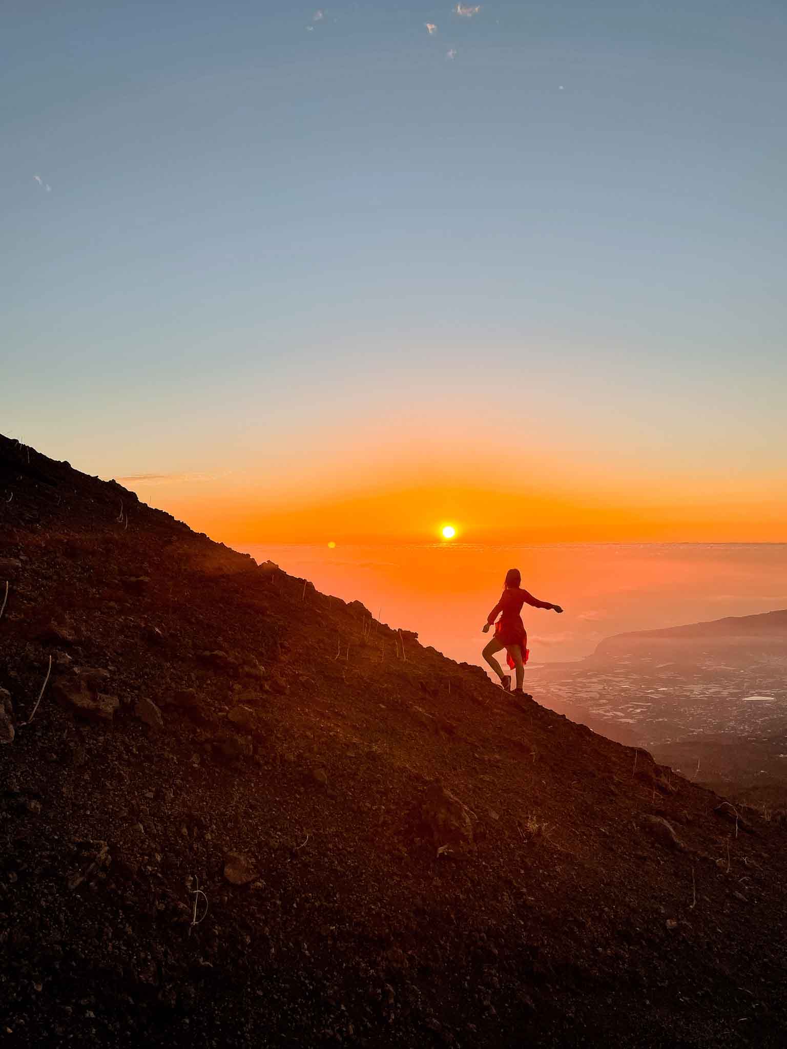
If there is one more special hiking trail in La Palma that you should do to make your trip more memorable, then this is it. Hiking to Pico Birigoyo mountain top to watch the sunset was a highlight for me.
It will be beautiful in any weather conditions. We were lucky to have a clear evening and we saw the whole island colored in beautiful sunset shades. It was one of my favorite memories from La Palma.
How to hike to Pico Birigoyo Peak?
The hike to Pico Birigoyo Peak is a short one. It starts from El Pilar recreational area just like Ruta de los Volcanes and goes straight uphill.
The hike is 1.7 kilometers long and has about 350 vertical meters. It took us about 35 minutes to climb to the top of the volcano. There is not an official number to this trail however the path is very clear and walked by many people chasing the best views in La Palma.
Whether you can hike there for the sunset/sunrise or not, I really recommend this trail! This is one of those rare spots where you can see over the whole island from coast to coast! How cool!?
For the route, you can check this hike on Komoot.com. Although they have walked a longer circular route, the part at the beginning goes exactly where the route to Pico Birigoyo summit is.
Location: Pico Birigoyo · Parking places
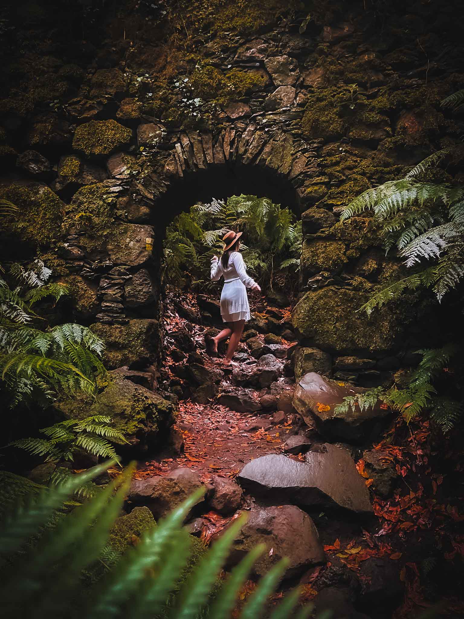
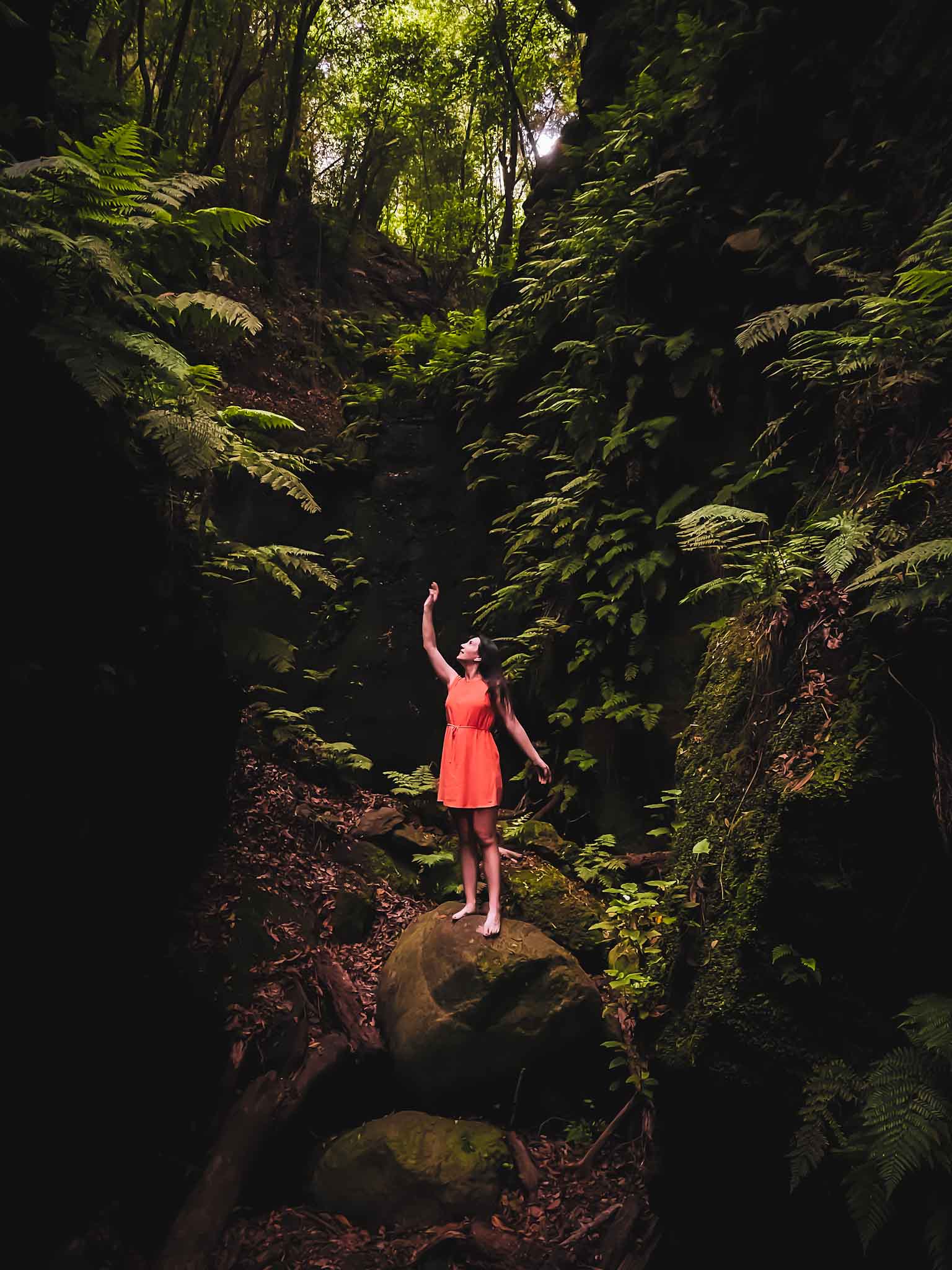
6. Marcos y Cordero trail
Marcos y Cordero hiking trail is officially the trail PR LP 06. However, there are many variations to this trail, but the most popular option is to hike from Casa del Monte to Los Tilos – it is a 14-kilometer route and will take you multiple hours to finish. Definitely plan to spend decent hours on this trail!
How to hike the Marcos y Cordero trail?
In order to do this trail, you have to drive to the finish at the Los Tilos Visitors Center, park your car, and take a taxi to the start of the trail because the start of the trail is accessible only by 4×4.
Taxi services from Los Tilos start at 9 AM and end around midday (depending on the season). Check this link to see the taxi timetable. Usually, they operate until 2 PM during the summer season and until 12:30 PM during the winter season.
Obviously, this hike is one-of-a-kind. It is full of streams, long, dark, and wet tunnels (flashlight and waterproof clothing recommended!), and lush green forests.
Make sure you have appropriate hiking footwear and a backpack with the necessary refreshments because it is a long hike!
Marcos y Cordero trail is challenging, and it is not safe to walk during bad weather. At the finish, at Los Tilos, you should definitely visit the beautiful Cascada de Los Tilos waterfall (picture above).
Location: Casa del Monte (start) · Los Tilos (finish) · Marcos y Cordero trail route · Cascade de Los Tilos waterfall
7. Hike underground inside a volcanic lava tube
From the top of the islands and above the clouds to dark lava tunnels underground. La Palma is all about unique experiences and this is one of those must-do things in La Palma for sure!
However, this is quite a short hike (about 500 meters), but very informative and unique nevertheless. The underground lava tube hiking tour offers you a once-in-a-lifetime opportunity!
You will walk inside a 3-meter-wide underground cave which is actually a lava tunnel from a 1949 eruption and find out more about the process of a volcanic eruption. From here you can also observe the aftermath of the 2021 volcanic eruption (photo above!).
Location: Underground lava tube hiking tour · Parking lot
More La Palma travel inspiration!
- Ultimate Guide: 23+ Best Things To Do And See In La Palma
- 17 Best Instagram Spots For Amazing Photos Of La Palma
- 21 Unique Spots And Hidden Gems In La Palma Island
- 7 Ultimate Best Hiking Trails You Should Do In La Palma!
- Check Out These 7 Unique Swimming Spots In La Palma!
Happy exploring!
La Palma surprised me in a good way! I didn’t know such a small island could accommodate so many different climates, landscapes, and unique places! If you can, please, leave a comment below if there are any significant changes to anything that is written in this blog post! Many thanks!
PIN FOR LATER!
Why barefoot?
Felt like doing that just for the photos 🙂