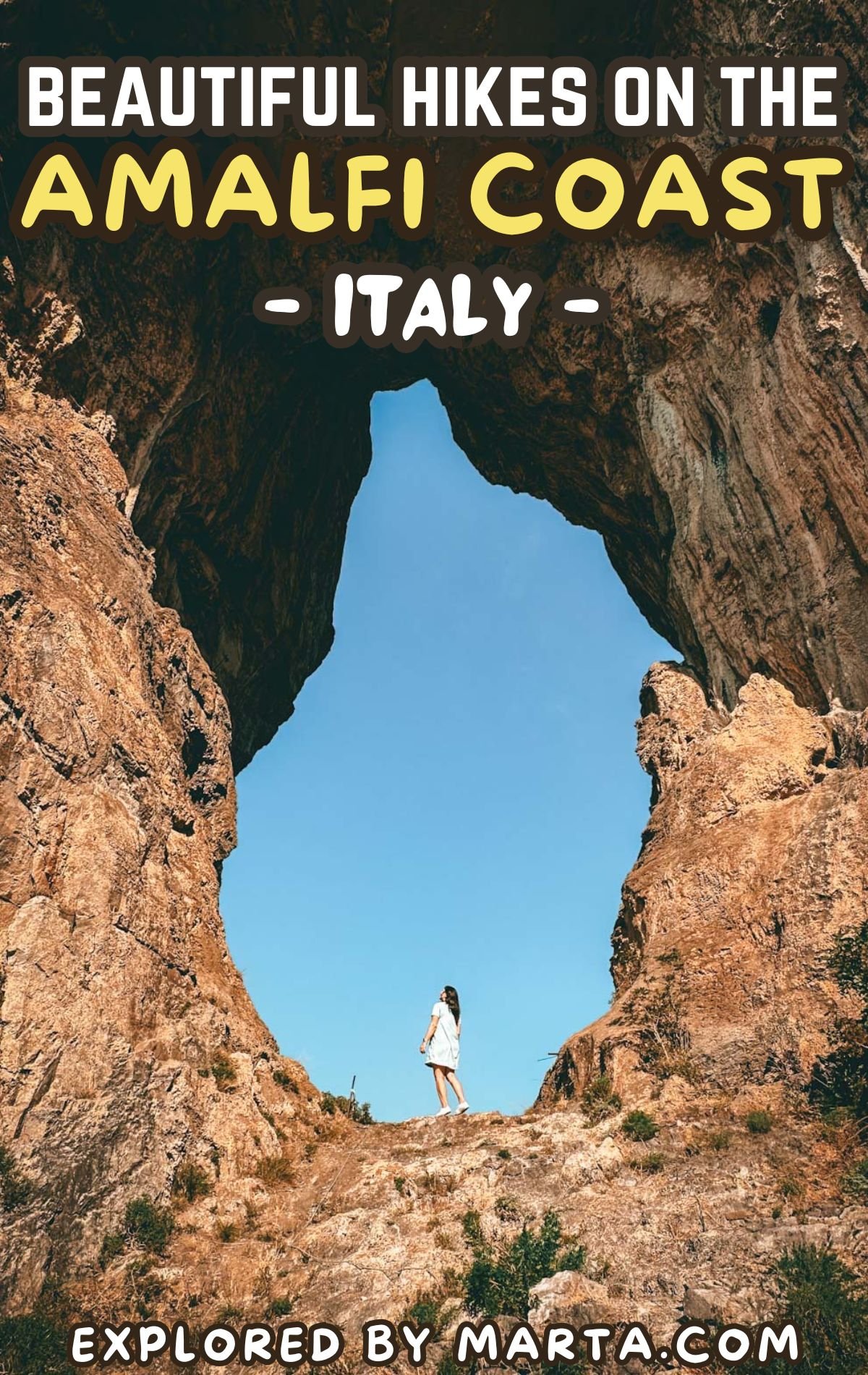
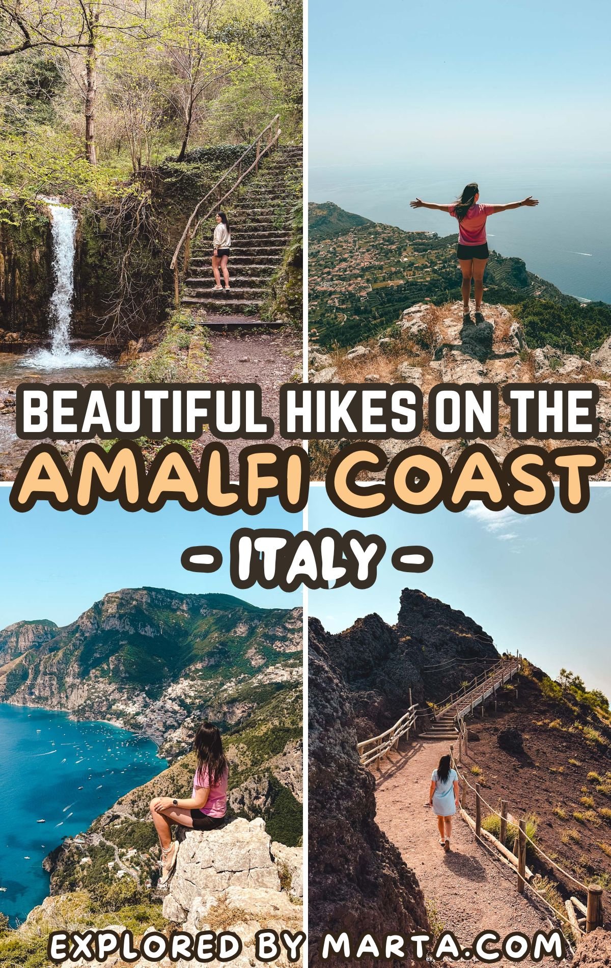
10 beautiful hikes on the Amalfi Coast, Italy (& nearby!)
This post may contain affiliate links. If you use these links to make a purchase or booking, I may earn a small commission at no extra cost to you! Thank you for your support!
Let me share with you the most beautiful walks and hikes on the Amalfi Coast and in the surrounding area! These hiking trails are suitable for all fitness levels and easy to include in your travel itinerary.
Famous for its stunning nature and panoramic views, the Amalfi Coast is a place like no other. We love hiking, and after spending about six months in this part of Italy, we’ve compiled a list of the most beautiful and scenic trails we’ve explored.
Most of these hikes have occasional trail markers, but I highly recommend downloading offline maps using the Organic Maps or MAPS.ME app and following the route to stay on track.
Read along to find out all about the most beautiful hikes on the Amalfi Coast with photos, descriptions, and locations on Google Maps. Happy travels!
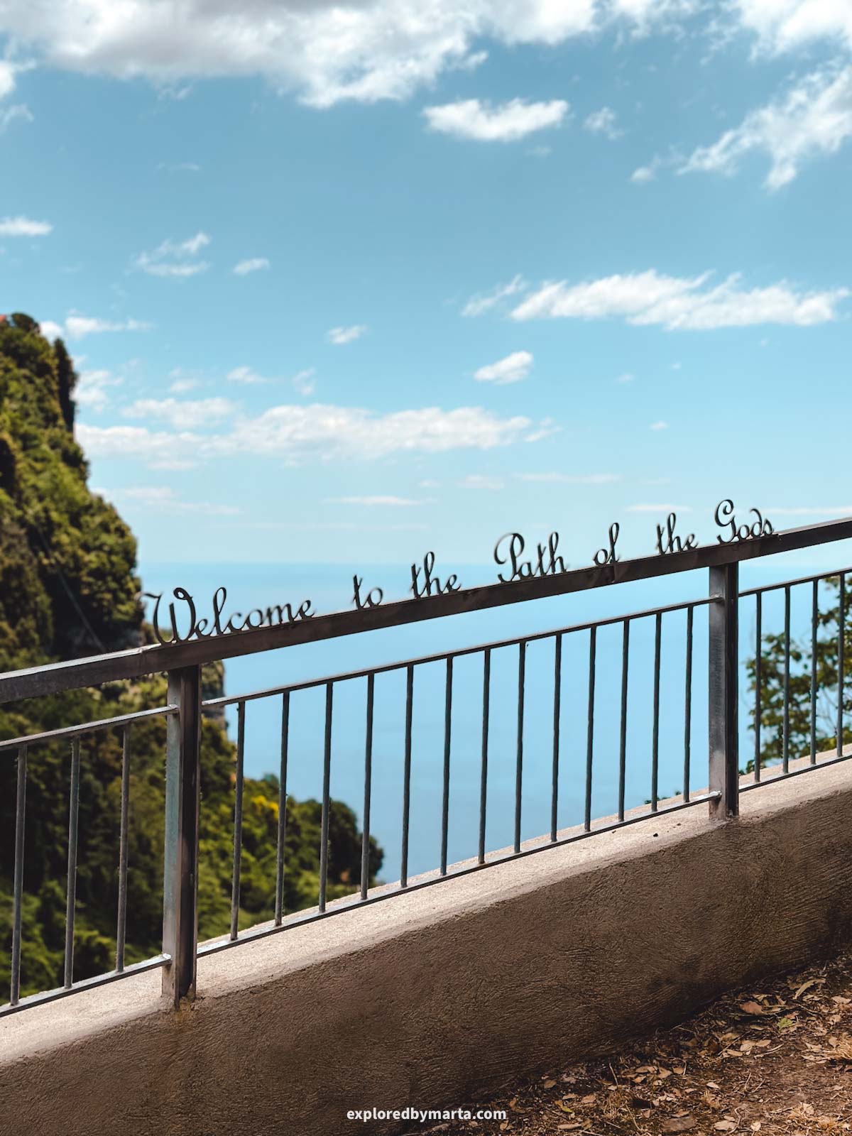
1. Path of the Gods, or Sentiero degli Dei
Distance: 12.30 km or 7.74 miles out-and-back
Difficulty: moderately difficult
Elevation gain: 600 m
Duration: 3h 30 min
Of all the hikes on the Amalfi Coast, this is the one you cannot skip!
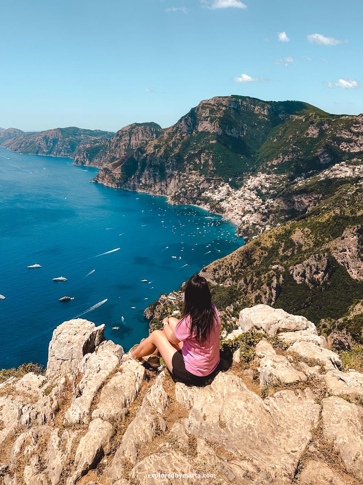
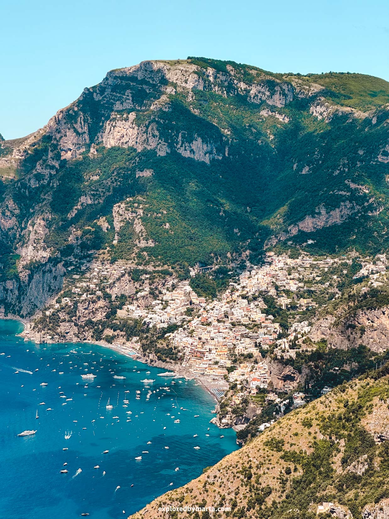
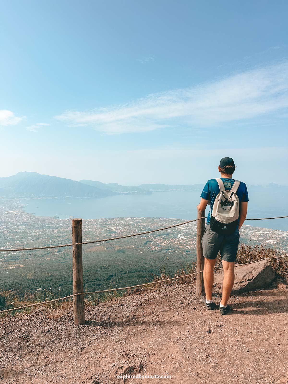
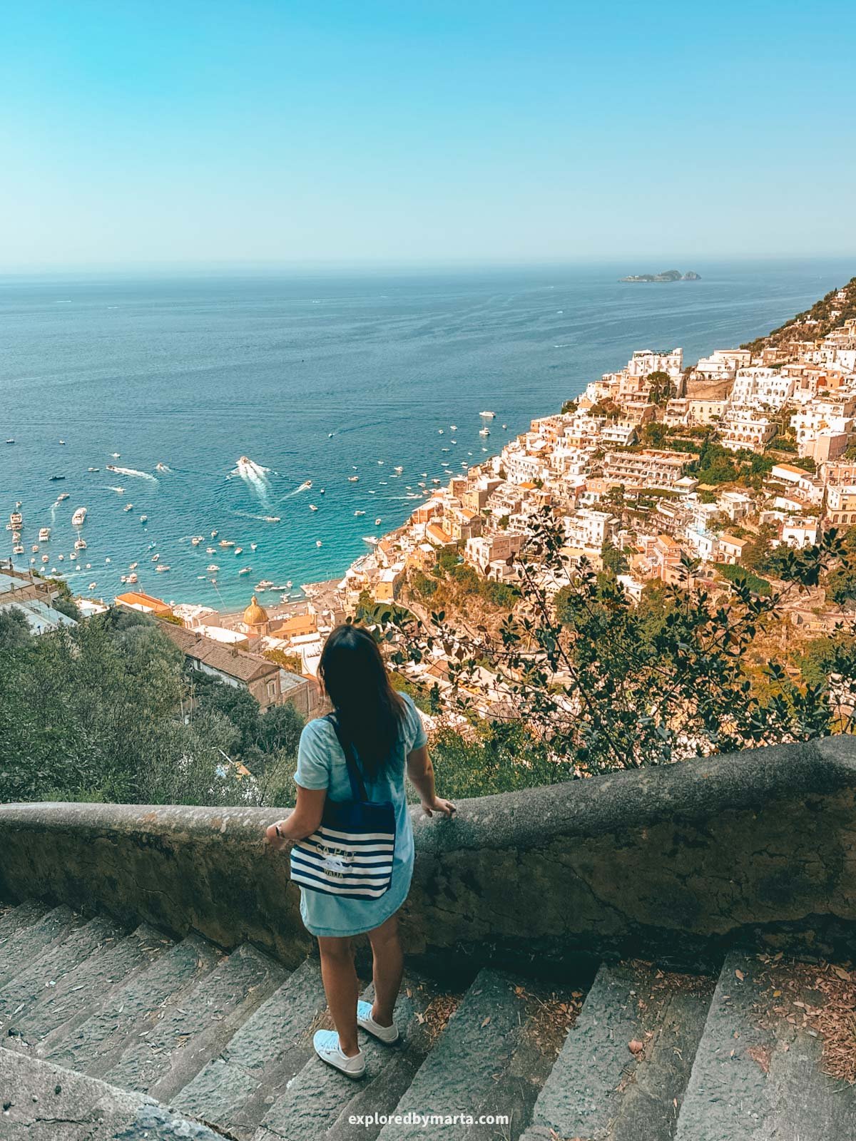
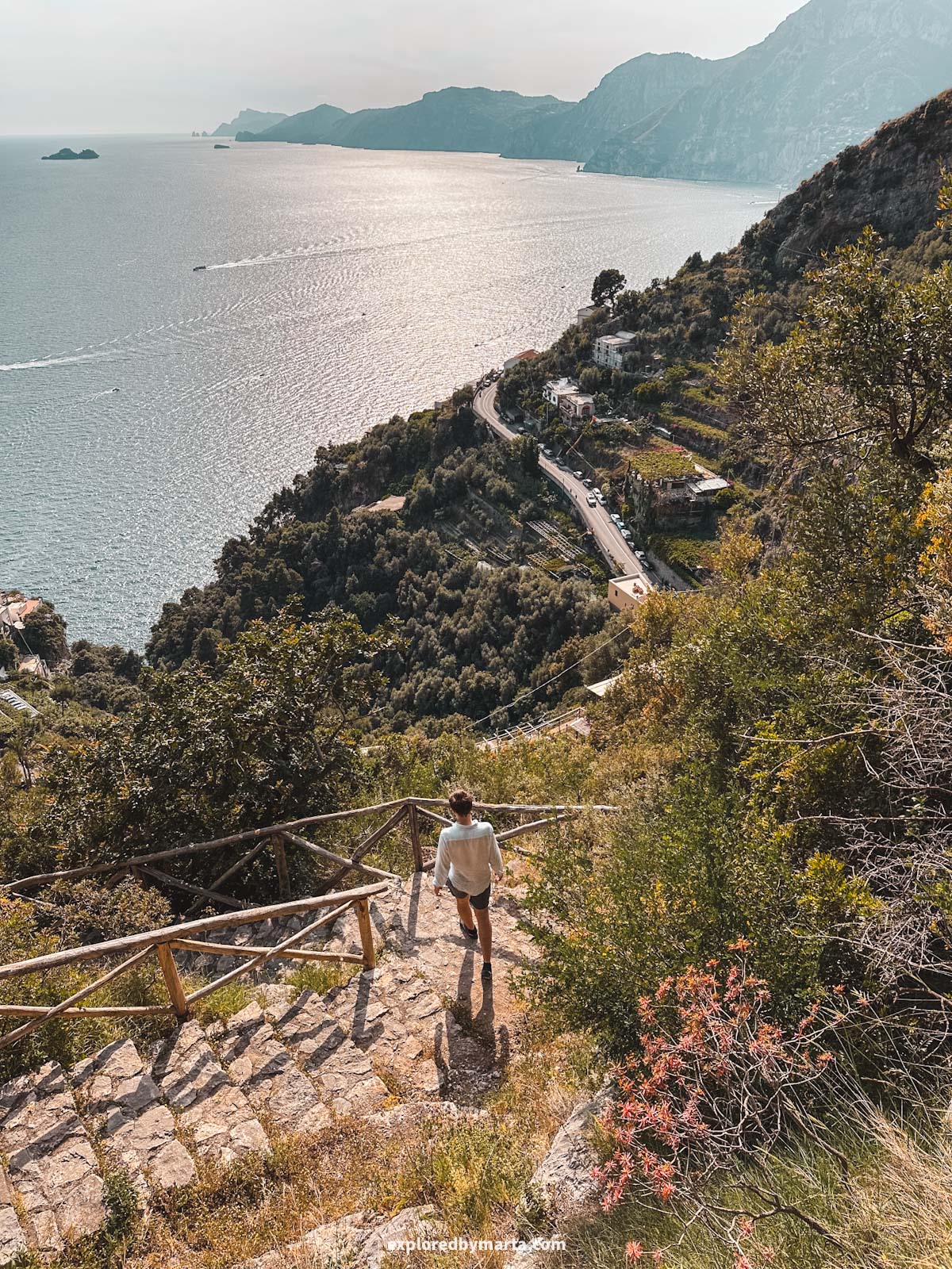
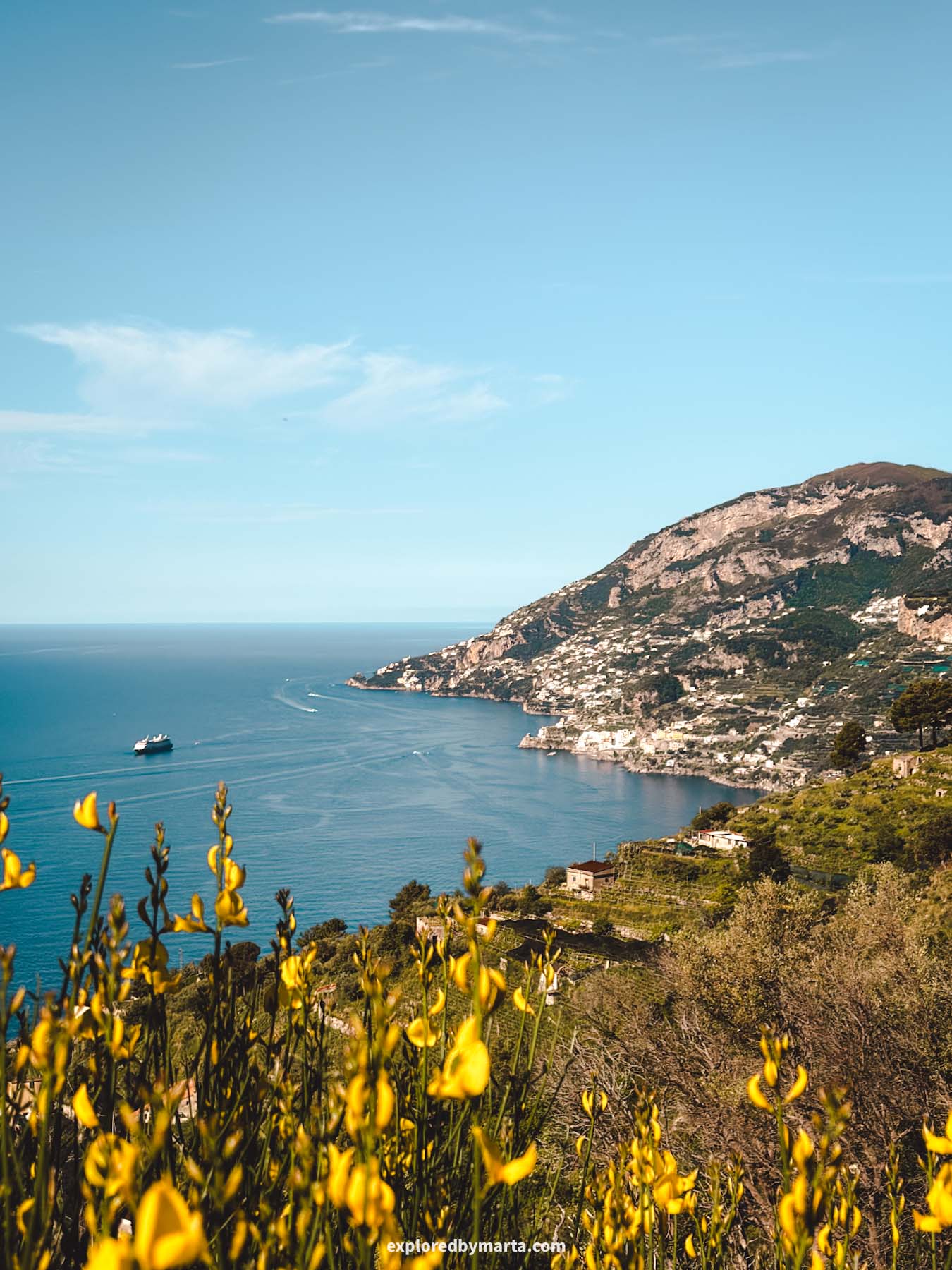
Path of the Gods, or Sentiero degli Dei, is one of the most famous hiking trails in Italy and is considered one of the most breathtaking hikes in the world! Did you even visit the Amalfi Coast if you didn’t hike this trail? We definitely did.
I my opinion, there is no better way to see the breathtaking beauty and all the picture-perfect angles of the Amalfi Coast and the Lattari Mountains forming the Sorrento Peninsula than by hiking this famous path.
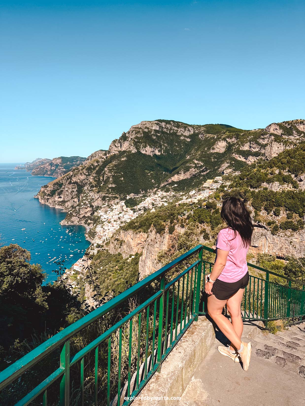
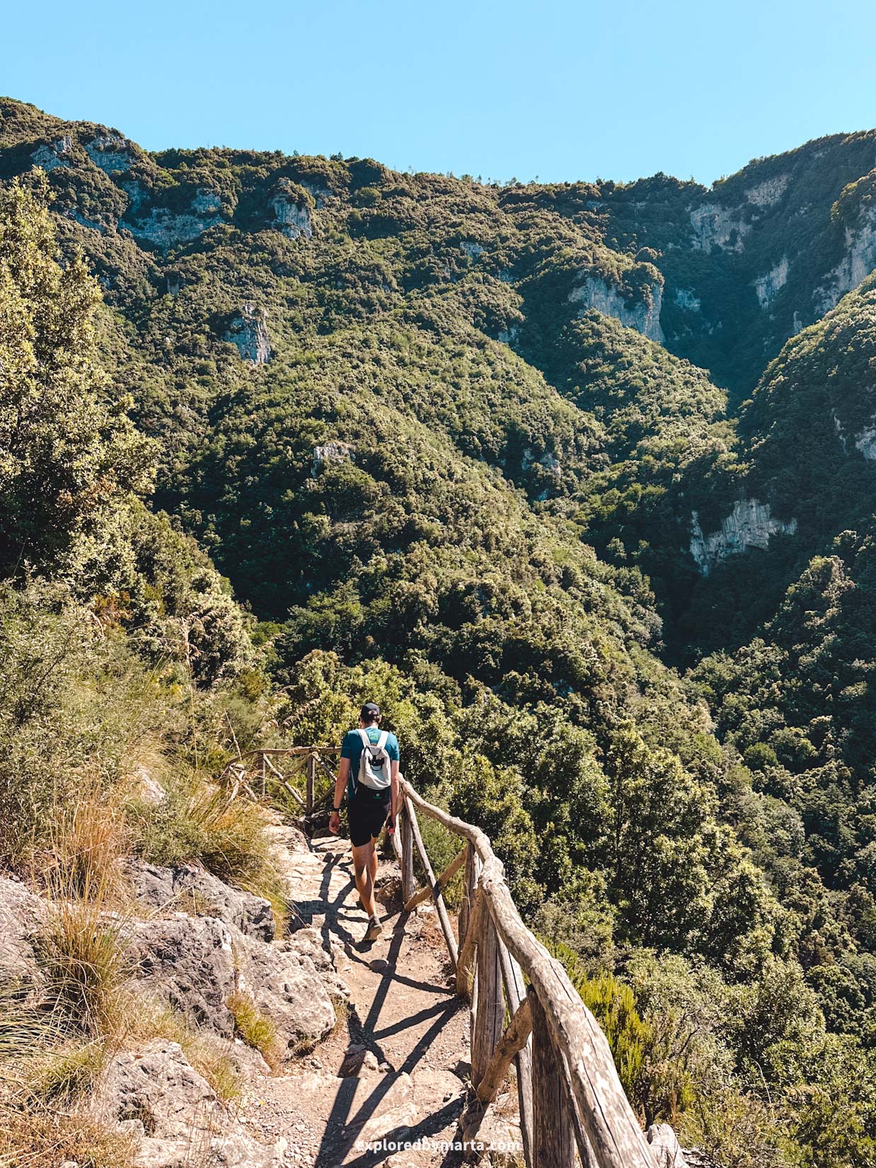
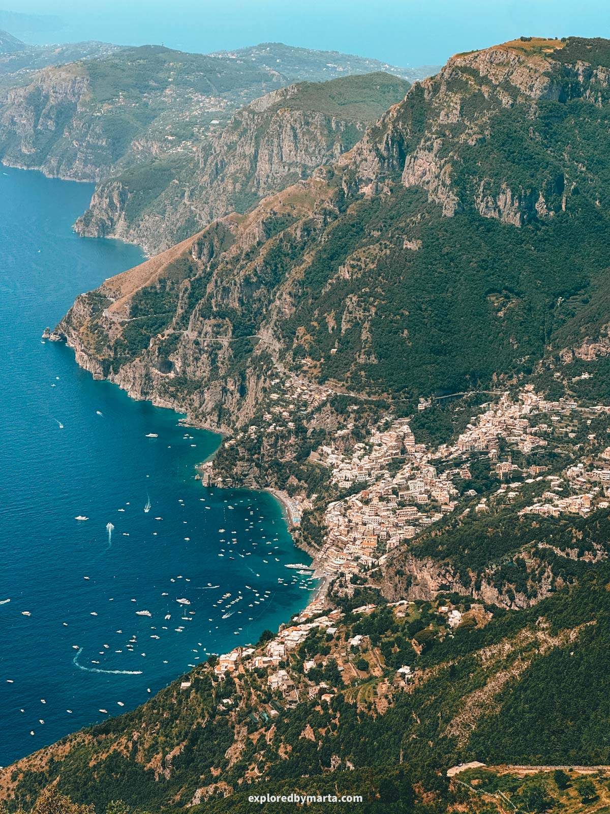
The Path of the Gods is an ancient pathway in the mountains of the Sorrento Peninsula that connects two mountain towns: Agerola and Nocelle.
The original hike starts in the center of Bomerano hamlet in Agerola and finishes in Nocelle village right above Positano.
However, these days people hike different versions of this hike, like Agerola to Positano or Praiano to Positano, etc. It depends on where you are staying, as well as your transportation possibilities.
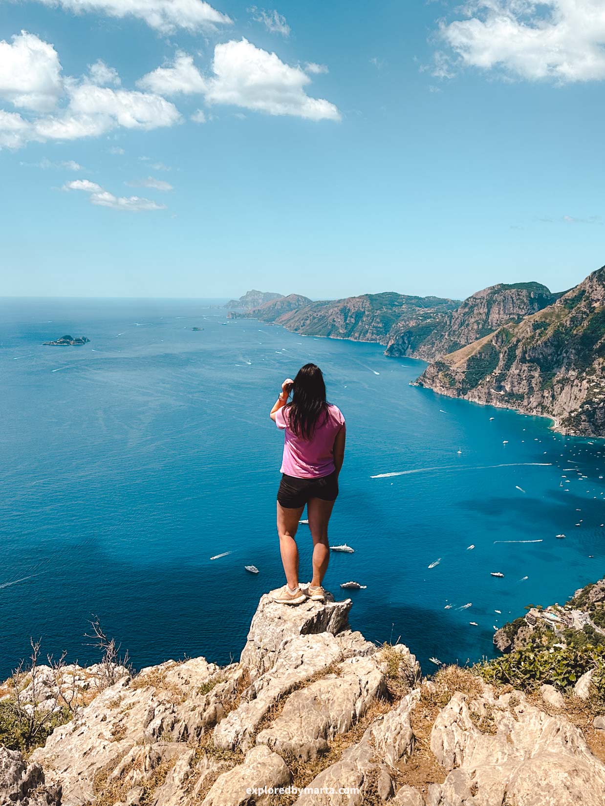
Also, you can walk it in different directions; however, the direction walking towards Positano is the better way to do it, because those are the iconic views this hike is famous for.
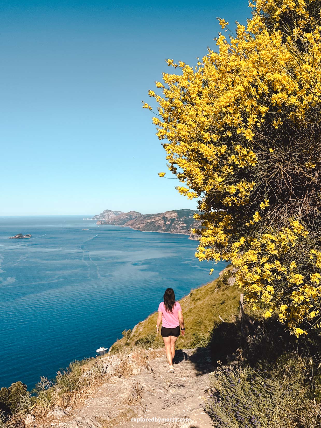
So I recommend starting the hike either in Agerola or in Praiano to get those breathtaking views.
Another thing to decide is whether you walk the hike only one way and then find public transportation to get back to where you need to be, or you walk the Path of the Gods hike there and back.
For us, we had our own car, so we hiked from Agerola to Nocelle and then walked all the way back to get back to our car.
Our version was a moderate difficulty 12.3-kilometer or 7.6-mile out-and-back hike that took us 3h 30min. We did the hike in the morning to avoid the midday heat.
Whichever route you decide to go, the main question you need to decide beforehand is about getting back to where you need to be.
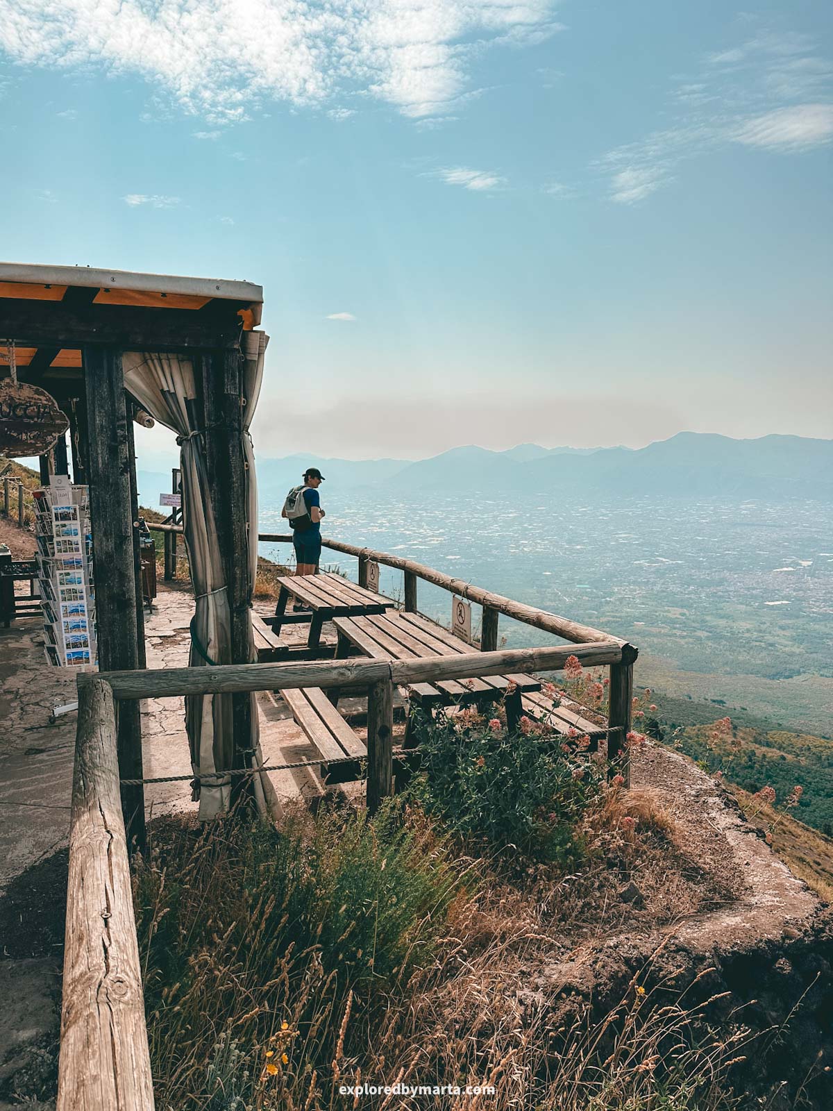
It’s not an easy hike, but it’s also not a challenging hike. To me, the exposure to the sun was a factor, so definitely bring a hat, water, and some snacks, especially if you hike there and back.
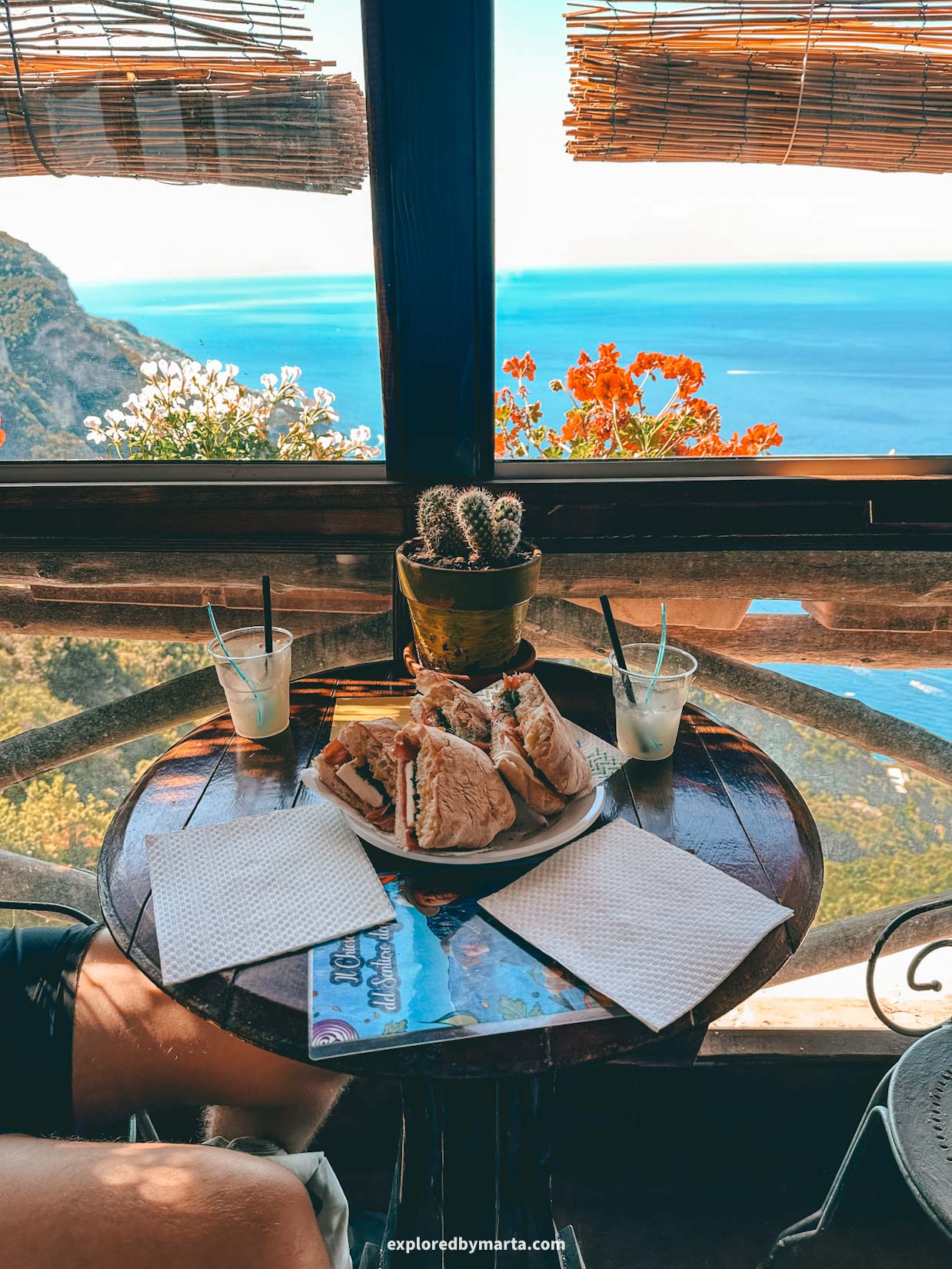
When we reached the village of Nocelle (our halfway mark), there was a beautiful little café where we got to have breakfast sandwiches with a nice view. This breakfast saved me because we did not bring any snacks with us. Ooops!
If we didn’t have a car waiting for us in Agerola, we would have continued from Nocelle down to Positano by a long and steep staircase, then hopped on a bus or ferry and returned to our hotel. There is also a bus from Nocelle to Positano, so you have lots of options here.
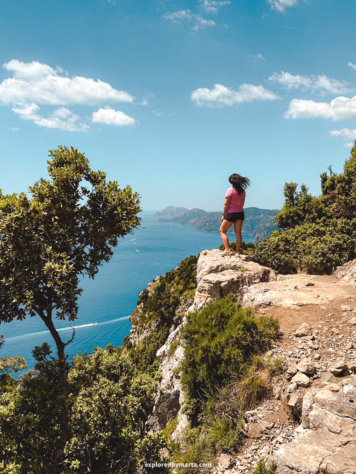
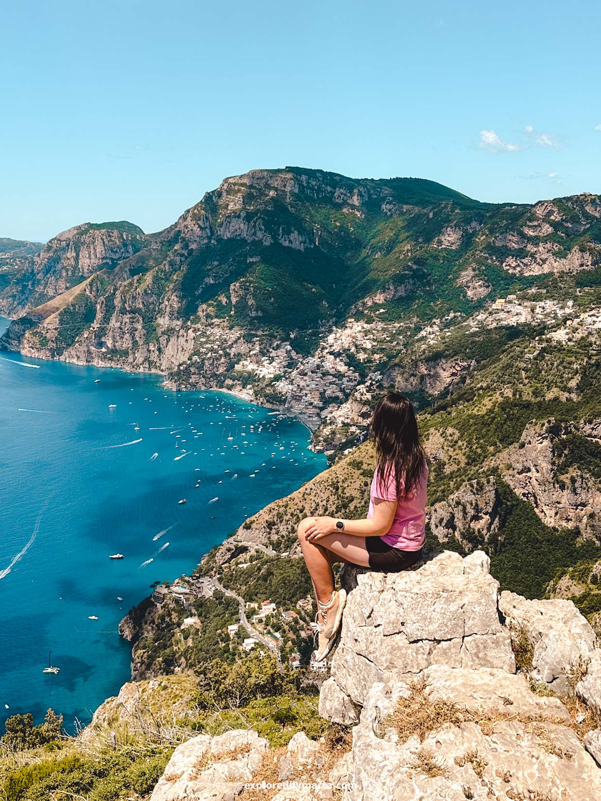
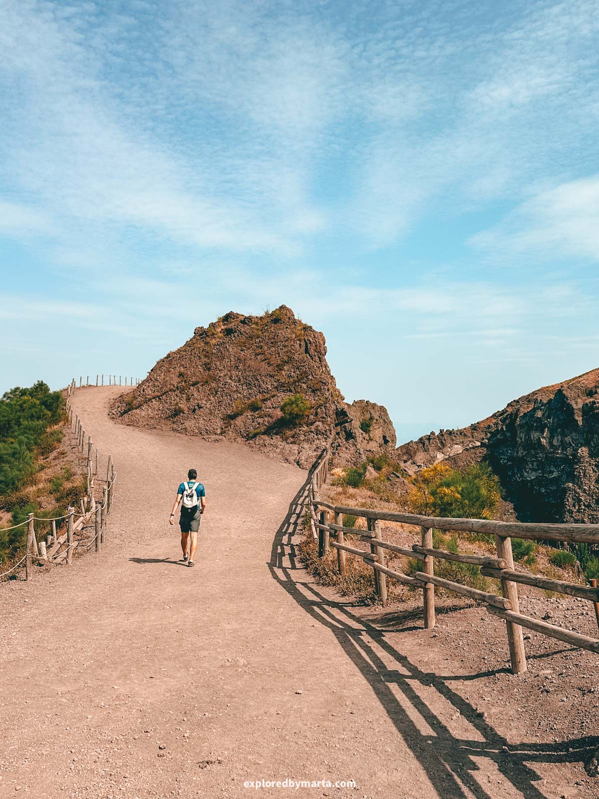
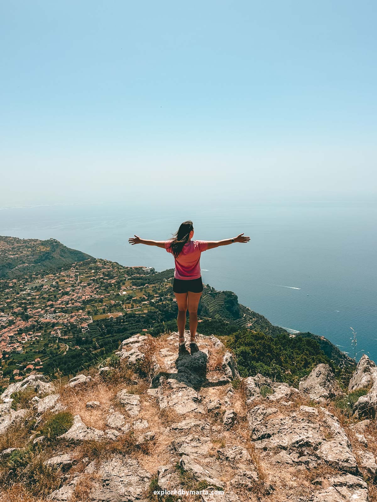
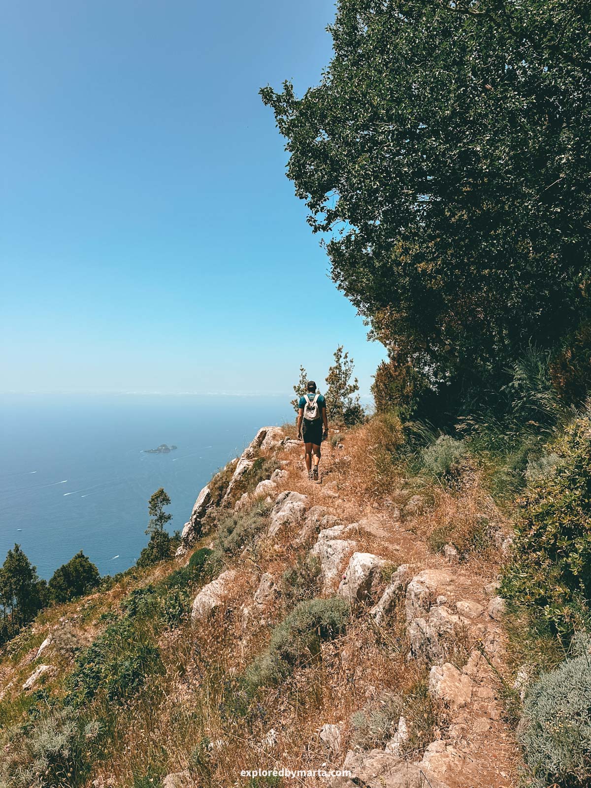
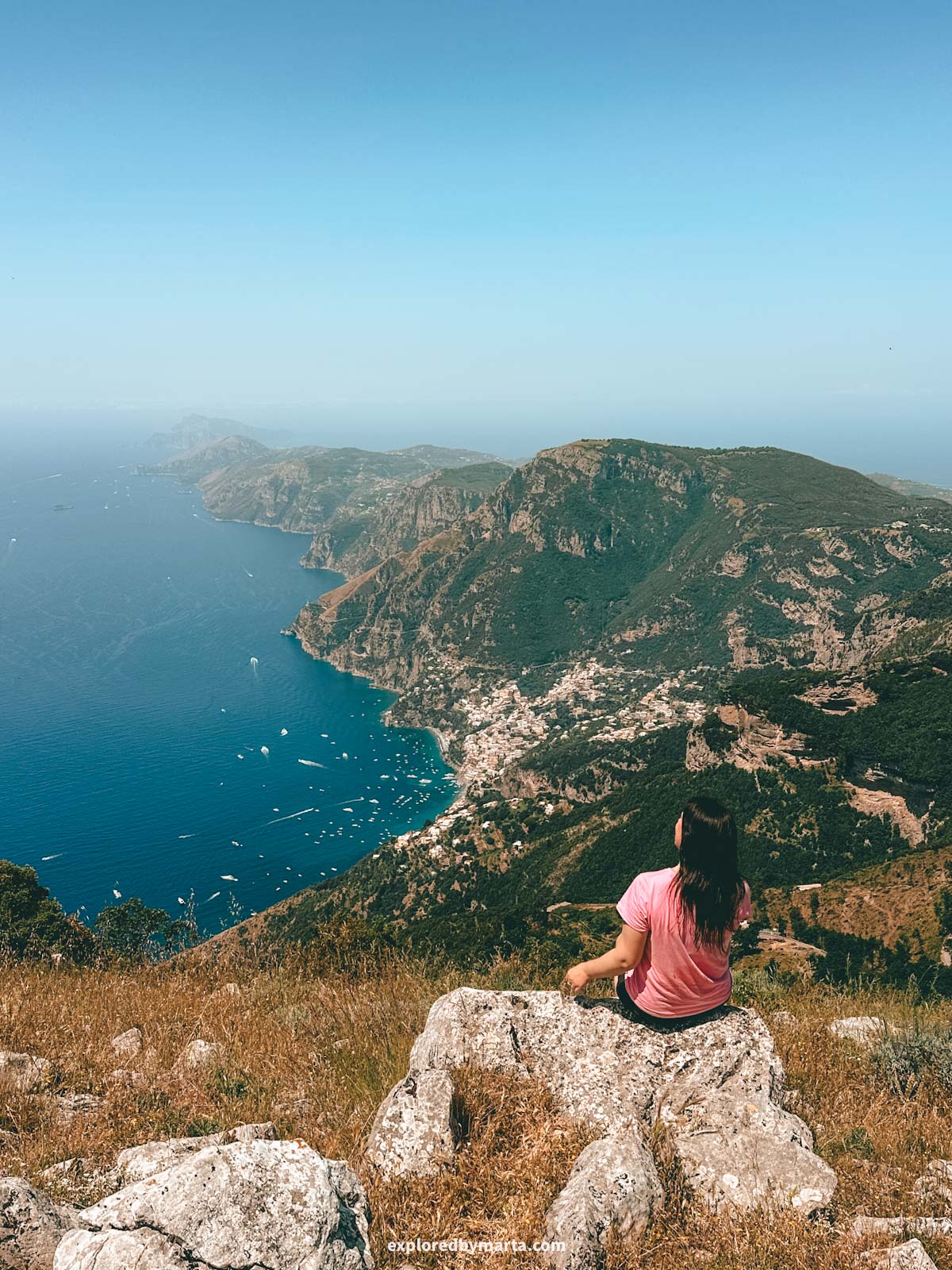
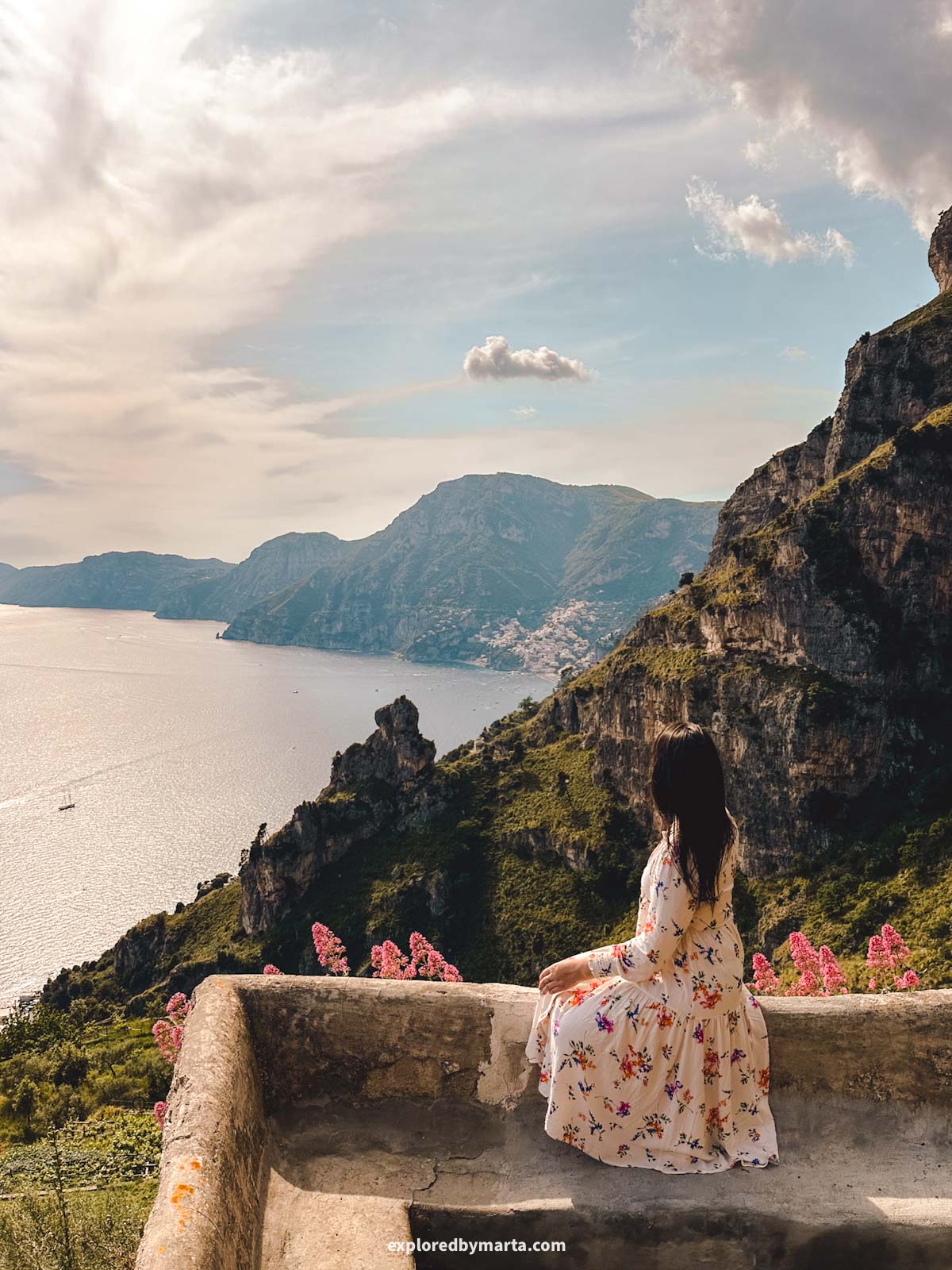
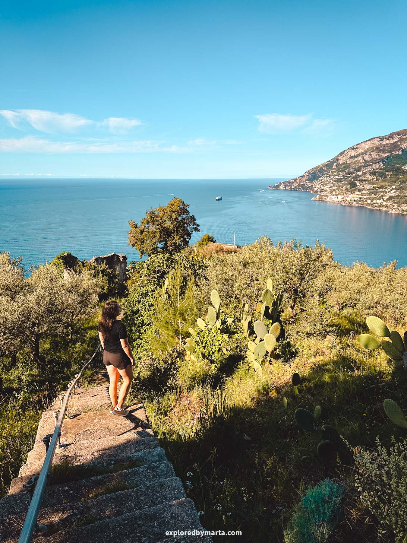
But to be completely honest, I’m so glad we got to walk there and back! There is a small section between Praiano and Positano where this hike has two parallel paths – one goes lower, the other one goes higher up the hill.
We walked the lower path there and returned by the upper path. The path higher up the hill offered us views we definitely did not see down below! So happy we did that!
Actually, the upper path gave us one of the most beautiful spots we saw on the Amalfi Coast, and we spent 30 minutes taking pictures here (see the first and third photos here, where I’m standing and sitting on a rock).
If you have a chance to walk the Path of the Gods, I highly recommend doing it! To me, there’s no question why this is one of the best hikes on the Amalfi Coast. Memories for a lifetime!
Location: Start of the Path of the Gods – Positano viewpoint
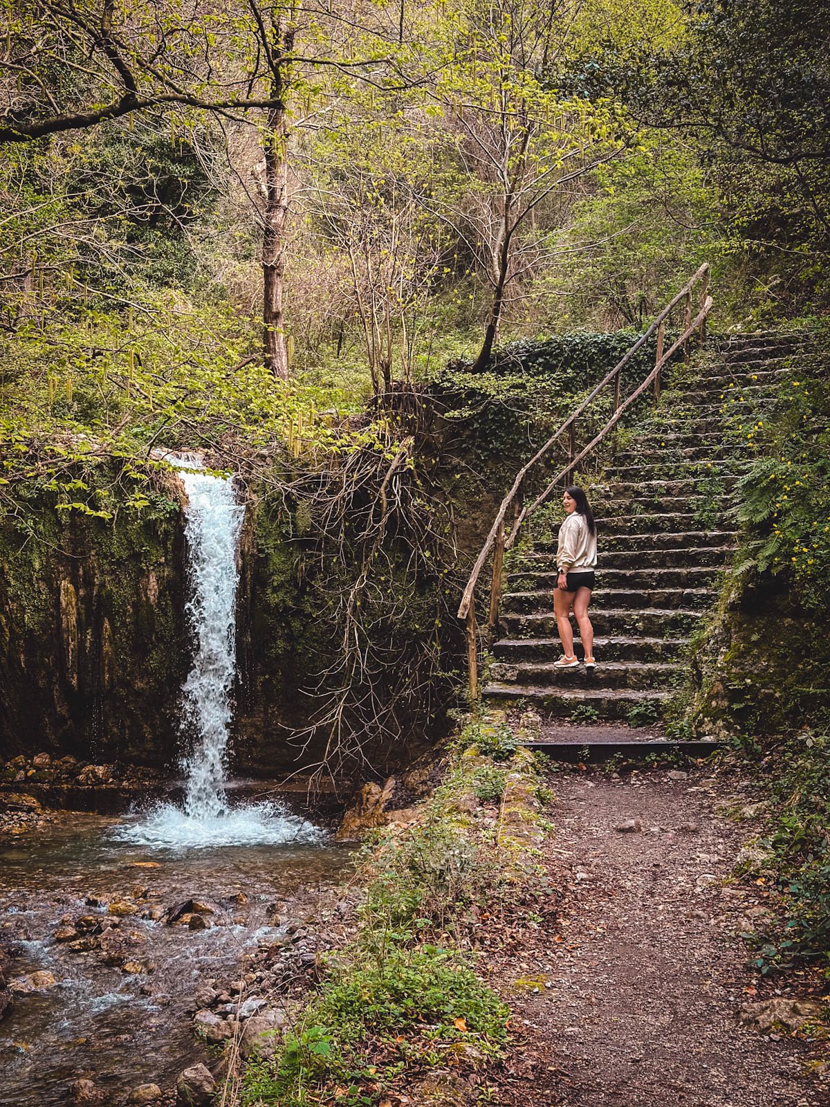
2. Waterfall hike to Valle delle Ferriere


Distance: 8.2 km or 5.1 miles circular
Difficulty: moderately easy
Elevation gain: 400 m
Duration: 2h 25 min
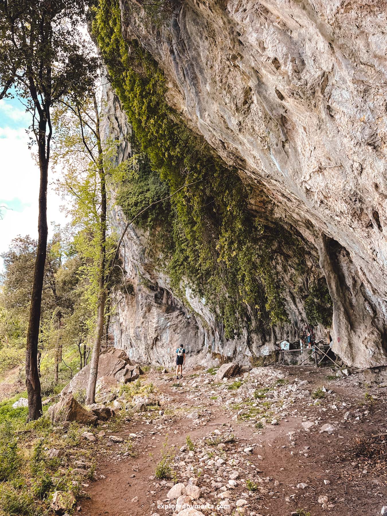
Located in the heart of the Amalfi Coast, that is, in Amalfi town, is the starting point of one of my favorite hikes on the Amalfi Coast – a hike to Valle delle Ferriere! This gorgeous valley was one of my favorite places to visit on the Amalfi Coast!
Amalfi town sits by the coast at the mouth of a river and is surrounded by lush mountains, lemon groves, and green forests, making it the perfect place to enjoy a peaceful hike along a gurgling river.
And there is no better hike to do in the town of Amalfi than the hike to Valle delle Ferriere!


You can start the hike from the beach, the main square, or pretty much anywhere in town. At first, the trail follows the main street, Via Lorenzo D’Amalfi, heading deeper into the valley.
Once you reach the Paper Museum, turn right and follow Via Paradiso, a smaller path that leads toward the mountains.
The path eventually turns into a forest trail, continuing alongside the river and passing several abandoned water mills and waterfalls.
The section along the river with the abandoned mills has its own name, the Valley of Mills, and some hikers only walk this far to check out the mills. Those ruins are pretty cool, but we continued on.


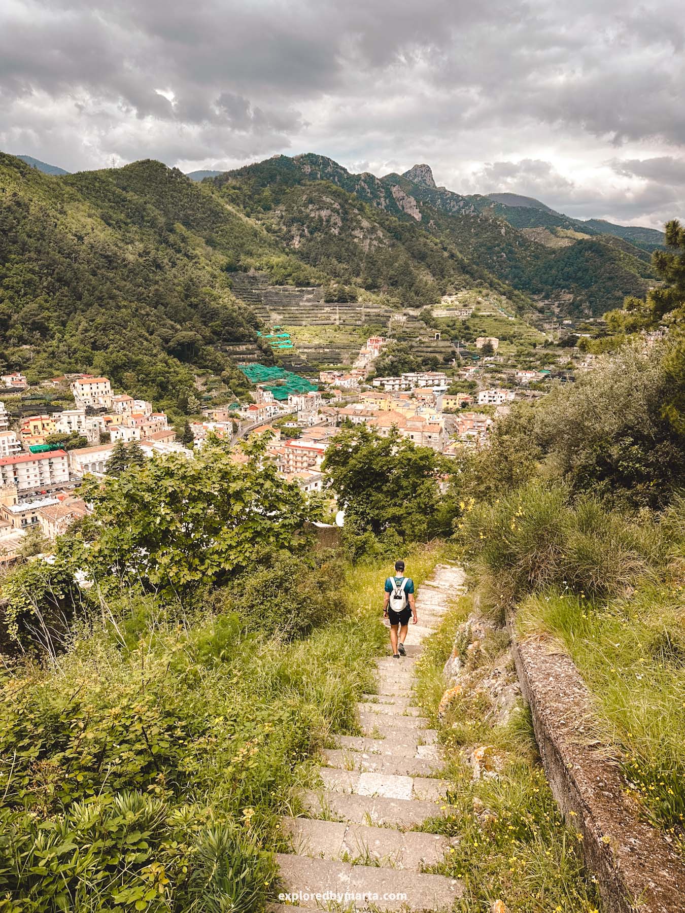
The trail officially ends at a waterfall deep in the valley. What’s left is to go all the way back to Amalfi the same way you came, or choose a different route (like we did) and walk back through Pontone village and then down the stairs from Pontone to Amalfi.
It was one of my favorite hikes we did on the Amalfi Coast, and you can tailor the hike to your needs – you can make it shorter by turning around sooner (by the mills) and walking back, or doing a loop like we did and passing by Pontone.
By the way, the stairway from Pontone to Amalfi was spectacular. The stairs bend around a cliff, and you have the best views over the lemon valley and olive groves below!


There are a couple of signposts along the way, but I recommend downloading an offline map and following directions there.
The best offline trail maps I’ve used are the Organic Maps app and MAPS.ME app. You can also check our Strava map, which I added above!
The total distance of the hike was between 7 to 8 kilometers (4.5 to 5 miles), and it took us a little over 2 hours, including plenty of photo stops.
This hike is very doable at any time of day, as the trees provide lots of shade and protect you from the direct sun.


I should mention that the last 200 meters of the trail at the end of the valley (including the final waterfall) are in a restricted area in a nature reserve. There may or may not be guides there controlling access to it.
That said, even if you’re not able to reach the very end, it won’t take away much from the experience. The waterfall is pretty tall, but quite dry, to be honest. I’d guess that it is almost non-existent during the summer months. But see for yourself!
Anyway, the hike is beautiful with or without it! One of my favorite Amalfi Coast hikes for sure!
Location: Valle delle Ferriere
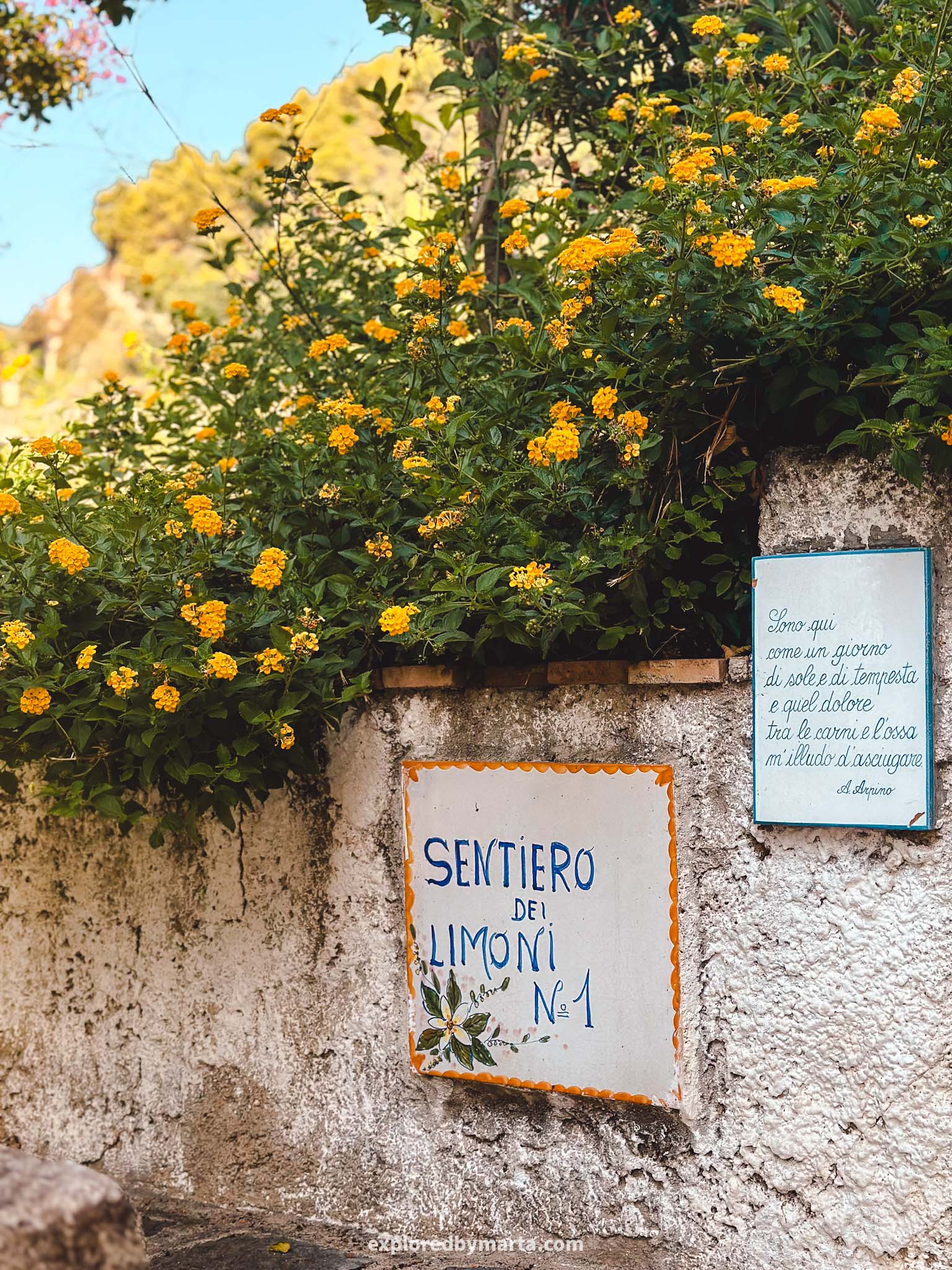
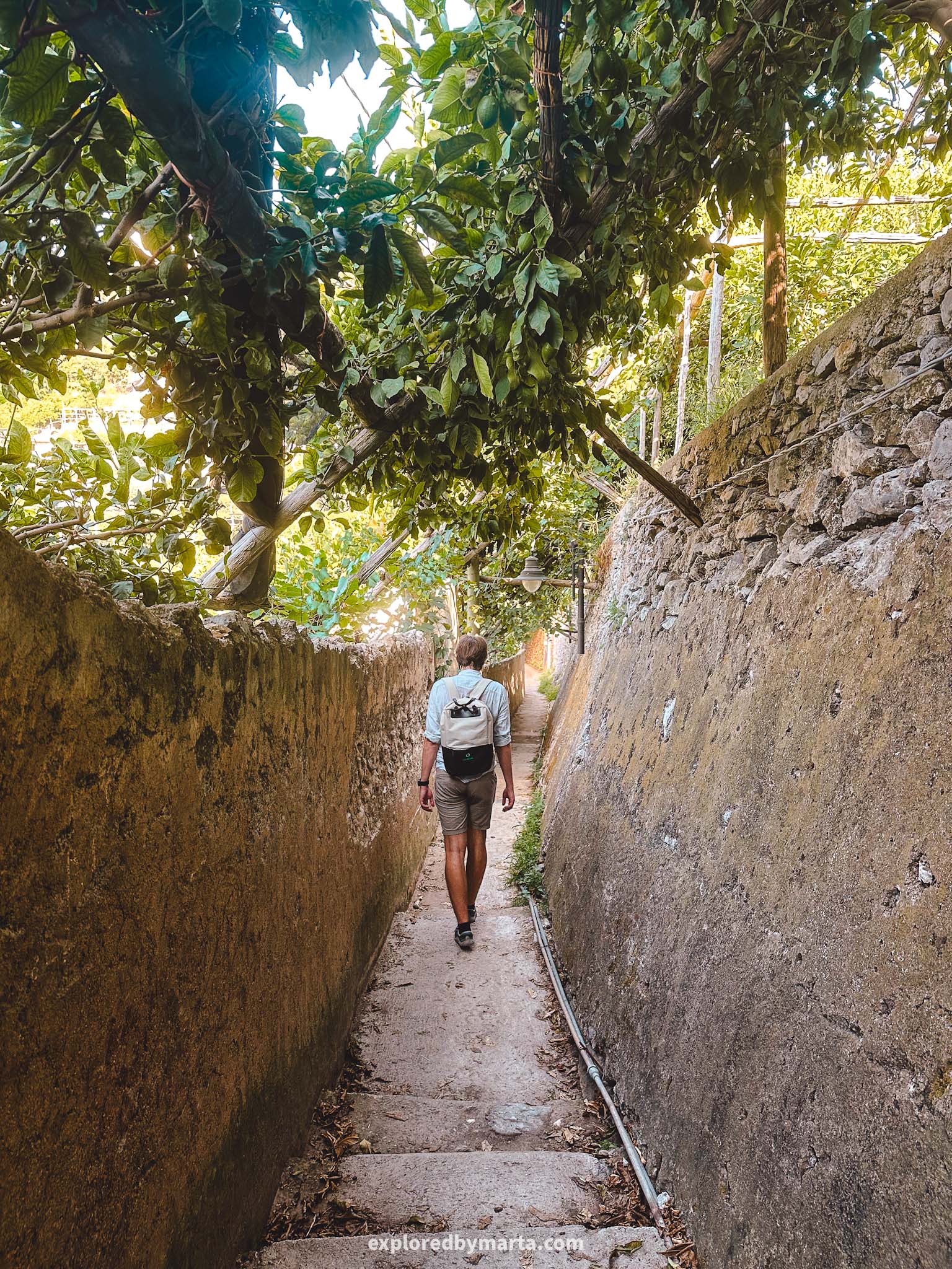
3. Sentiero dei Limoni, or Path of the Lemons
Distance: 5 km or 3.1 miles circular
Difficulty: easy
Elevation gain: 150 m
Duration: 2h
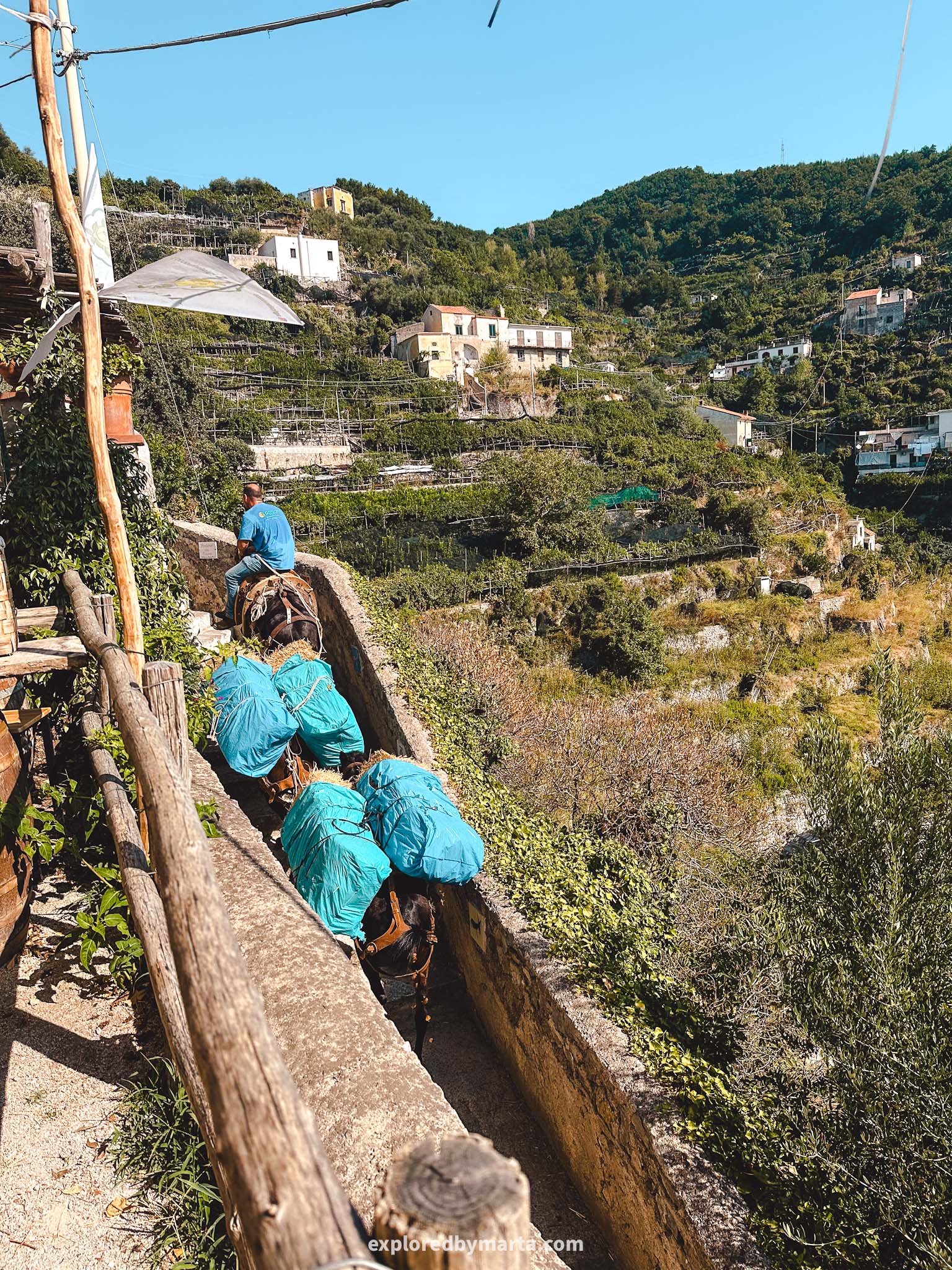
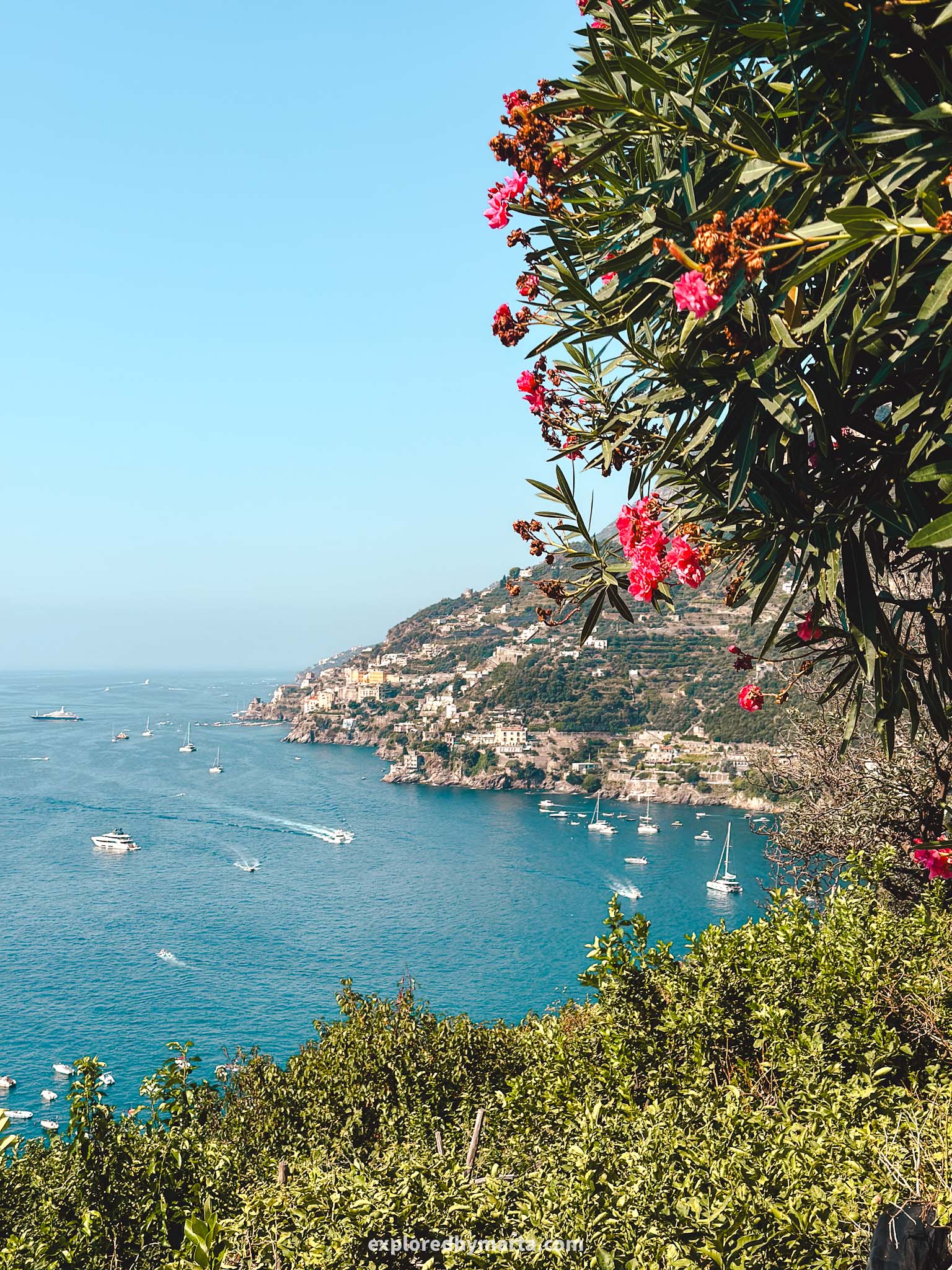
Sentiero dei Limoni, or Path of the Lemons, is one of the most famous Amalfi Coast trails. It is a historical path connecting two nearby towns – Minori and Maiori.
Skip the hassle and join a guided tour to the Path of the Lemons!
The path is only 2 kilometers or 1.2 miles long (one way), making it one of the easiest hikes on the Amalfi Coast – totally manageable for kids and travelers of different fitness levels! So, if you love shorter hikes, then this is the one for you!
However, the path goes over a 100-meter-high hill between the two towns, so there will be some climbing involved, but that’s the hardest part.
We did this hike starting from Maiori town. The hike starts next to the Santuario Santa Maria a Mare church in Maiori and finishes down in Minori town.
We then explored Minori for a bit (I recommend stopping by the legendary pastry shop Pasticceria Sal De Riso for a cake) and walked by the coastal road back to Maiori.
This hike is known for its panoramic views of the coastline and the Tyrrhenian Sea, as well as the surrounding lemon groves where you can see the local pride and joy – the famous Amalfi lemons (sfusato amalfitano).
The path is mostly paved, and there’s no need to have special clothes or footwear to do this hike, but do grab some water bottles with you, as it can get pretty hot during the day.
Historically, this path was created to transport lemons and other goods between the two twin towns. Even today, donkeys are used as a means of transportation along the path. And we saw them during our hike!
Around the midway point, there was a small lemon farm with a bar where they offered lemon granita and lemonade. We stopped here to sit down under the lemon trees to have a glass of each.
If you want to hike like we did by walking the path and then coming back by the coastal road, then I would dedicate 2 hours to do this round trip. But 3 to 4 hours if you want to explore the town and have lunch there before hiking back to where you began.
Either way, this hike was one of my favorite things we did on the Amalfi Coast. Besides, this hike is significantly less visited than some other hikes on the Amalfi Coast, probably because it is further away from other tourist hotspots on the coastline.
For those of you who love longer hikes, you don’t have to stop in Minori. Minori village is connected to Ravello, another beautiful village, by a steep staircase, so you can walk all the way up to Ravello if you want. However, you’ll have to manage some steep stairs to get there.
Location: Path of the Lemons
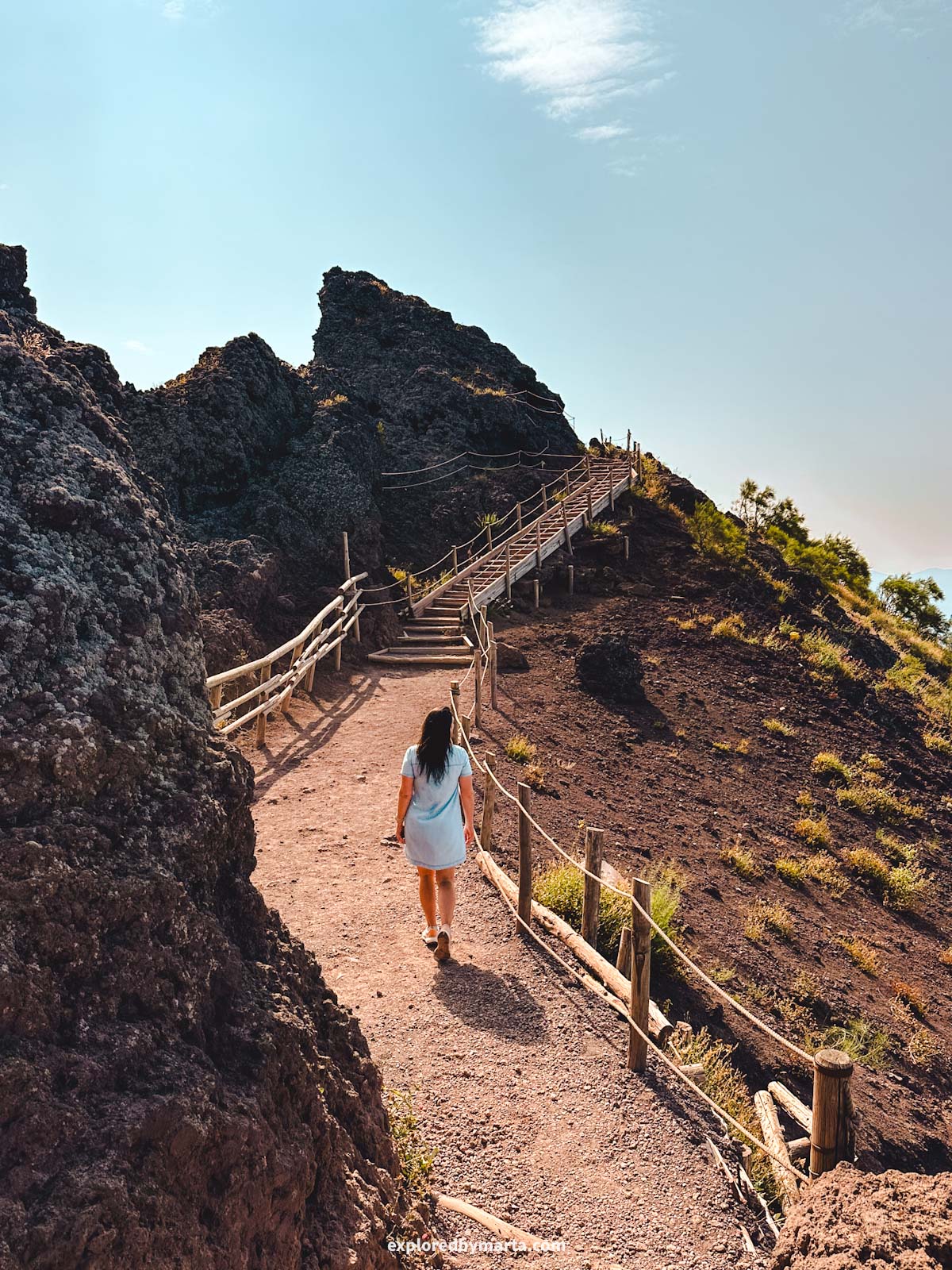
4. Hike to the summit of Mount Vesuvius
Distance: 7.2 km or 4.5 miles out-and-back (longer route)
Difficulty: moderately easy
Elevation gain: 350 m
Duration: 2h
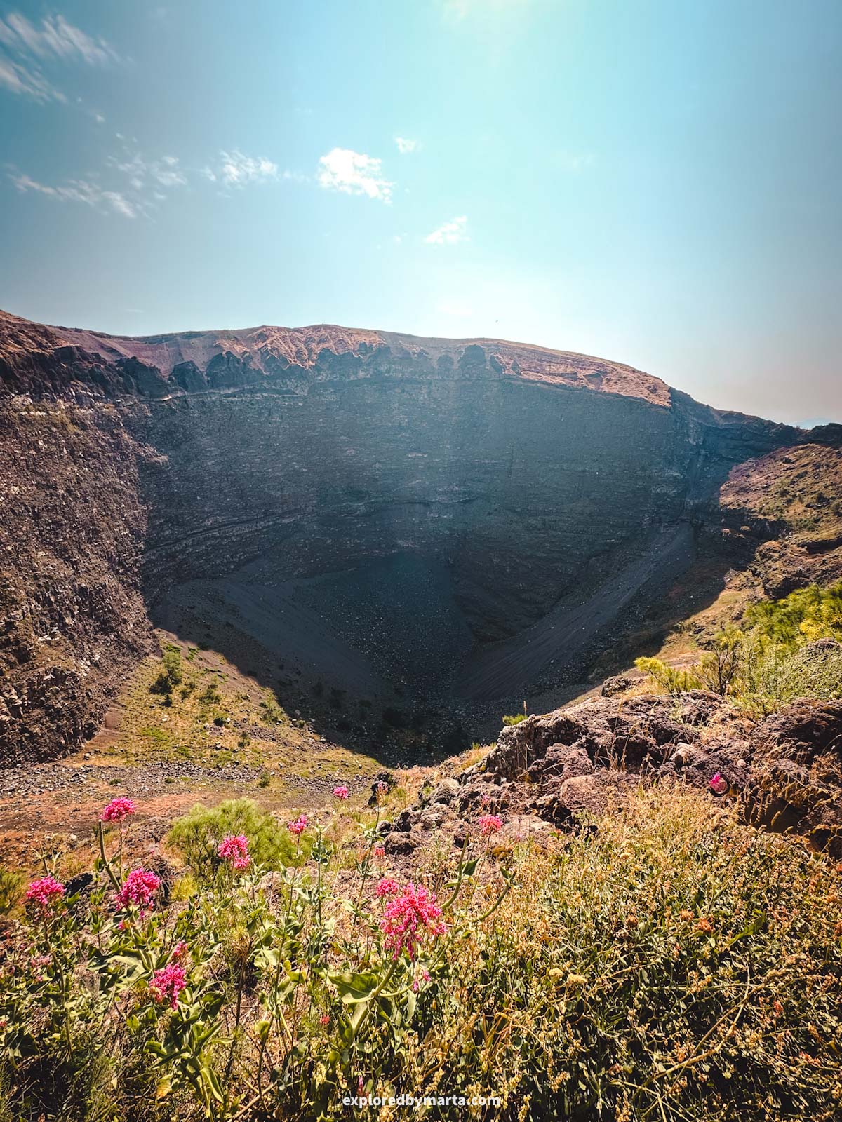
Who remembers the notorious volcano from history lessons that buried a whole town and its inhabitants under layers and layers of volcanic ash?
That’s Mount Vesuvius for you, and the doomed city of Pompeii. And I can’t be the only one who remembered the horror story of the Pompeii eruption from history lessons!
Now that I’ve seen it up close, it doesn’t seem so scary anymore, haha.
If you are traveling all the way to Naples and the Amalfi Coast, you will probably make your way to Pompeii, am I right? Then you might as well climb to the summit of Mount Vesuvius – it is not that difficult!
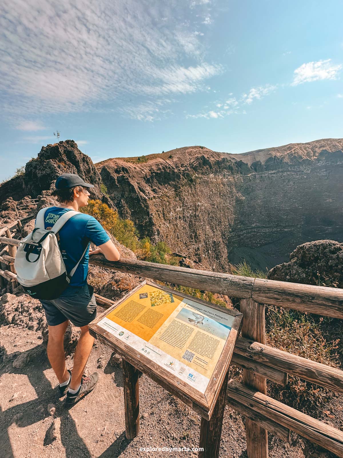
Access to the crater is restricted, and you can only climb up there during opening hours after purchasing a ticket.
Because we had a car, we visited the volcano individually, but you can join some group tours, if it’s easier for you. See some of the tours below!
For those who rent a car, you’ll have to drive to the Mount Vesuvius parking lot (book your spot in advance!), and then start hiking up from there if you want a longer hike, or jump on a shuttle bus if you want a shorter hike.
We started climbing up from the parking lot, and after 1 hour and 3.6 kilometers or 2.2 miles, we reached the far end of the crater (the furthest we were allowed to go).
The round trip took us just under 2 hours, and we did 7.2 kilometers or 4.5 miles.
However, most of the visitors take a bus up to the ticket office/visitor center and start the hike there.
From there, the hike to the far end of the crater will be 1.7 kilometers or just over 1 mile long and will take about 30 minutes. It is a steeper climb up to the crater!
Best time to hike this? Definitely in the morning, if you can, before the midday heat and before the crowds show up! Climbing Vesuvius is quite a popular activity, and it does get crowded!
We entered right after it opened and could explore on our own, but I’ve heard that later in the day, they let people inside with 10-minute intervals and in groups.
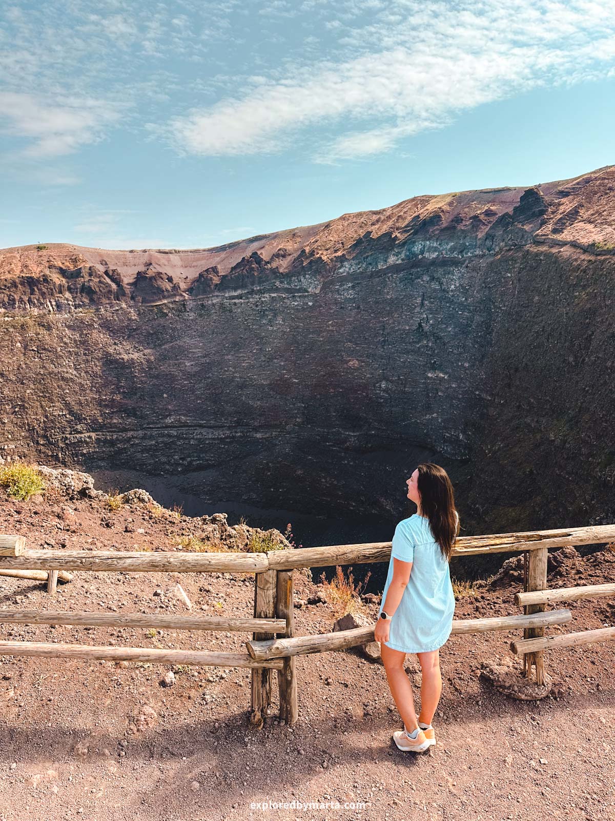
Nevertheless, this is a once-in-a-lifetime thing to do! I was shocked by how deep the crater was, and we could even smell gases coming out of it. Vesuvius is still an active volcano, after all!
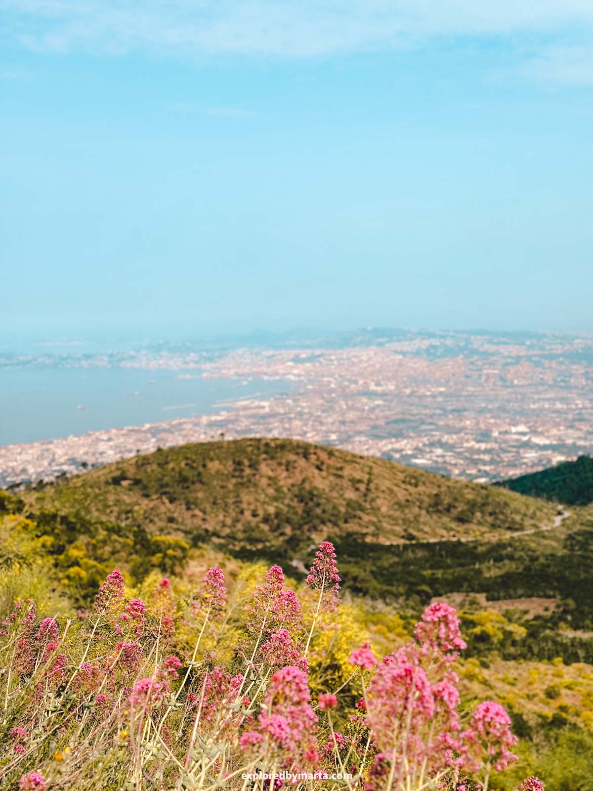
And those views! You can see Naples from above, as well as the doomed city of Pompeii, if you can find it. Made me realize how powerful the 79 AD eruption was, because Pompeii is quite some distance away from the volcano!
Location: Vesuvius Parking – Vesuvius Crater Access
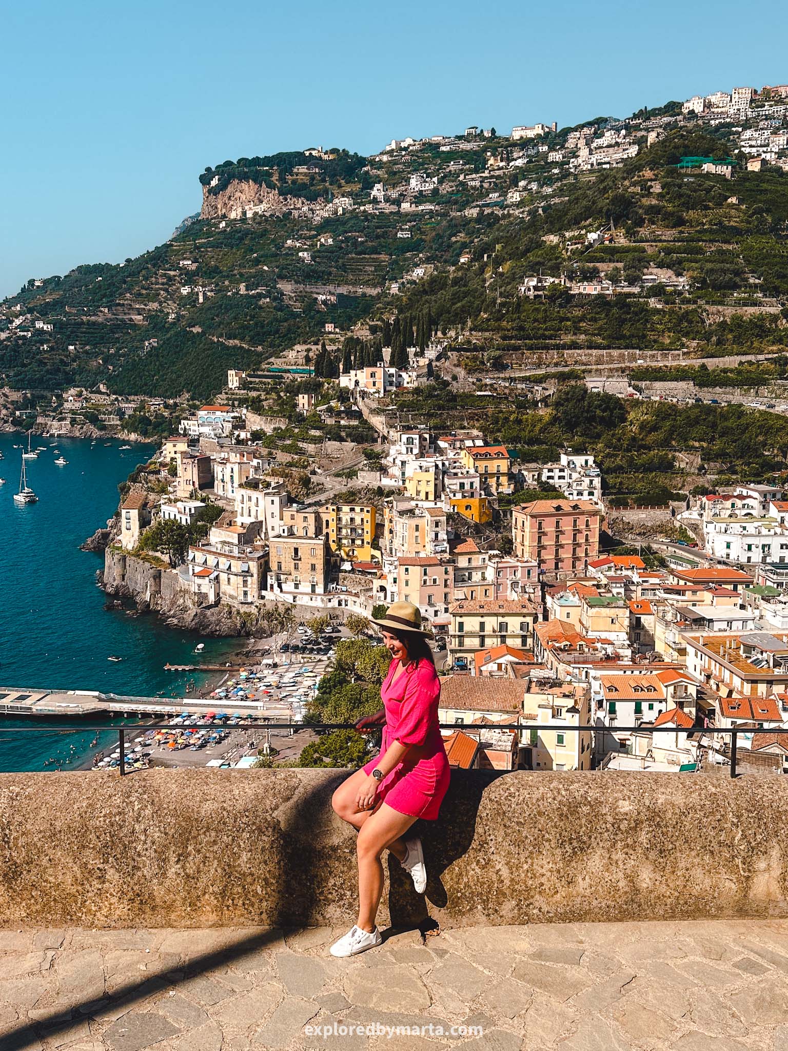
5. Hike to the haunted Torre dello Ziro


Distance: 3.5 km or 2.2 miles out-and-back
Difficulty: easy
Elevation gain: 200 m
Duration: 1h 30min
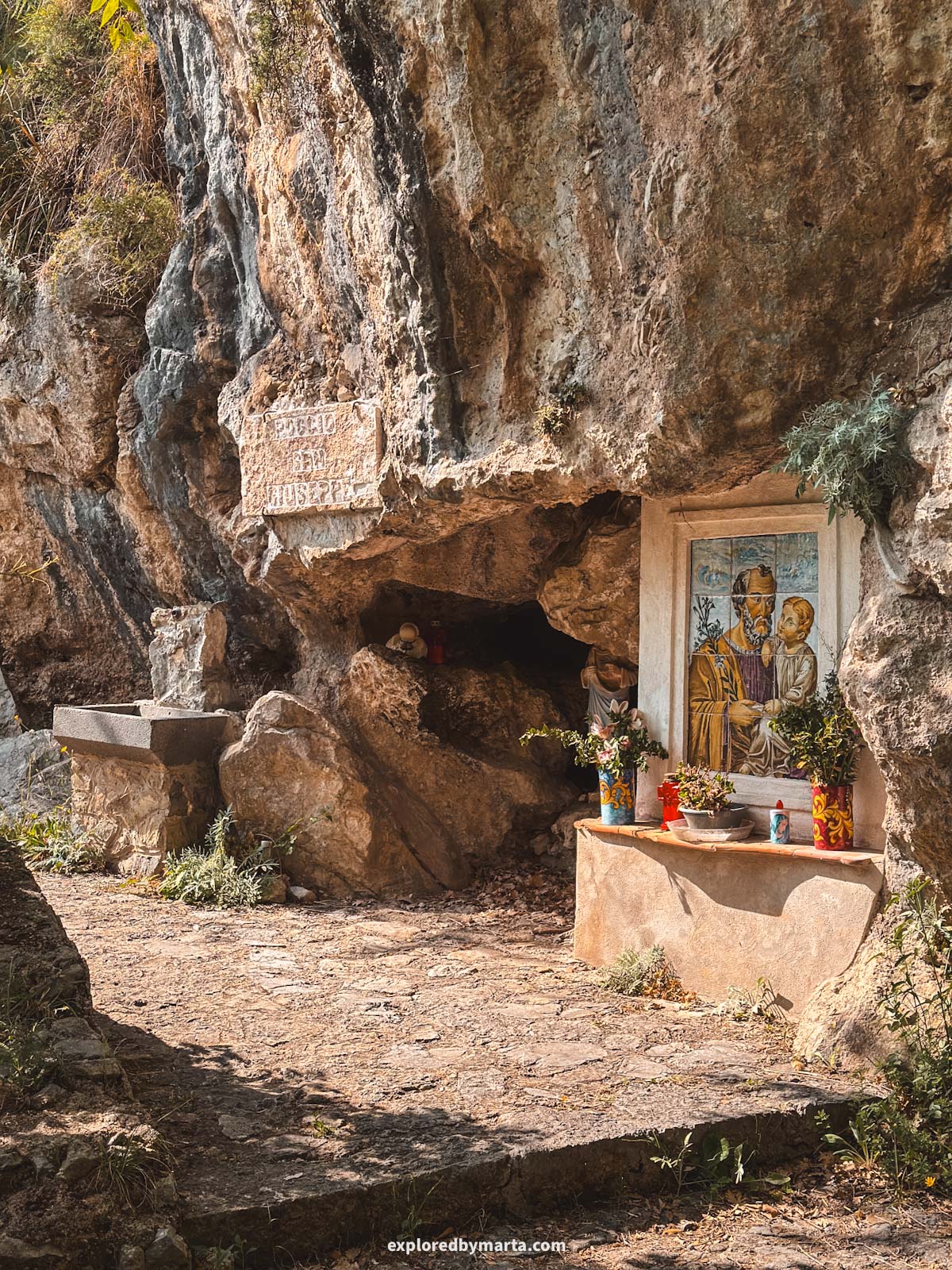
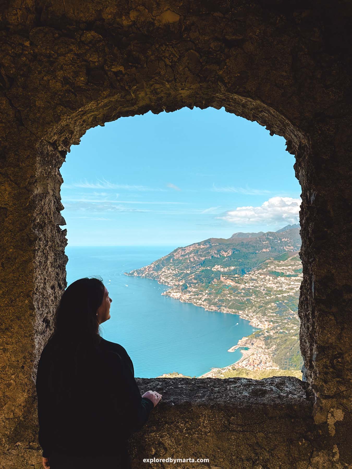
Sitting atop Mount Aureo, Torre dello Ziro or the Ziro Tower is one of many defense watchtowers built back in the 15th century to protect the Amalfi Coast’s villages from pirate attacks.
Today, Torre dello Ziro serves as a tourist destination for history geeks, hiking enthusiasts, and anyone hunting the best views of the Amalfi Coast. I am all of those, so it made sense to hike up to the haunted tower!
If you have more time and energy to spare, it is possible to hike up there from both towns, Amalfi and Atrani, which sit on either side of the Mount Aureo mountain.


For us, we had a rental car, so we drove up to the picturesque village of Pontone and started the hike from there on Via Pisacane Street. If you don’t have a car, you can get there by taxi or by bus.
Once you get to the starting point, just follow the trail markers pointing to the tower. It was a 2-hour round-trip hike for us. It was the perfect choice for a midday hike because we got plenty of shade from trees, so it was a fairly nice and easy walk.
If you check on Google Maps, there is an observation deck along the way called Veliero del Belvedere. I highly suggest paying a visit to this scenic spot! It offers panoramic views of the nearby village of Atrani.


Torre dello Ziro watchtower is partly renovated, and you can freely access it and even climb to the top of it. But did you know that the legend says the tower is haunted?
They say that the Duchess of Amalfi and her child were imprisoned here because of her affair and, unfortunately, never made it out of here. The ghosts were probably sleeping when we visited because we did not see or hear anything suspicious.
Despite the legend, these ruins are a breathtaking place overlooking the beauty of the coast, including the towns of Amalfi and Atrani. I love a good hike with a rewarding view, and this was definitely one of those hikes!
Location: Torre dello Ziro – Veliero del Belvedere
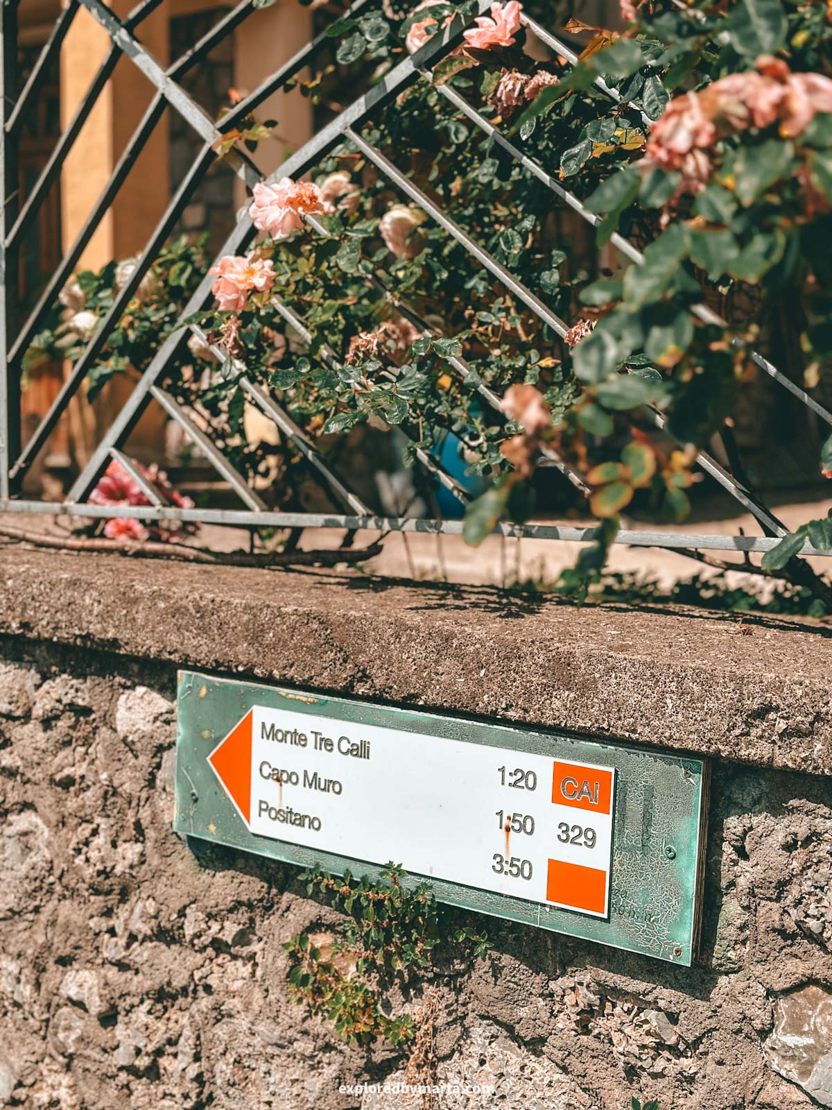
6. Circuit of Tre Calli
Distance: 9.5 km or 5.9 miles circular
Difficulty: moderately difficult
Elevation gain: 500 m
Duration: 2h 50min
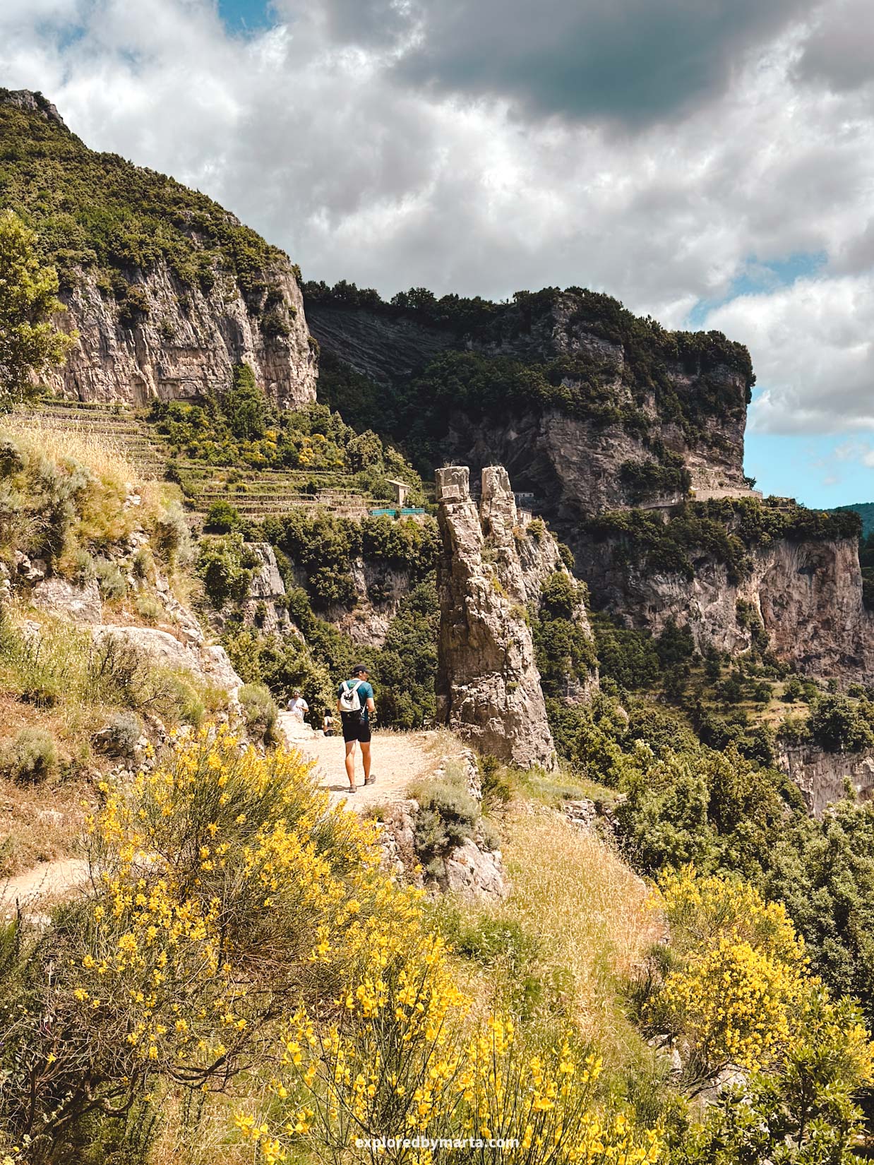
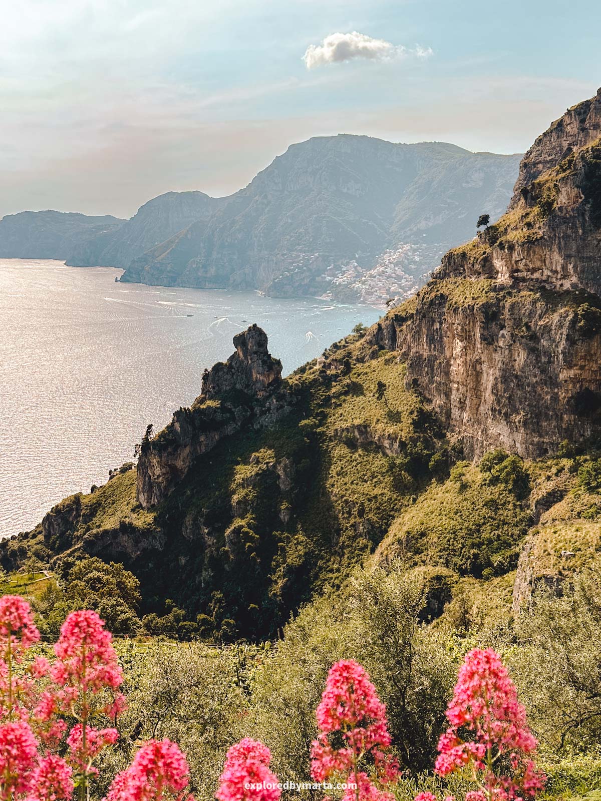
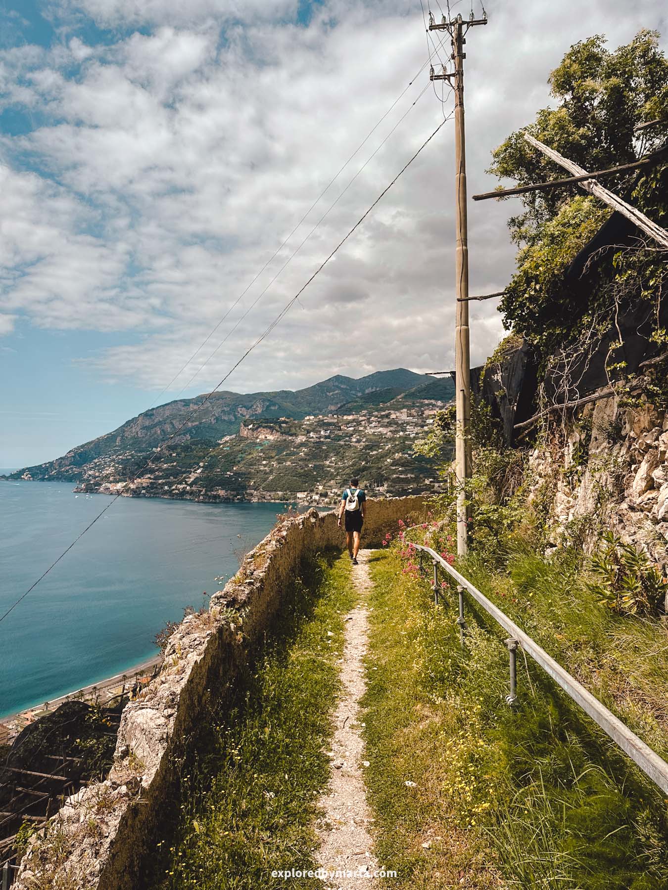
If hiking the Path of the Gods hike wasn’t enough and you’re looking for alternative routes, but with the same 360-degree views of the Amalfi Coast, then the Circuit of Tre Calli might be the best option for you!
The Circuit of Tre Calli starts in the same spot as the Path of the Gods hike – in Piazza Paolo Capasso, the main square of Bomerano, a hamlet of the Agerola municipality.
But this time, you’ll have to head to Via Tommaso Mannini Street – you’ll see trailmarks with the ‘Tre Calli’ name on them on the street.
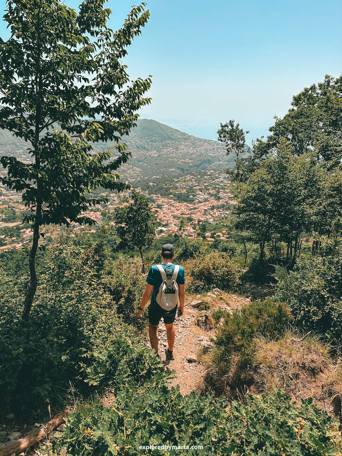
Then the hike continues by the east side up to the summit of Tre Calli mountain, and then down the mountain by the west side, then around the mountain along a paved road, and back to Agerola.
The east side climb goes along farms, up a set of steeper stairs, and through a denser forest area, which could be a bit overgrown in spring; however, the trail on the west side is much wider and cleaner, with almost no bushes along the way.
While we did a circular route (more like a lollipop-type route), you can easily do a there-and-back route, using only the west side of the mountain, if you want to avoid denser forests and some bushes.
However, when we walked this trail in June, the east side trail was pretty decent, not overgrown at all, and we got fantastic views of the whole Agerola valley below us.
This is definitely a bit of a steeper climb of moderately difficult sections, but overall nothing extreme, and doable for most people who do some hiking.
This hike is not nearly as popular as the Path of the Gods hike, but it offers equally breathtaking views from the top of Tre Calli mountain. For this reason, the Circuit of Tre Calli is one of my favorite hikes on the Amalfi Coast.
We had the mountaintop all to ourselves for a moment!
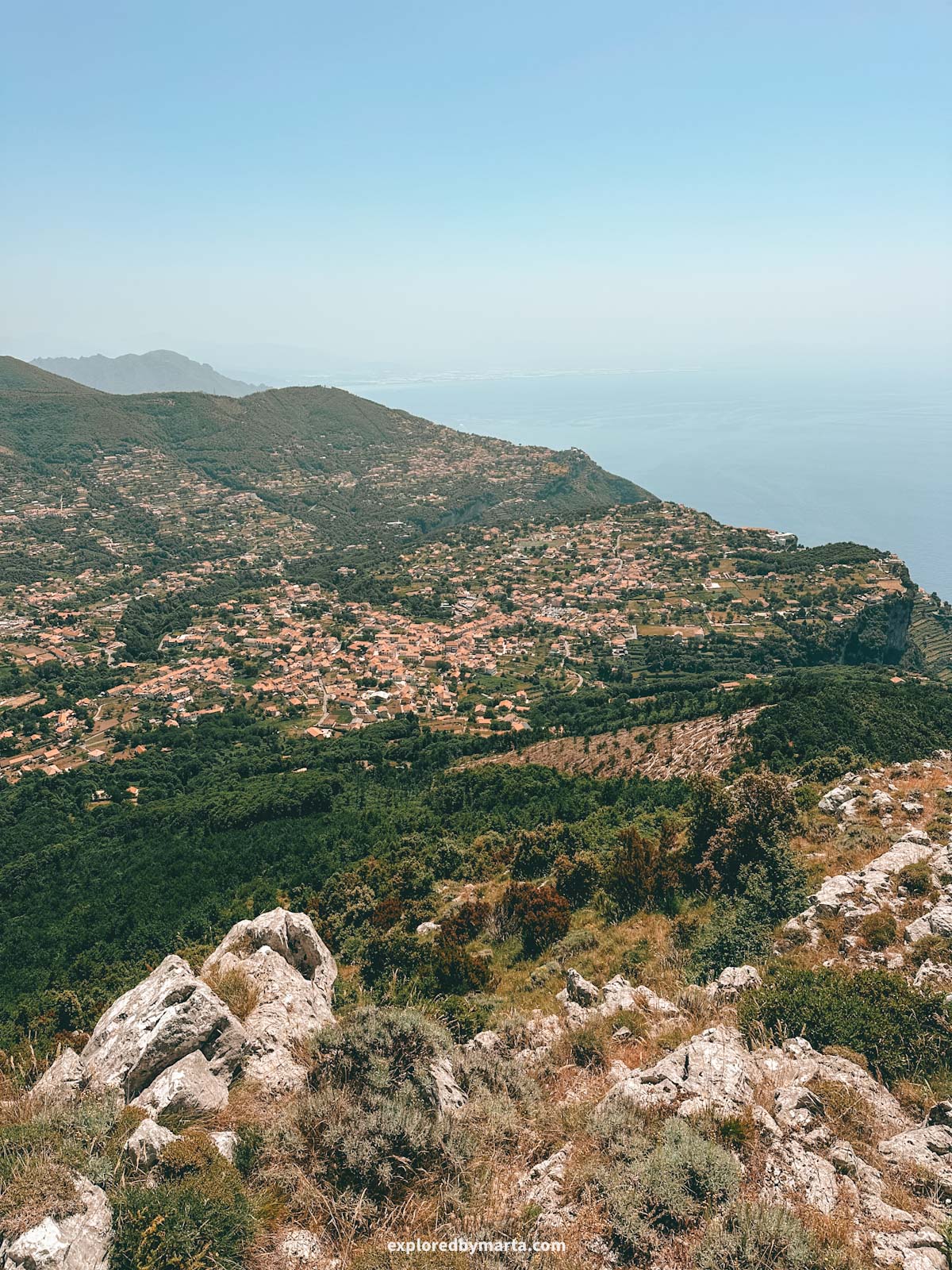
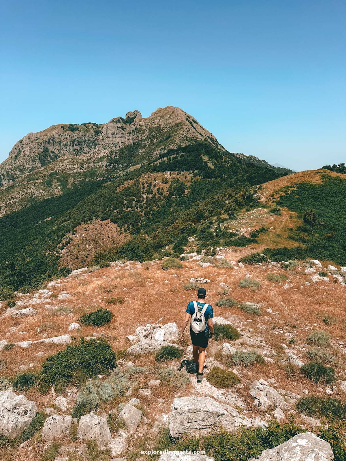
Don’t forget to bring enough water and some snacks – you’ll want to spend some time enjoying the panoramic views of Positano, the mountains of the Sorrento Peninsula, including the highest peak on the peninsula right next to Tre Calli mountain.
On a clear day, you can even see the Island of Capri!
The west side trail offers very little shade, so a hat will be useful on sunny days. Also, because of the steepness of the trail closer to the summit, proper, good footwear will make your life much easier. However, I did the hike in road running shoes and survived, haha.
Location: Monte Tre Calli – Start of the trail
7. Hike to Buco di Montepertuso
Distance: 4.3 km or 2.7 miles out-and-back
Difficulty: moderate
Elevation gain: 400 m
Duration: 1h 40min
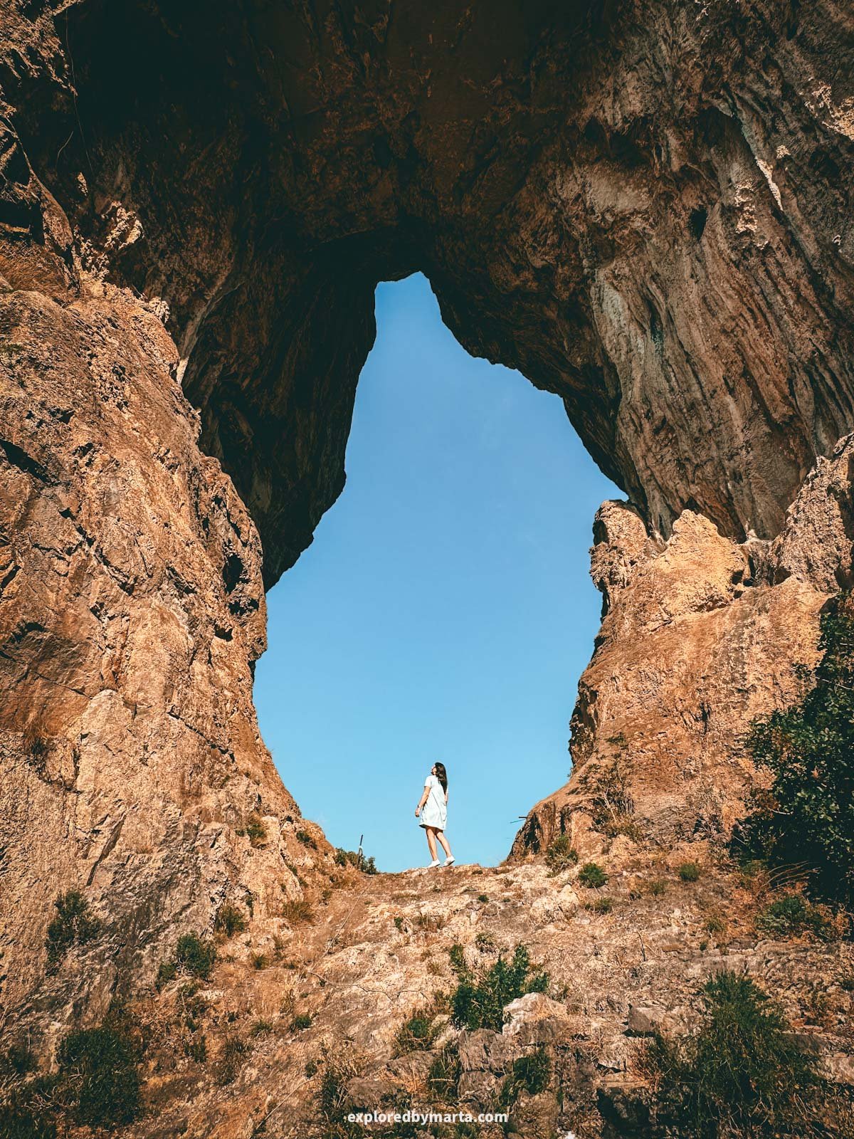
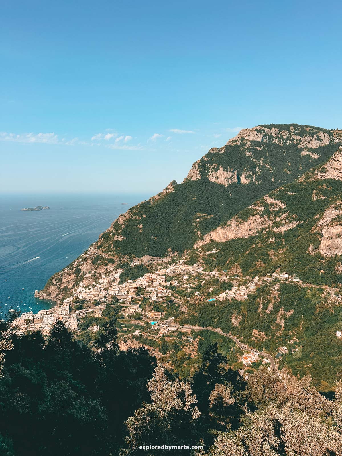
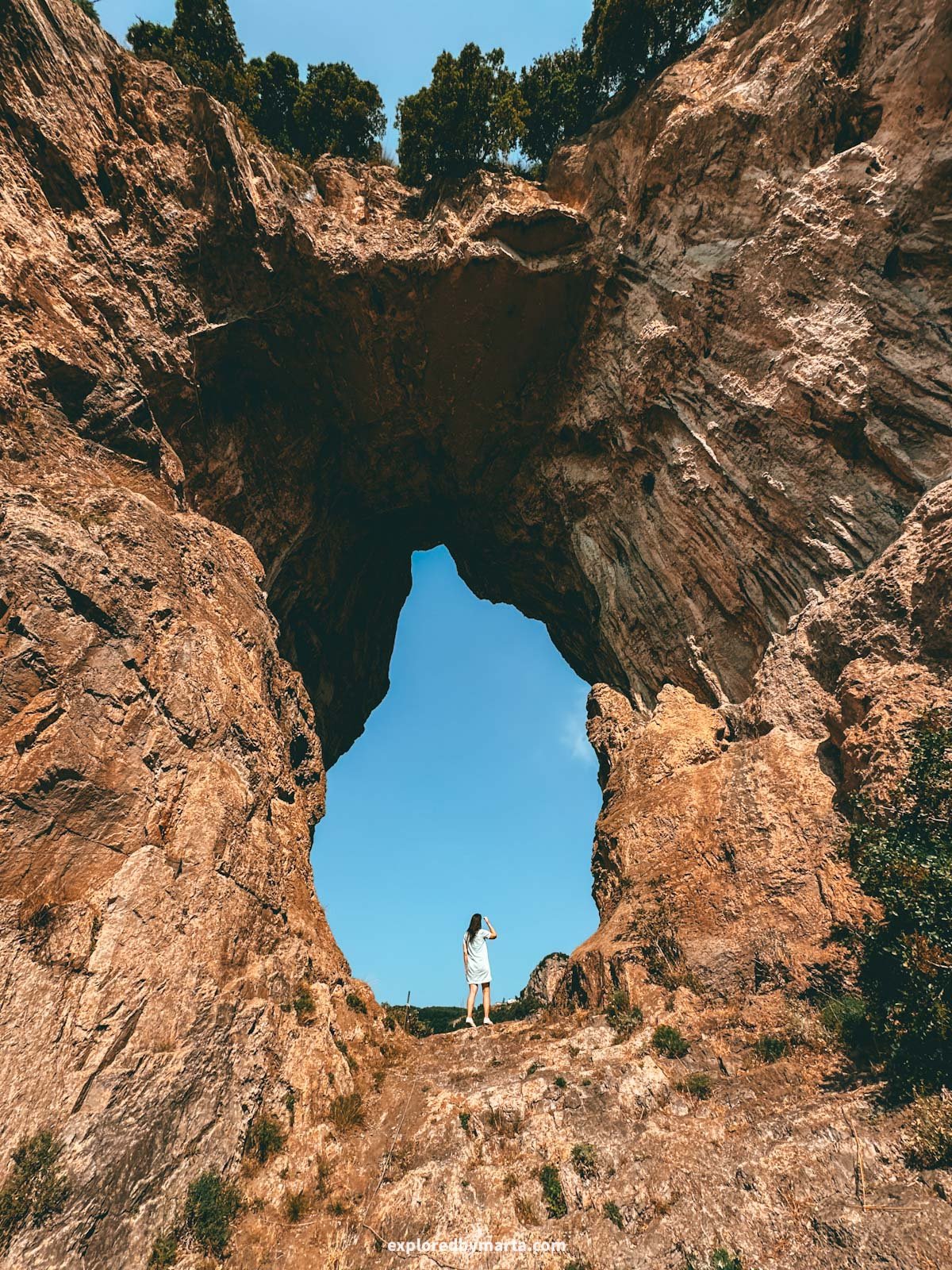
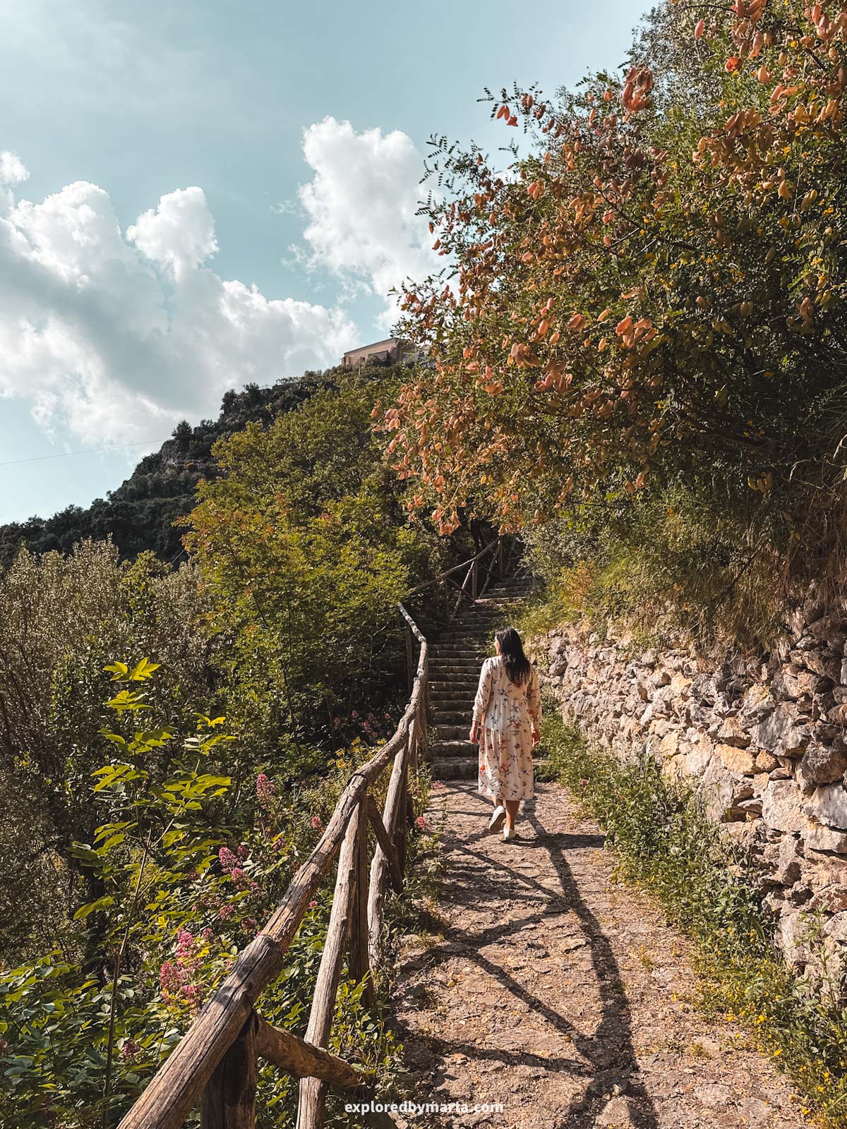
Buco di Montepertuso, or Montepertuso Hole, is a massive perforated rock in Montepertuso village above Positano. This was one of my favorite hidden gems we found on the Amalfi Coast!
If you are a nature lover and you are staying in Positano, a hike up to Positano’s most unique natural landmark must be among your top things to do in Positano!
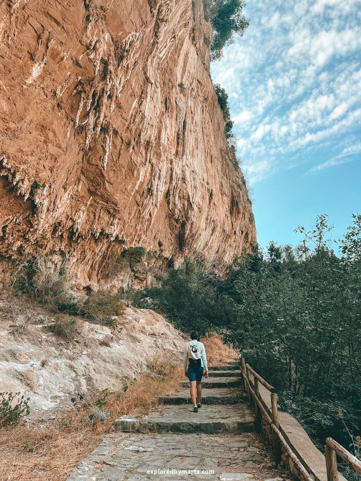
The hike itself is pretty straightforward – endless uphill stairs with the last 200 meters by a smaller forest path. I easily did this hike in my white sneakers, no need for special hiking shoes. Just make sure you are comfortable!
The hike starts wherever you are in Positano – if you start by the beach at sea level, you’ll just have to manage more elevation gain, but if you start somewhere higher uphill, you’ll have a bit less climbing.
We arrived in Positano in the morning by SITA bus and got off the bus at the Positano Sponda bus stop, so we started our hike from there.
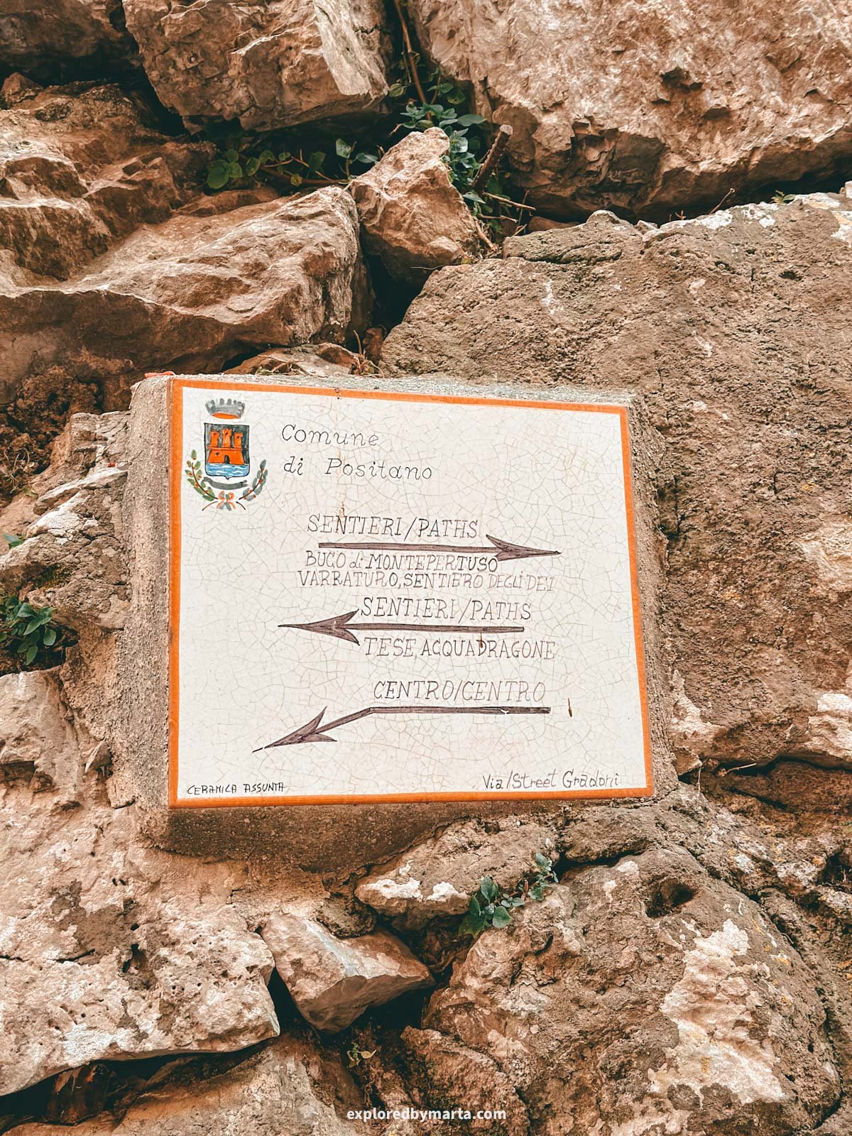
At first, we followed the main road, then turned onto Via Grado, a long flight of stairs that leads up to Montepertuso, a hamlet right above Positano.
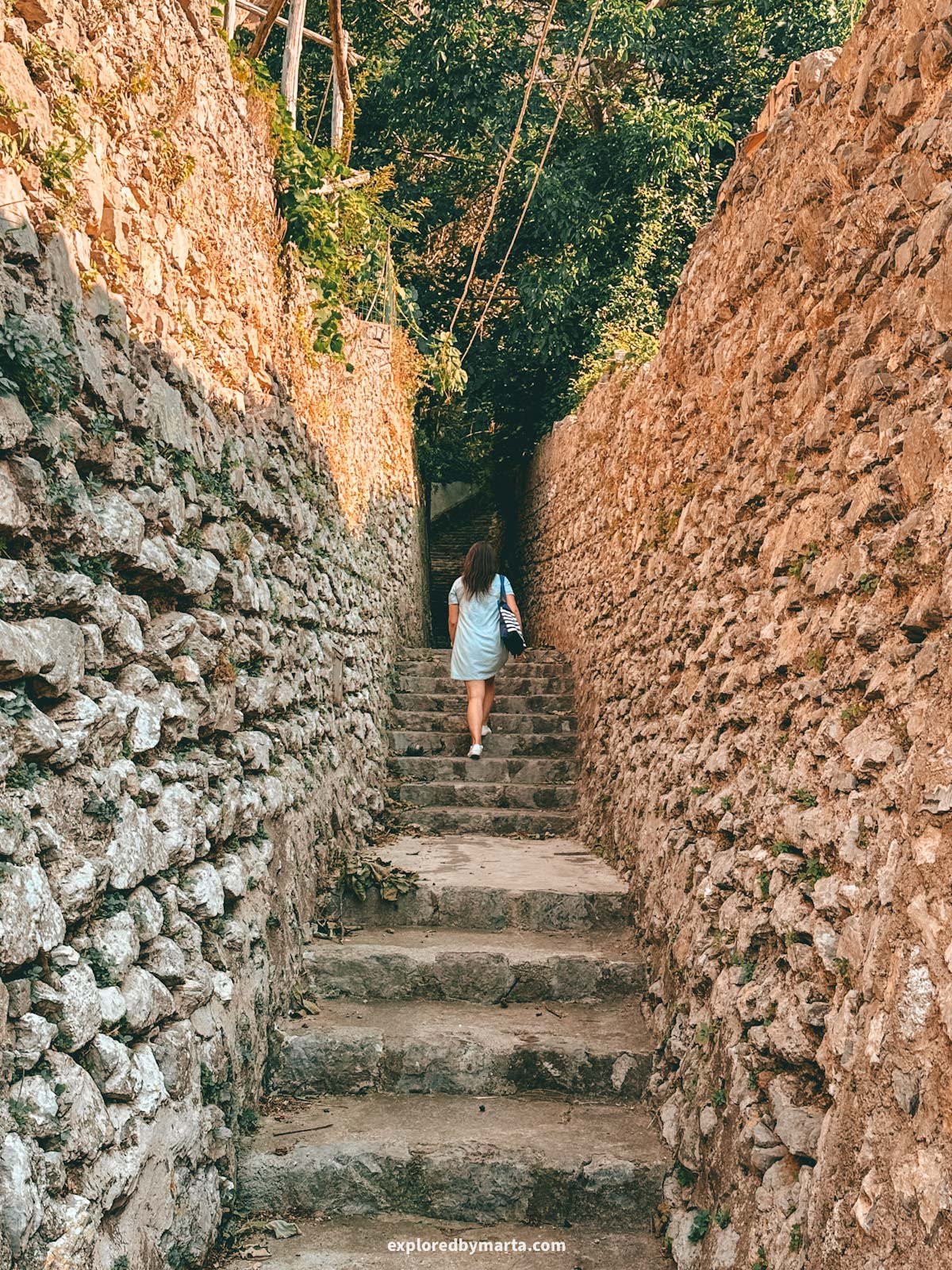
In Montepertuso, we found our way to the Via Gradoni path and continued up until the street ends right by a farm. From there, we got on a small forest path that led us above the farm into the forest and right to the iconic hole in the mountain.
The forest section is very short, and the hole is right there above the farm; you just don’t see it from below, because the trees are in front of it. Getting there is not complicated at all, but the challenging part is just the elevation.
From the bus stop, we managed to accumulate 400 meters, or 1,300 ft, of elevation! It was really like climbing stairs non-stop, haha. I was dripping in sweat, and we drank almost 2 liters of water.
However, the iconic rock formation was totally worth the climb. I love rock arches, holes, and all kinds of unique natural rock formations, so this view was like Christmas for me. Plus, the way back down was all downhill and very easy.

If you’re not a fan of climbing stairs (hello, what are you doing on the Amalfi Coast!?), then you can take the bus or a taxi up to Montepertuso village and then walk the final steps from there. This way, it should be totally doable for most people, including kids.
Fun fact! Did you know that the name of the Montepertuso village translates as the ‘Mountain of the Hole’? There’s a local tale that says the hole was formed during the fight between Archangel Michael and the Devil himself.
The story goes that the Devil was causing great chaos in the area, and it was up to Saint Michael to end it. They say that during their battle, the Archangel Michael struck the mountain with such force that he left behind a massive round hole in it.
Either way, we thoroughly enjoyed the views of Positano and the shimmering blue sea during the hike, and I enjoyed the iconic hole in the rock even more so! I hope you get to squeeze this hike into your itinerary!
Location: Buco di Montepertuso
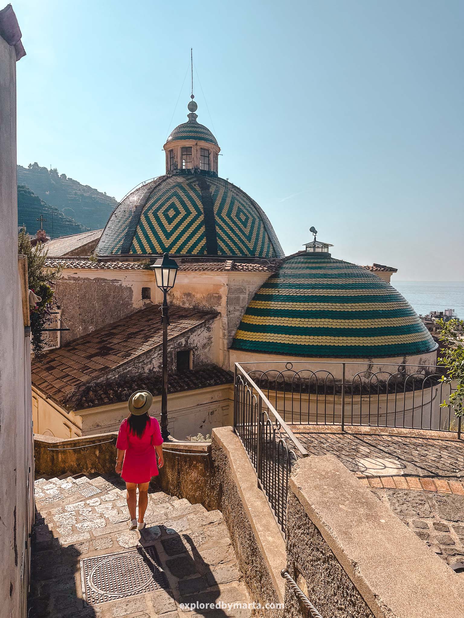
8. Hike to Convento di San Domenico in Praiano
Distance: 2 km or 1.25 miles out-and-back
Difficulty: easy
Elevation gain: 230 m
Duration: 1h
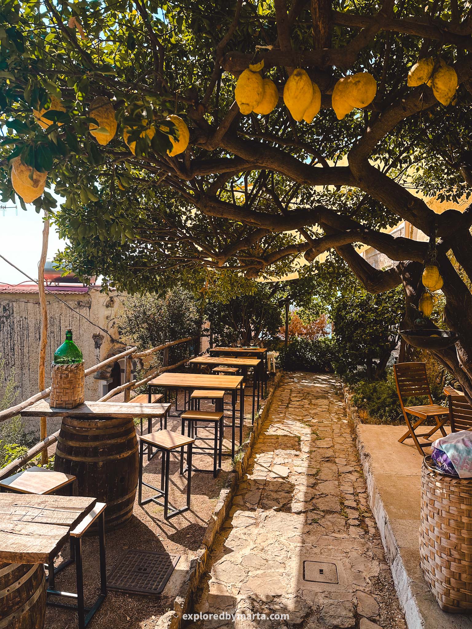
For those of you who are staying in or visiting Praiano, I’ve found the perfect easy trail for you with beautiful views, a touch of history, and even some artworks all within a 1-kilometer hike!
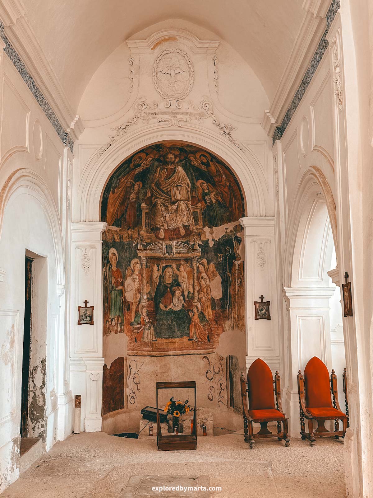
Sitting on the slopes of Monte Sant’Angelo a Tre Pizzi, the highest mountain on the Amalfi Coast, right above Praiano, is a 16th-century Dominican convent, a beautiful historical building with even more beautiful views.
Hiking up to this historical convent was one of my favorite things to do in Praiano!
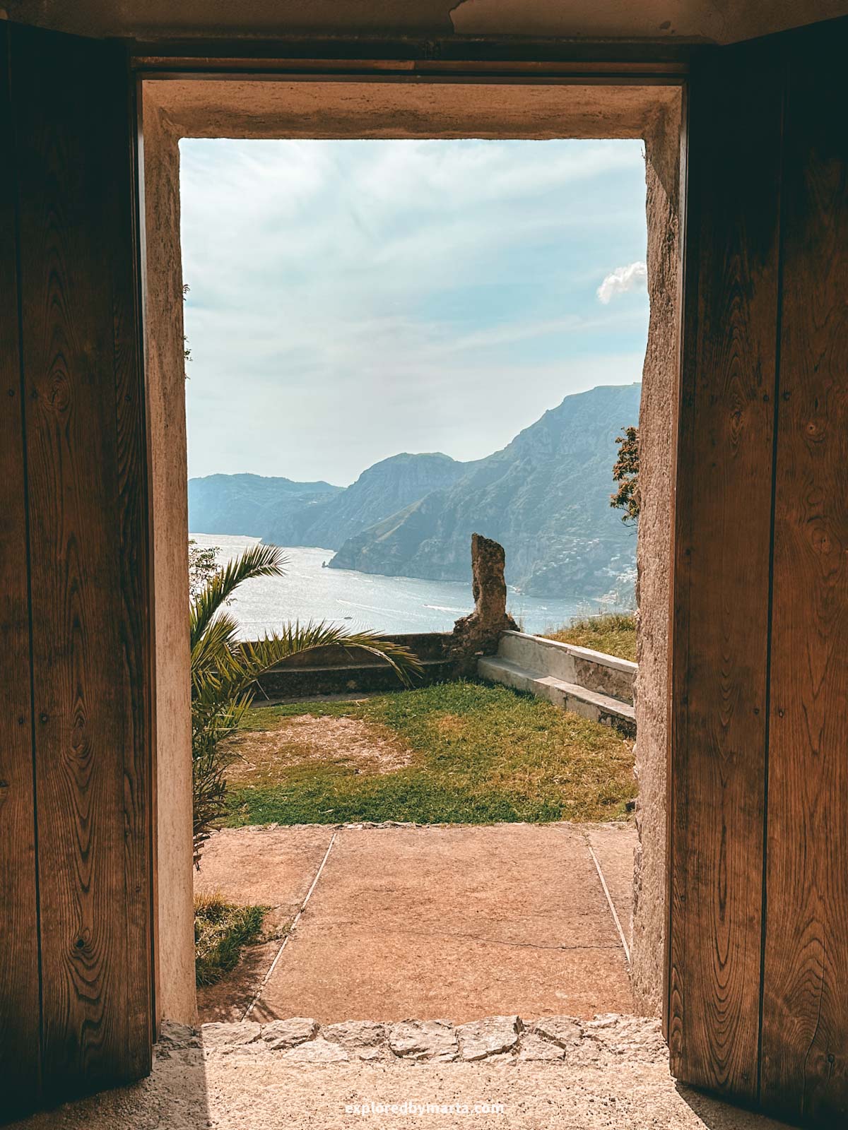
The convent with the adjacent church is open to visitors, and you can check it out for free. It does have opening hours, tho, so make sure to be there during the daytime when it is open. But the views are worth it on their own, too!
We only peeked inside the church. Although it was quite simple, there were a couple of very beautiful Renaissance‑era frescoes painted on the walls and one of the altars (see photo above).
Exploring the historical church was a cool experience, especially because we were completely alone there! Although the guardian of the monastery later showed up, doing some things around the convent.
But the most beautiful part of this hike was definitely the view from the top.
We could easily see as far as the Island of Capri, not to mention Positano, the mountains along the Sorrento Peninsula, and, of course, Praiano village.
We spent quite some time gazing at all the beauty in front of us! Although the convent sits 364 meters or 1,200 ft above sea level, it wasn’t too difficult to get up there, so I highly recommend doing the hike even if you’re not a hiker (but do bring water with you!).
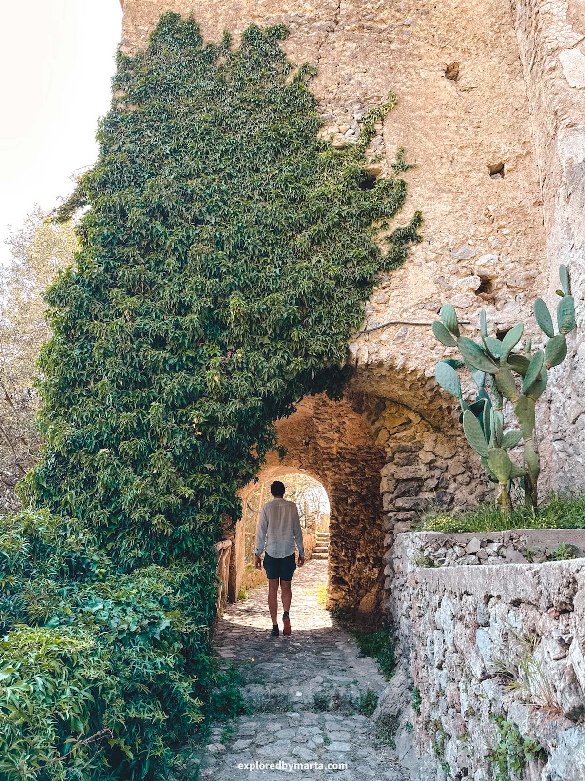
The convent can be accessed by stone stairs leading up from Praiano. The trail starts on Via Croce street in Praiano and continues uphill to the convent. Just follow the ‘Sentiero degli Dei’ direction signs!
It was only a 1-kilometer uphill hike with some 230 vertical meters (750 feet). Very doable!
The path goes through a forest with occasional sections passing through open terrain, where you can see amazing views of the coastline and the Tyrrhenian Sea.
It isn’t a steep staircase, and we saw families with kids walking up and down the path. Plus, the trail is very well made, so you don’t need any special footwear. I climbed up in sneakers and a dress.
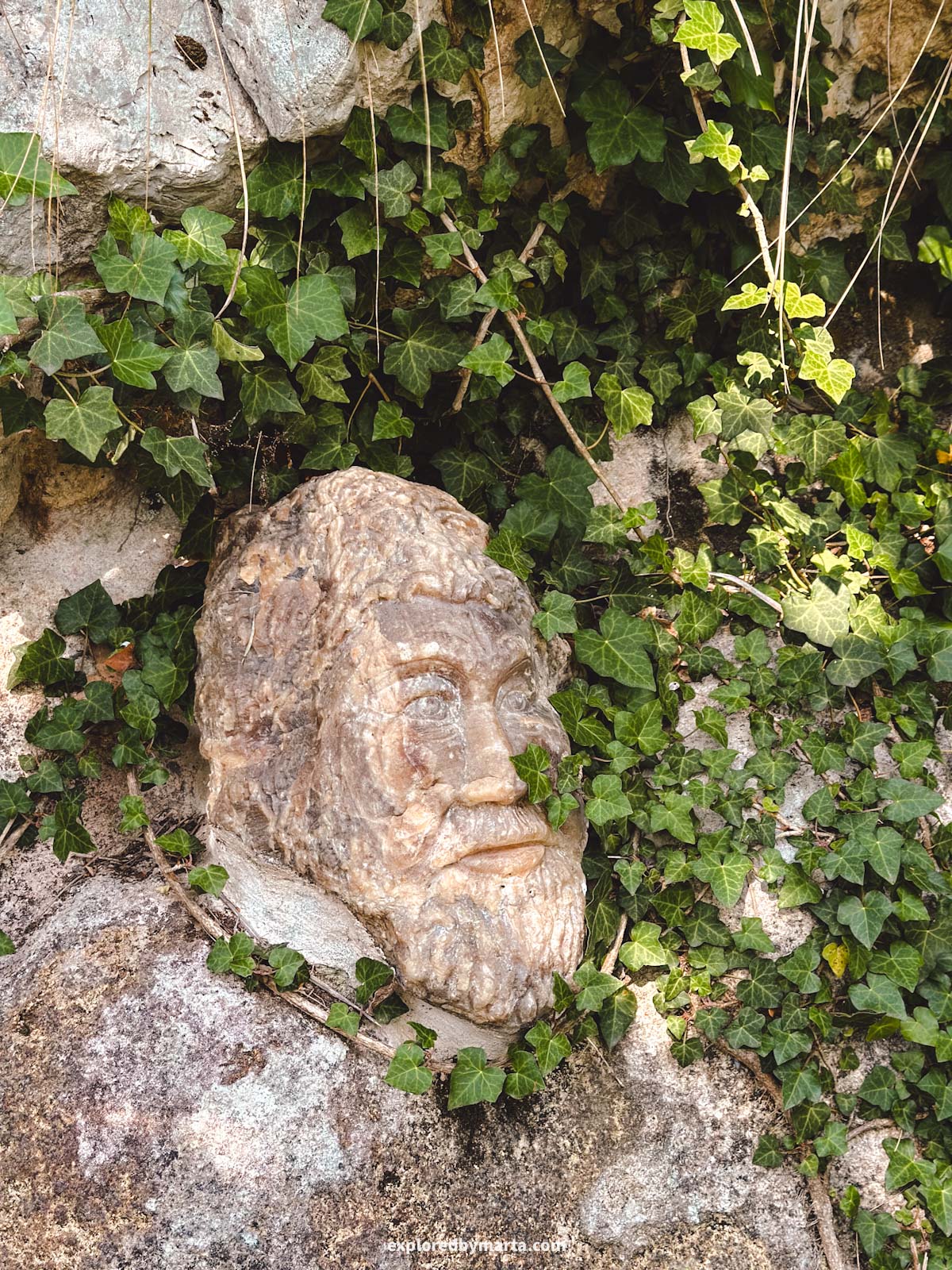
Here comes a unique twist. When we visited, the trail up to the very top was decorated with interesting art installations – human heads! I saw them all the time along the path. I didn’t count, but there might have been around 20 of them. Can you count them for me?
This is actually one of the trails that lead up from Praiano village and later connect to the famous Path of the Gods hike. If you’re staying in or near Praiano, consider combining these two hikes all in one!
Location: Convento di San Domenico
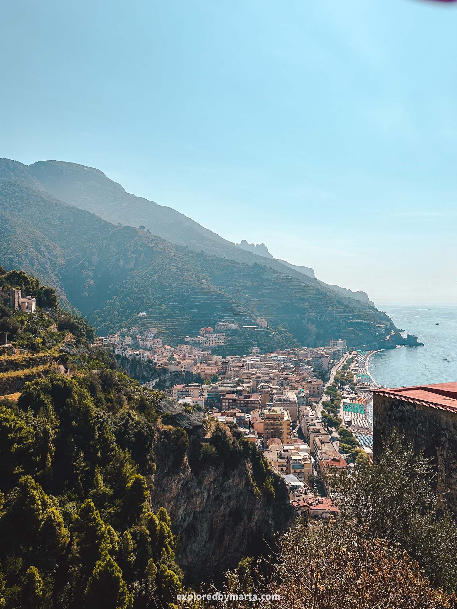
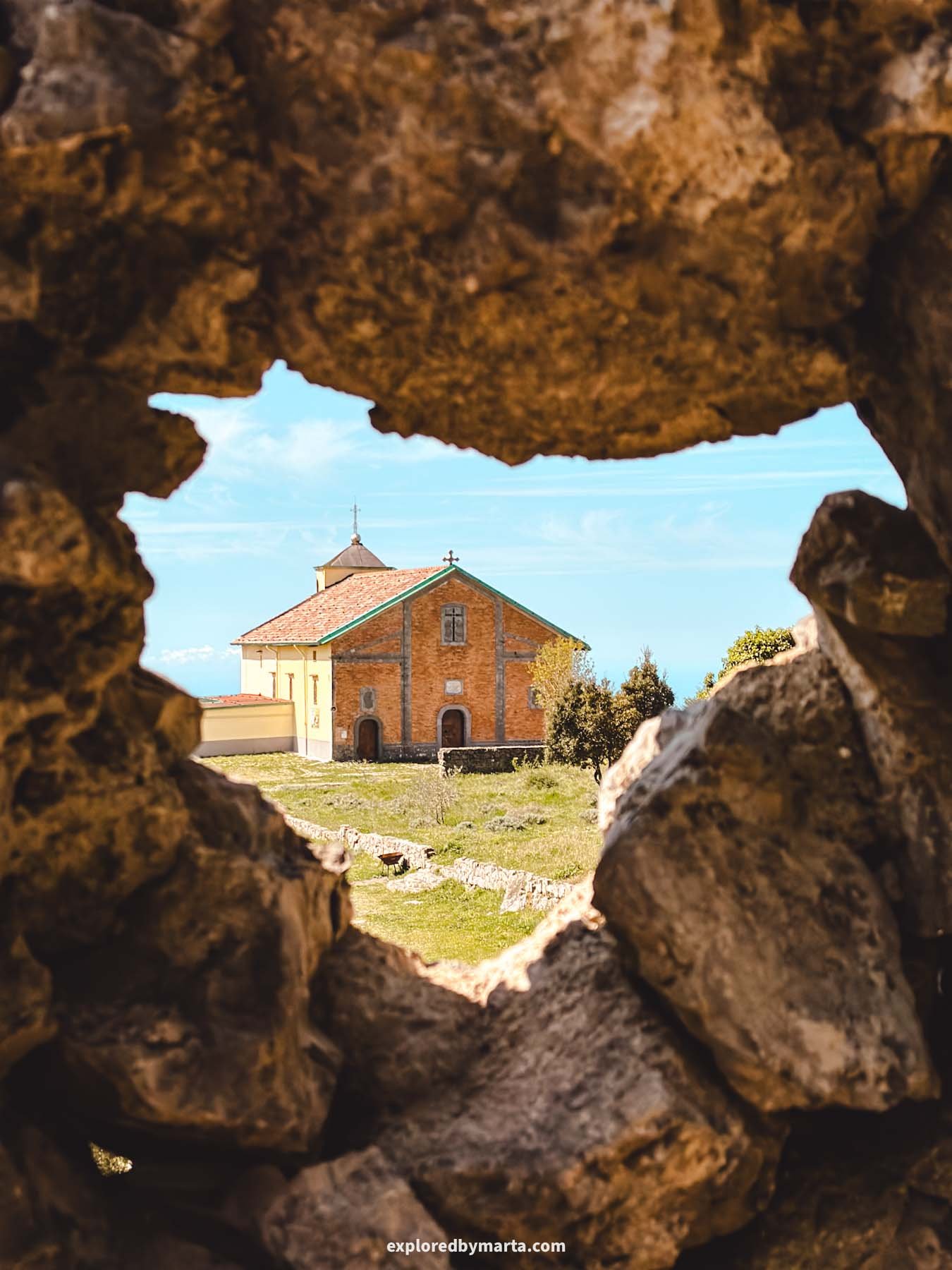
9. Hike to Maiori’s hilltop sanctuary
Distance: 9.3 km or 5.8 miles out-and-back
Difficulty: difficult
Elevation gain: 860 m
Duration: 3h 30min
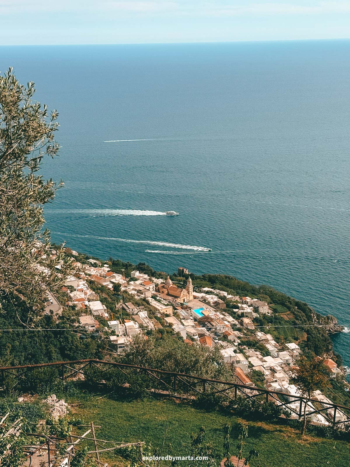
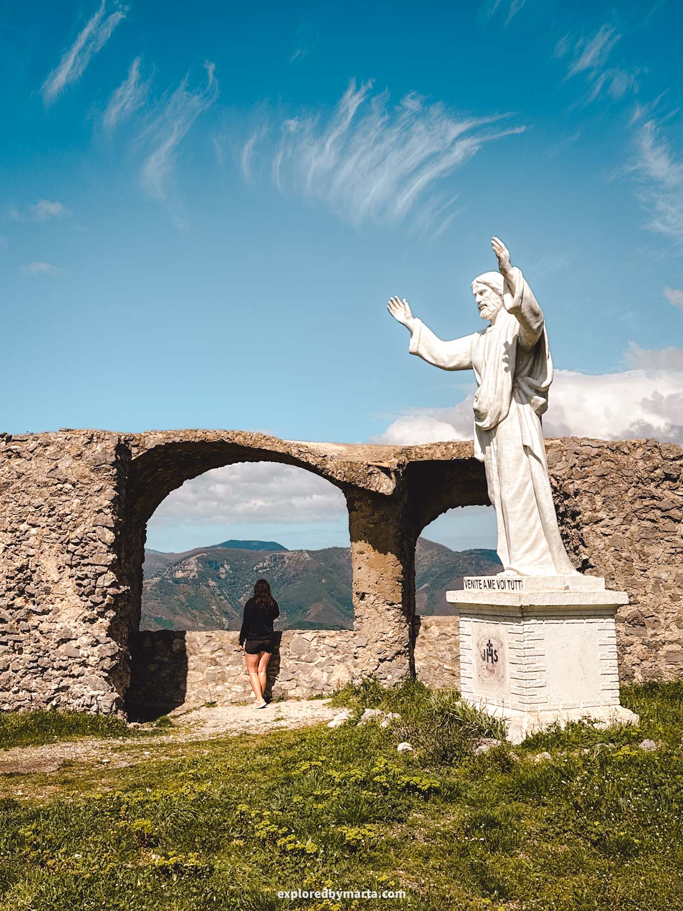
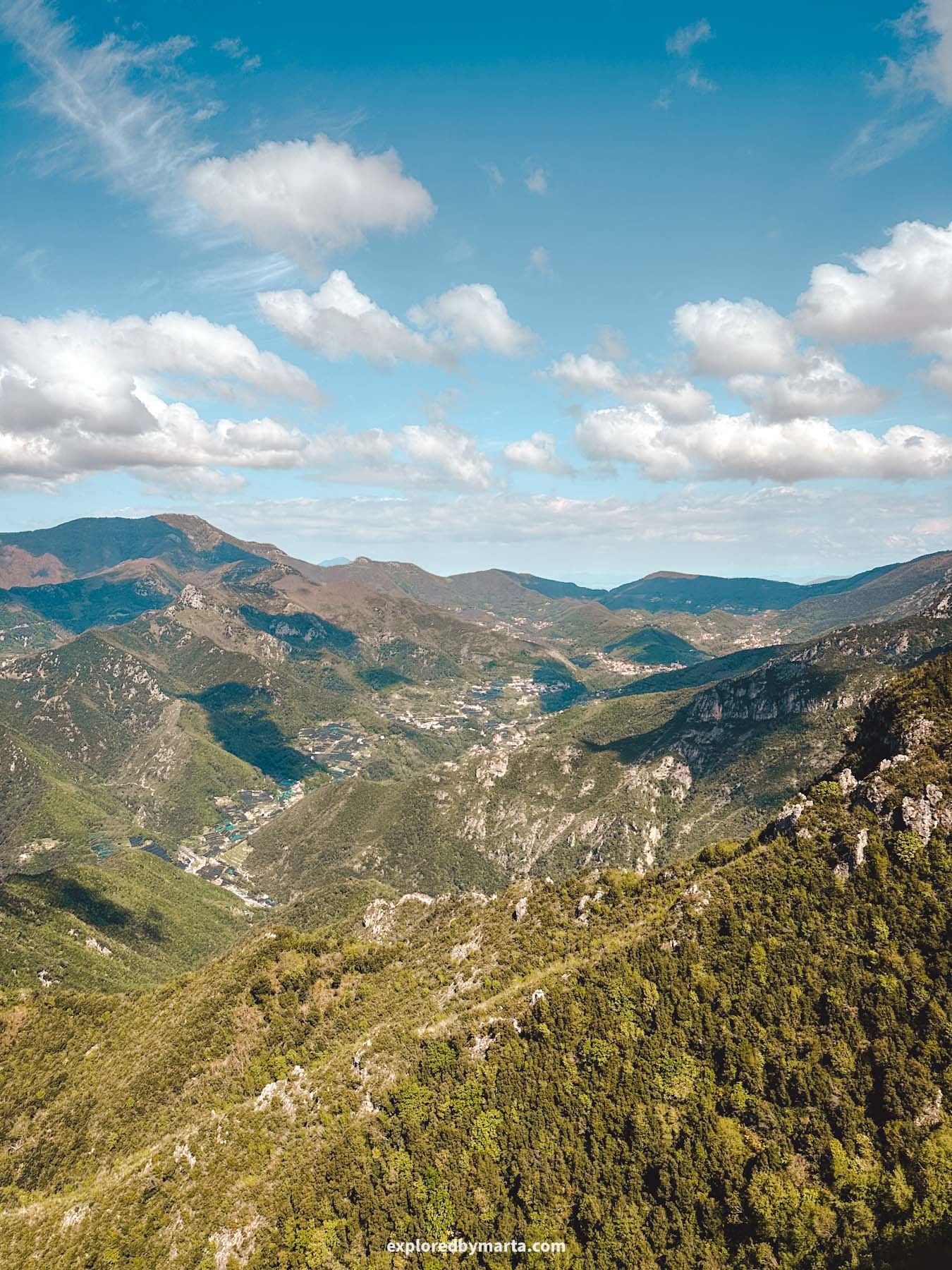
Sitting atop Monte Falerzio, around 830 meters (2,720 feet) above sea level, right next to Maiori, is a small sanctuary called the Santuario di Maria Santissima Avvocata.
You can actually spot the little hilltop building from the town below while strolling along Maiori’s Lungomare or relaxing on the beach. Here’s the catch – there’s a trail from Maiori that leads all the way up to the sanctuary!
If you’re staying in Maiori and want to do a scenic hike, this is one of the best hikes you can do on the Amalfi Coast. However, it’s not the easiest one.
The hike is pretty straightforward, but it does require a decent amount of effort. You’re essentially climbing from sea level to 830 meters (2,720 feet) in just 4 kilometers. It took us about two hours to reach the top.
So, unless you’re a regular hiker, I’d recommend sticking to the Path of the Lemons and skipping this climb. However, if you’re up for a challenge, this hike will reward you with some of the most spectacular views of the Amalfi Coast.
But what about the sanctuary? Its origins date back to the 15th century, when a chapel was built inside a cave on the mountain after a local shepherd had a vision of the Virgin Mary. The cave with the altar is still visible there today.
The sanctuary itself was built at the beginning of the 16th century on the mountain above the original chapel. The original structure was destroyed in a fire, but was later rebuilt and restored in the 19th century.
Today, the sanctuary is a popular destination for both pilgrims and hikers. It can be reached via hiking trails from towns like Cava de’ Tirreni, Cetara, or, like in our case, from Maiori.
The hike from Maiori has the steepest climb, but it’s also the shortest route to this scenic sanctuary. My legs definitely felt the effort for days after this challenging trail, but the views were absolutely worth it.
Just make sure to protect yourself from the sun, bring plenty of water, and pack some snacks because it will be at least a half-day adventure away from civilization! Remember that you’ll have to hike all the way back, too!
We started the hike right by the beach, followed some streets, made our way to Via Grade dei Pezzi Street, then climbed stairs up until we were above the lemon terraces, and followed the path, passing farms and orchards along the way.
About halfway up, the farms ended, and we continued through a forest. Some sections were exposed with no shade, but the final stretch took us through a denser forest with plenty of shade.
Sometimes I couldn’t help but think we were the only crazy ones who had decided to hike up this mountain, but along the way, we ended up meeting several other groups of hikers.
But other than that, there is nothing along the way, so you’re basically on your own, except for one water fountain where we could refresh ourselves, but I wouldn’t rely on that.
We also passed some ruins and crossed small streams. Overall, there’s nothing technically difficult about the hike – just the steady uphill climb, some occasional mud, and some overgrown sections. Other than that, I have great memories from this adventure!
Location: Santuario di Maria Santissima Avvocata
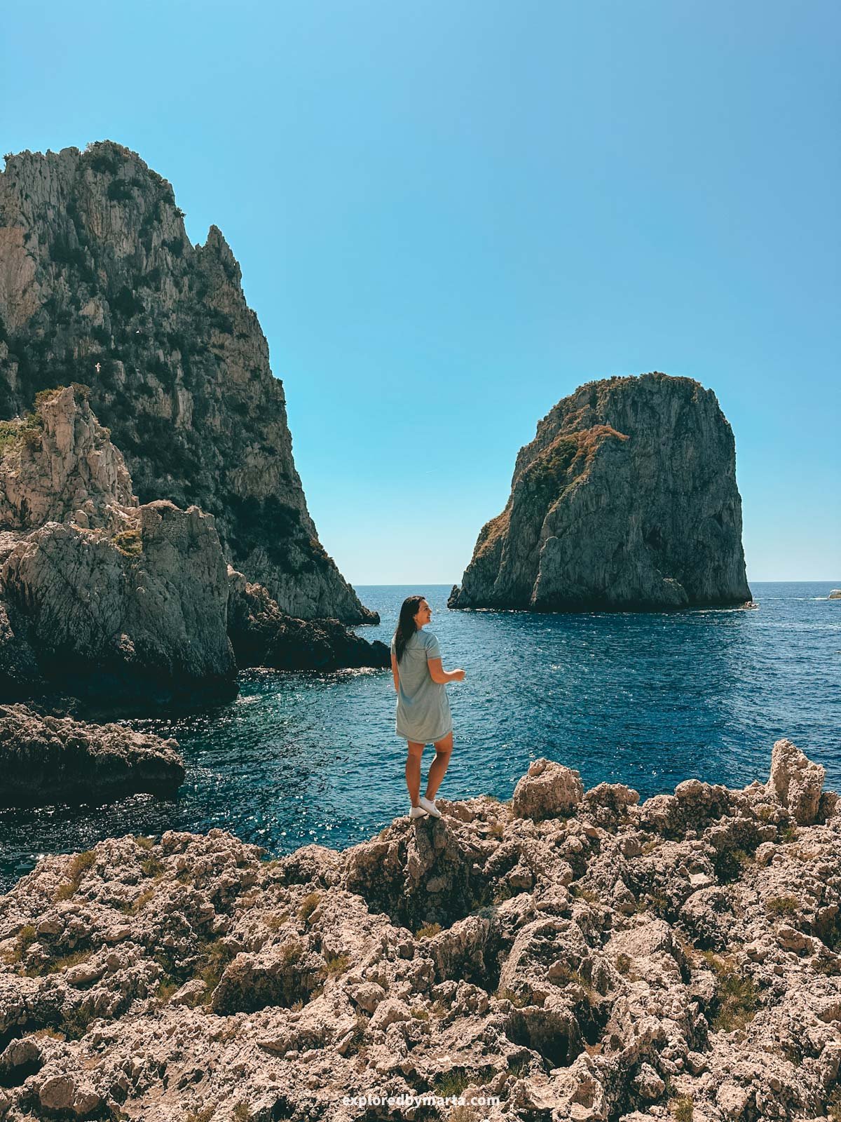
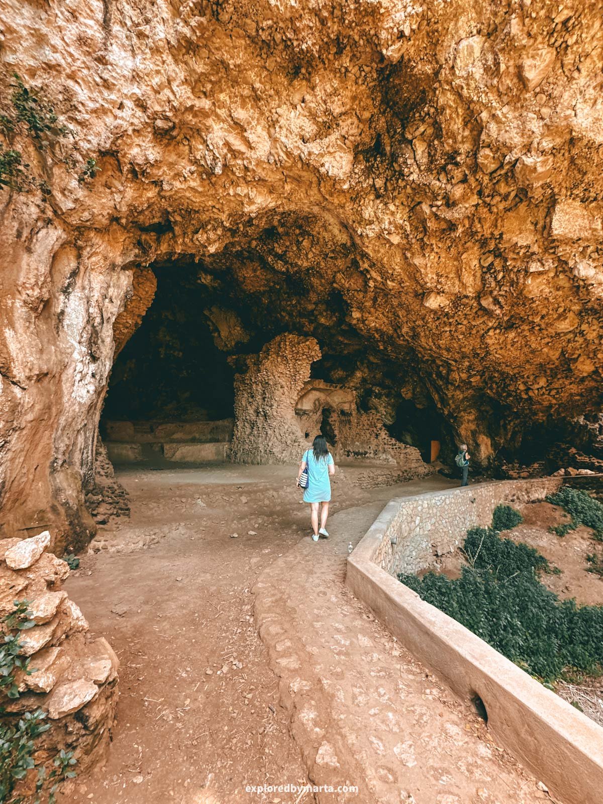
10. Pizzolungo Trail in Capri
Distance: 5 km or 3.1 miles circular
Difficulty: easy
Elevation gain: 300 m
Duration: 2h
I have always seen Capri Island as an extension of the Amalfi Coast. It is right there by the coast, and you can clearly see it during many hikes on the Amalfi Coast.
For that reason, I had to include the Pizzolungo trail, my favorite hike in Capri, on this list.
It is a 5-kilometer or 3.1-mile circular trail that starts in the main square of Capri town, then follows Via Camerelle, Via Tragara, and then Via del Pizzolungo. Then, by Via Matermania and Via Croce back to the main square.
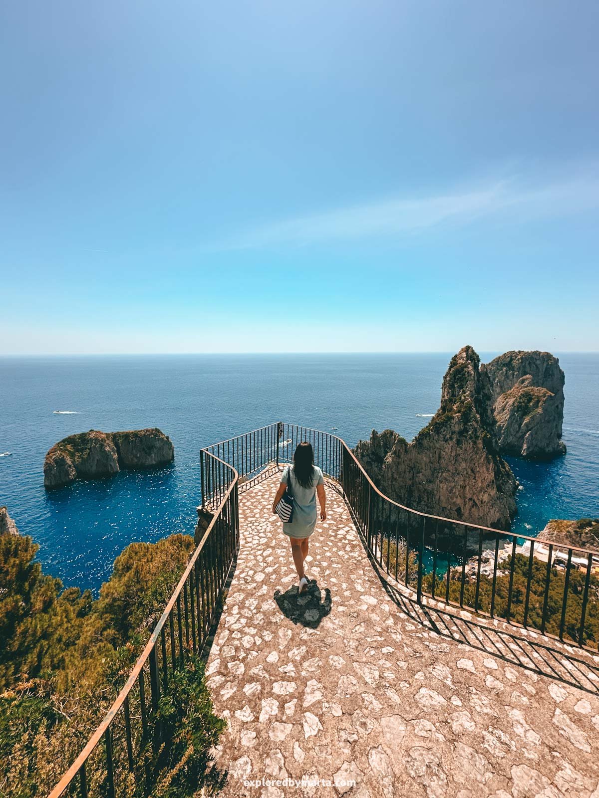
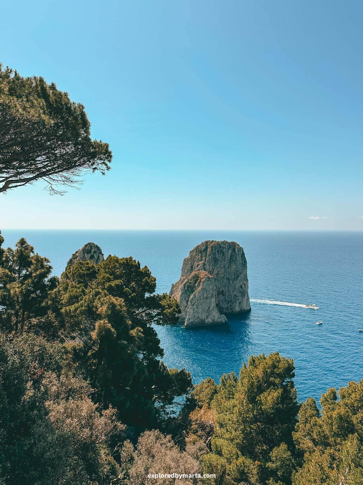
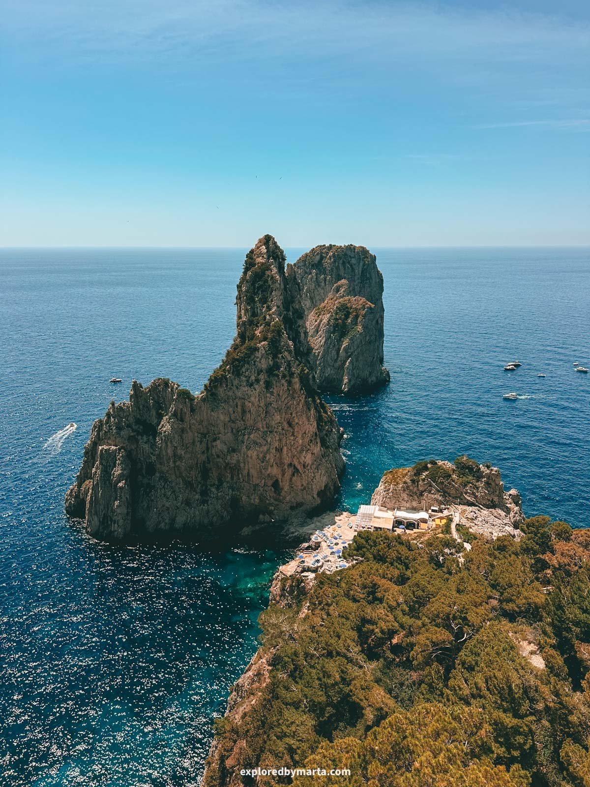
It is one of the most scenic routes you can do in Capri. If you love nature and wish to avoid the usual crowds, but want to see the natural beauty of Capri, including the iconic Faraglioni sea stacks, then this coastal trail is one of the best things to do in Capri.
The path is paved almost the whole way and allows you to admire the breathtaking beauty of the island by passing scenic coastal viewpoints, fragrant forests, and even a cave and a natural rock arch. The whole way, you have views of the iconic Faraglioni rocks.
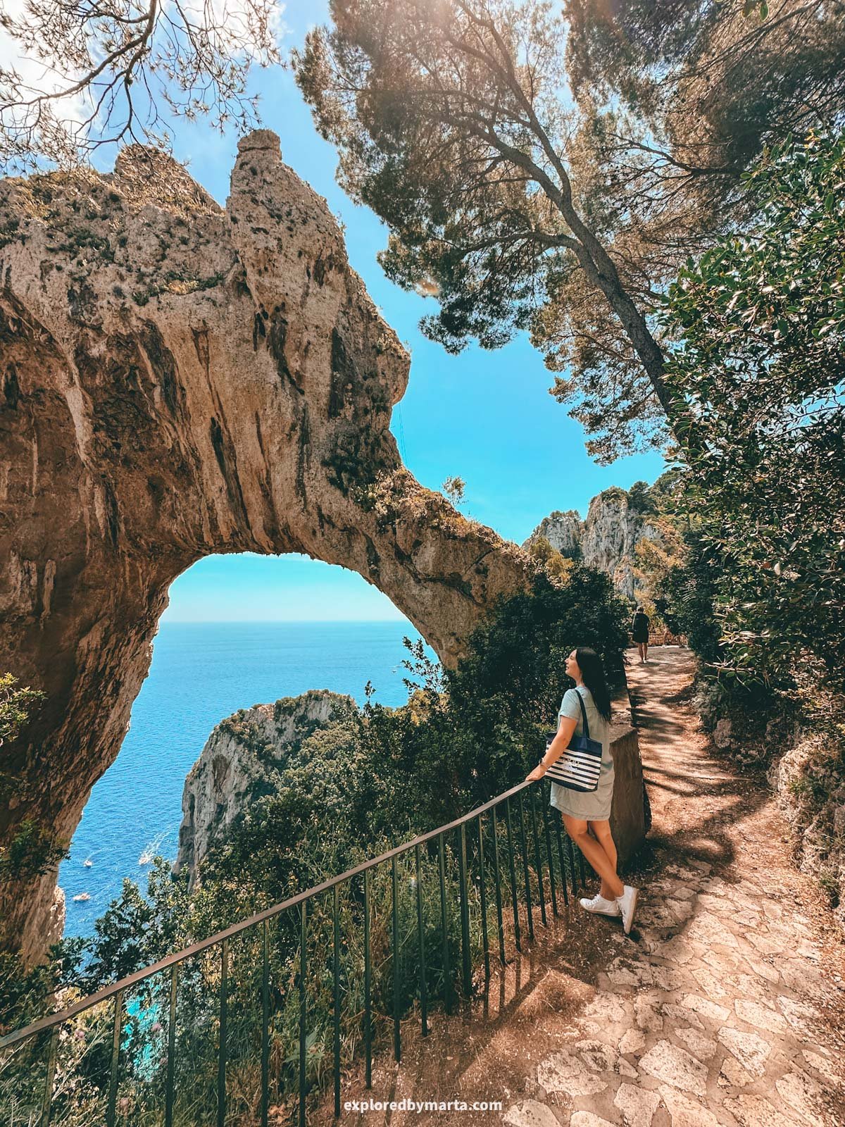
We also stopped by a scenic restaurant with a view during the hike.
If you aren’t afraid of climbing steps, you can even walk down to the Faraglioni di Capri rocks and see them up close from the shore. Then simply climb back up and continue the path. This is what we did.
In just 2 hours, we managed to visit some of the most iconic spots and some of the best viewpoints on the island. Even if you come here for a day trip, this short trail will make you fall in love with this little island instantly.
Location: Via del Pizzolungo
Happy exploring!
The Amalfi Coast, a UNESCO World Heritage Site, is known for its natural beauty, scenic views, and beautiful architecture. I haven’t been everywhere, but it has to be one of the most beautiful places on our planet!
We spent half a year living in and exploring the area on and around the Amalfi Coast. It’s easy to see why this place has drawn everyone from simple fishermen to Roman emperors to its shores for thousands of years.
I hope you find some travel inspiration in this Amalfi Coast guide, and that you enjoy your time on Italy’s Divine Coast as much as we did. The beaches, the views, the scenic hikes, and the villages… it’s a place you won’t ever forget!
PIN FOR LATER!
Very good and detailed information, thank you. Gave me lots of inspiration
Thank you, Charlotte! 🙂