9 beautiful hiking trails in Gran Canaria, Spain
This post may contain affiliate links. If you use these links to make a purchase or booking, I may earn a small commission at no extra cost to you! Thank you for your support!
If you are looking for easy, beautiful hiking trails in Gran Canaria to include in your vacation itinerary, you’ve come to the right place! Those are the best hikes when you can still enjoy a relaxing dinner afterwards and wake up feeling fresh the next morning!
Gran Canaria is one of the eight inhabited Canary Islands, and I’d say it is the best Canary Island for hiking (yes, we have visited all the islands!), as it has a vast network of trails in very different landscapes.
We spent several months on the island exploring all its corners, so in this blog post, I’m sharing with you some of the most beautiful hiking trails in Gran Canaria with descriptions, photos, and locations. Happy hiking!
Three things to know about hiking in Gran Canaria
The best way to enjoy Gran Canaria is by hiking. There are numerous hiking paths in Gran Canaria, from short and easy to difficult multi-day hikes. You can find all the official hikes on the Gran Canaria Senderos website.
Usually, trails have some markers, but you can’t fully rely on them, so you should download an offline trail map on your phone and bring a fully charged phone with you. I recommend using the Organic Maps app and MAPS.ME app.
Gran Canaria may have forests, but you’re still likely to be hiking in direct sunlight, so be sure to wear a hat and bring plenty of water. Also, hiking when it rains is not a good idea – rockfalls and landslides are a thing here. Check the weather forecasts!
1. Hike from Cruz de Tejeda to Artenara

Distance: 7.5 km one way (getting back by a taxi, or you can also hike back)
Difficulty: moderately easy
Elevation gain: 300 m
Duration: 2 h
Everybody should find time to do at least one proper hike through the mountains in Gran Canaria with the most panoramic views of the dramatic volcanic landscape, and I’m here to tell you which hike it is.
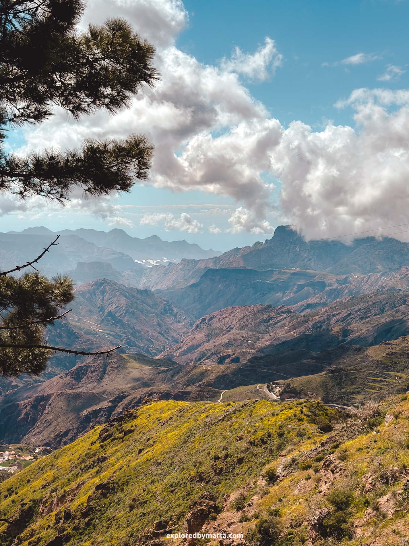
Without a doubt, the hike from Cruz de Tejeda to Artenara is the most scenic hike in Gran Canaria. You’ll have amazing views the entire time – that’s why it is my favorite of all the hiking trails in Gran Canaria!
The hike is 7 kilometers long (one way!) and very straightforward. It starts at the Cruz de Tejeda parking lot, where you can park your car for free, and follows the rim of the massive Tejeda crater until you reach Artenara, the highest village in Gran Canaria.
It took us around 2 hours, and the views were absolutely fantastic. I had my phone out the entire time and took way too many photos – I can’t possibly post them all here, haha.
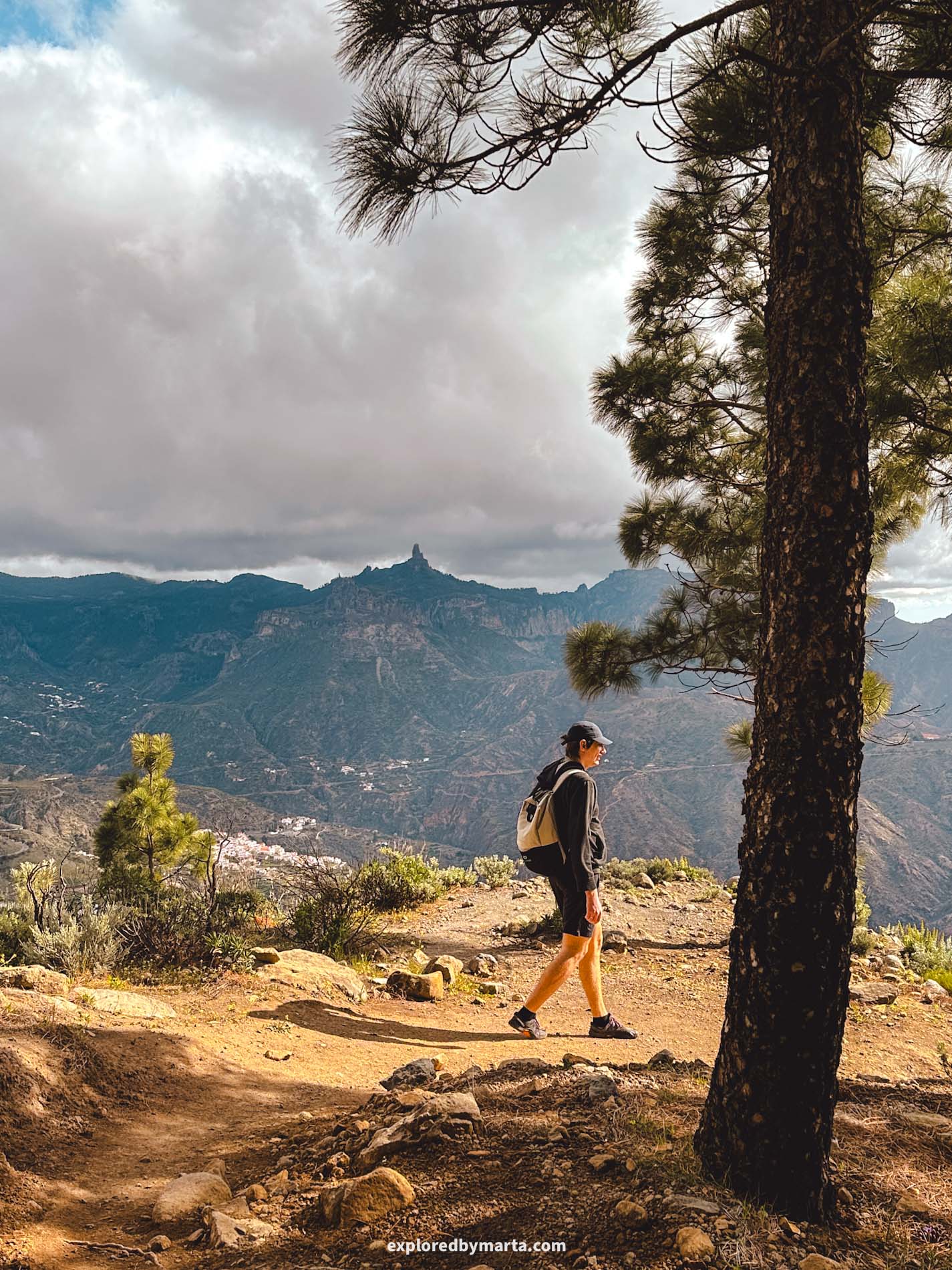
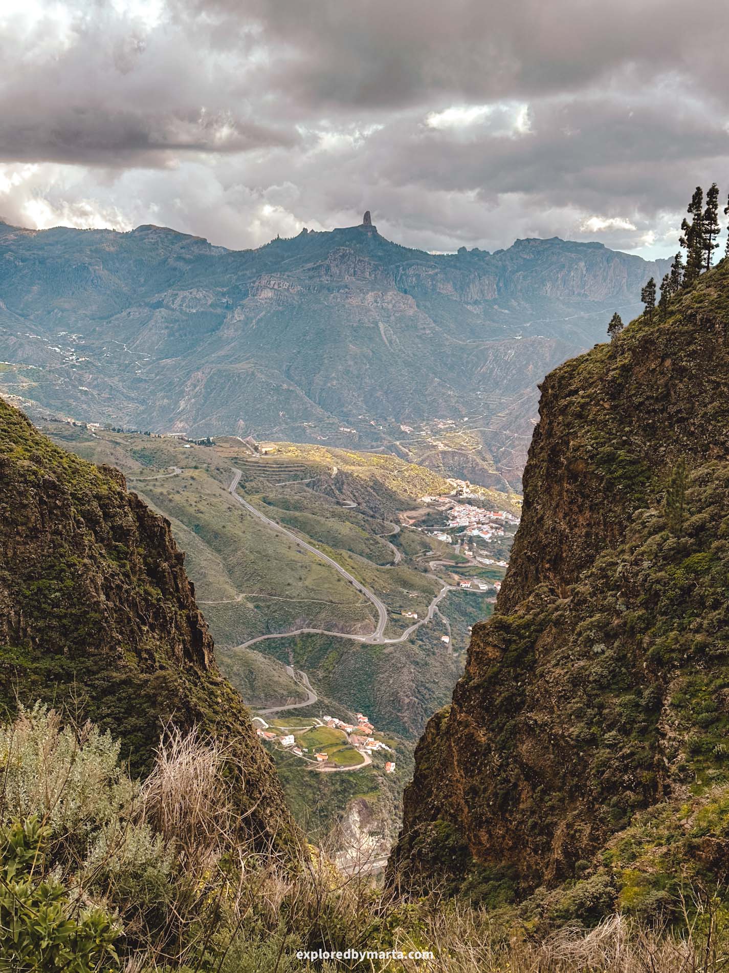
If you walk from Cruz de Tejeda to Artenara like we did, the hike includes about 300 meters of elevation gain. Along the way, you’ll enjoy the most scenic views of the Caldera de Tejeda crater and surrounding mountains, including the iconic Roque Bentayga and Roque Nublo.
The trail is pretty easy to follow. If you check the map from time to time, you can’t go wrong, and there are some trail markers along the way, too.

Once we reached Artenara, we finished our hike next to the village church, enjoyed the views for a bit, and then took a taxi (they’re parked right by the church) back to Cruz de Tejeda, where we had left our rental car.
You can also hike back the same way, but you’ll need to add another 600 meters of elevation gain since Artenara is much lower than Cruz de Tejeda (and there’s a mountain in between). But if you can dedicate most of the day to the hike, then why not?
Location: Cruz de Tejeda
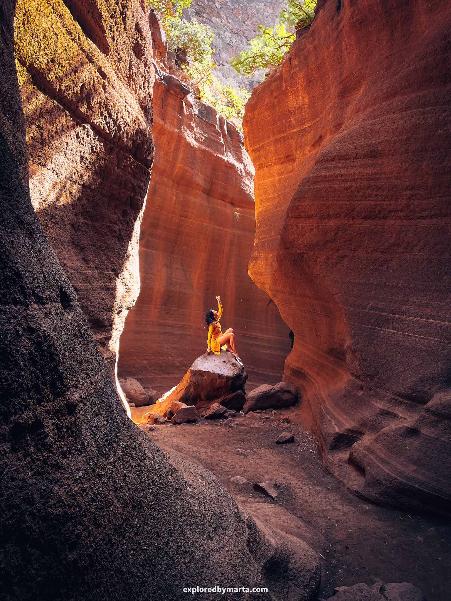
2. Hike to the slot canyon of Barranco de las Vacas
Distance: 1.5 km (out and back)
Difficulty: easy
Elevation gain: 70 m
Duration: 45 min
Now, this one is one of the easiest hiking trails in Gran Canaria!
Barranco de las Vacas is one of the most unique places to visit in Gran Canaria. It is a narrow ravine with wave-like sandstone walls in golden and rust colors that resemble the famous Antelope Canyon in the United States.
Although Barranco de las Vacas slot canyon is really small and short (like 100 meters short!), it has become one of the most sought-after attractions in Gran Canaria.
Just like other canyons, Barranco de las Vacas was formed by erosion, wind, and rain over the period of thousands of years.
You can reach Barranco de las Vacas with a short and easy hike. Park your car at the side of the road, then follow the path that leads directly into the valley from the parking area. At first, the hike leads you down to the riverbed.
After reaching the riverbed, go through the tunnel under the bridge and follow the riverbed uphill. Just 100 meters from the bridge, you’ll arrive at the beautiful slot canyon. That narrow canyon spot is among the most photo-perfect places in Gran Canaria.
After you take the perfect photo, just hike the same way back. It is a very short hike and quite easy to do, so if you’re traveling with kids, this is a great, short hike to do together.
Location: Barranco de las Vacas
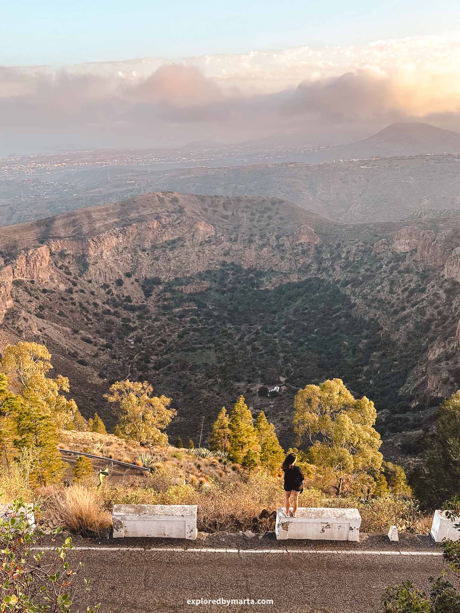
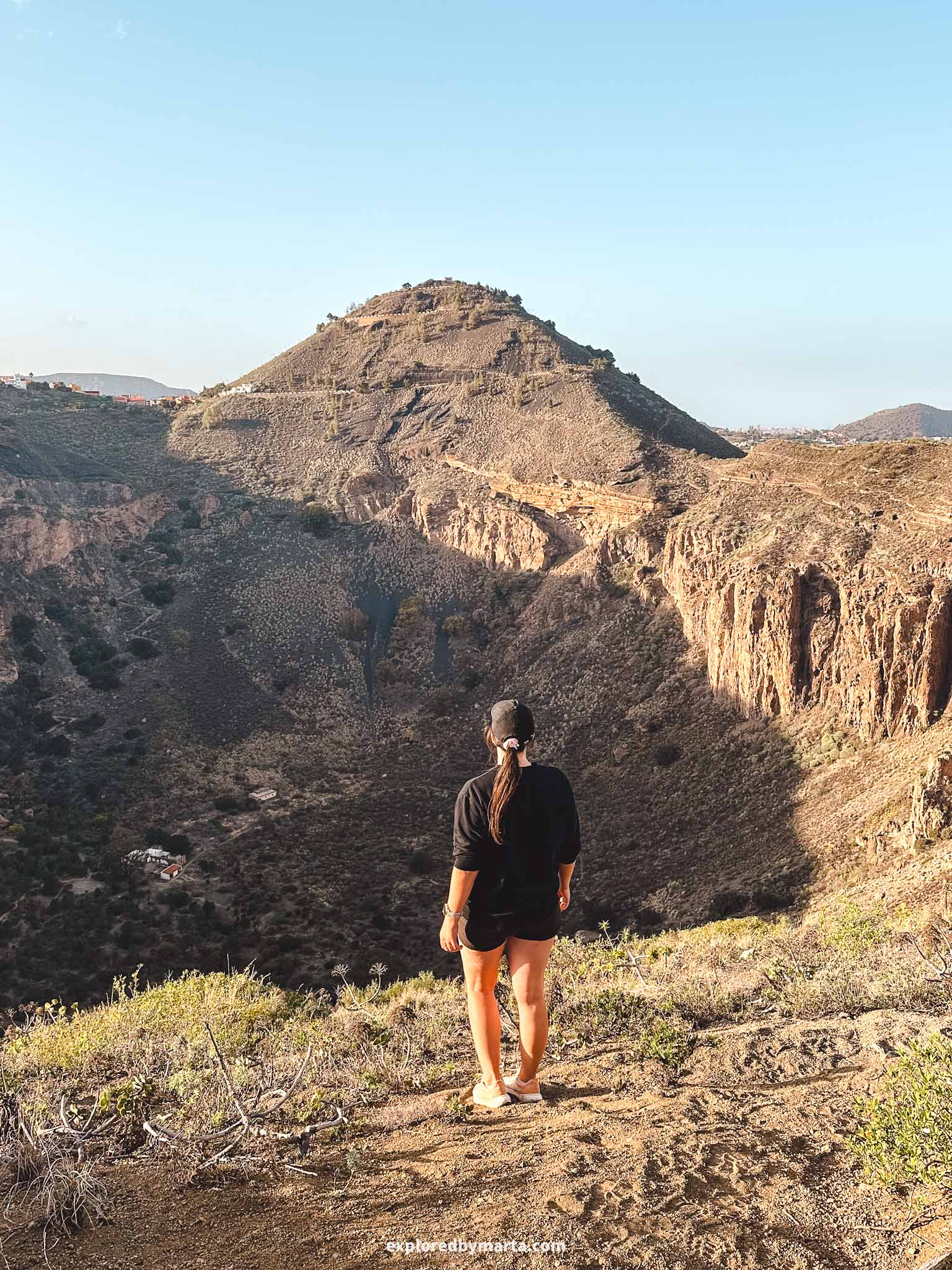
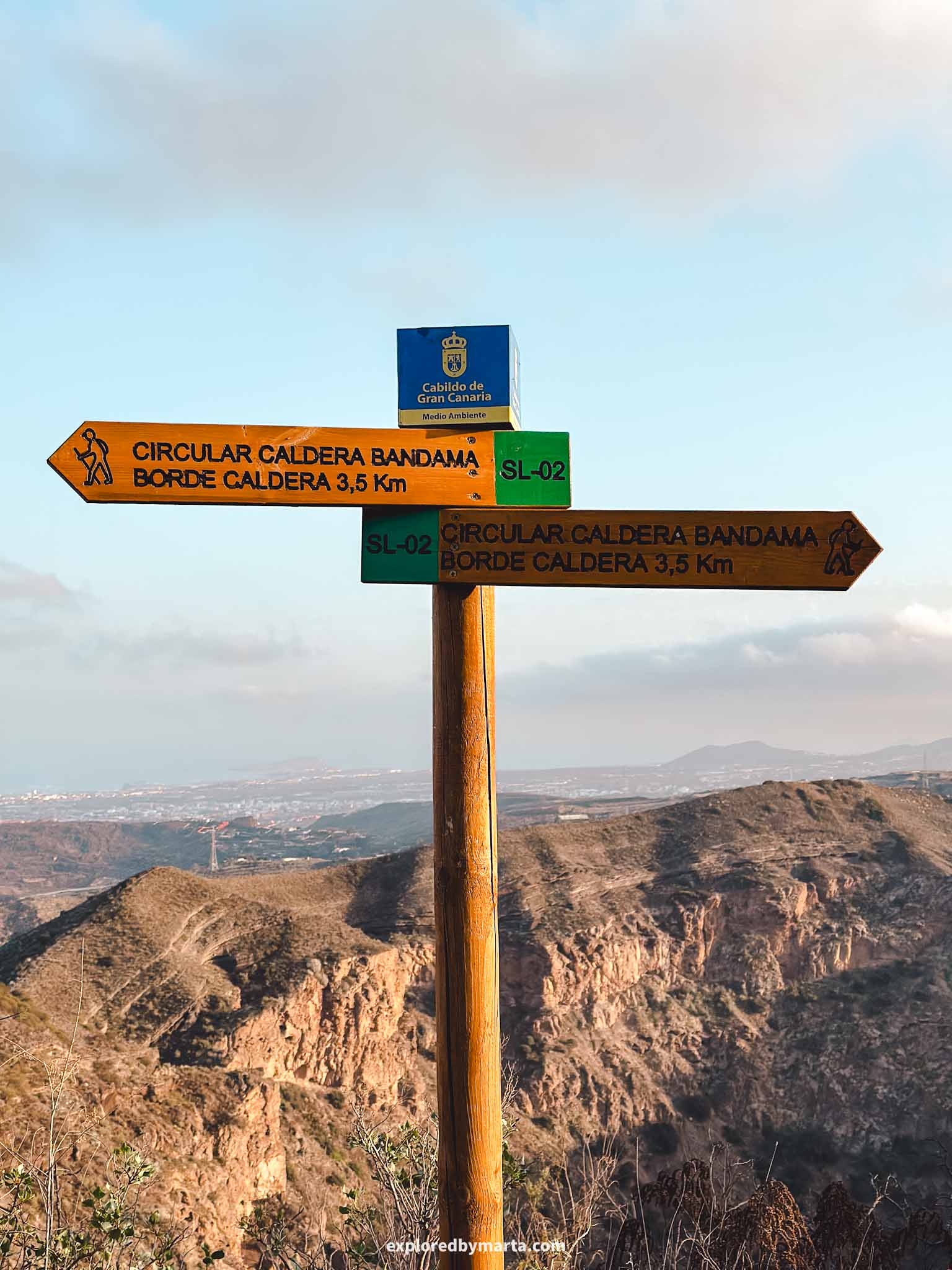
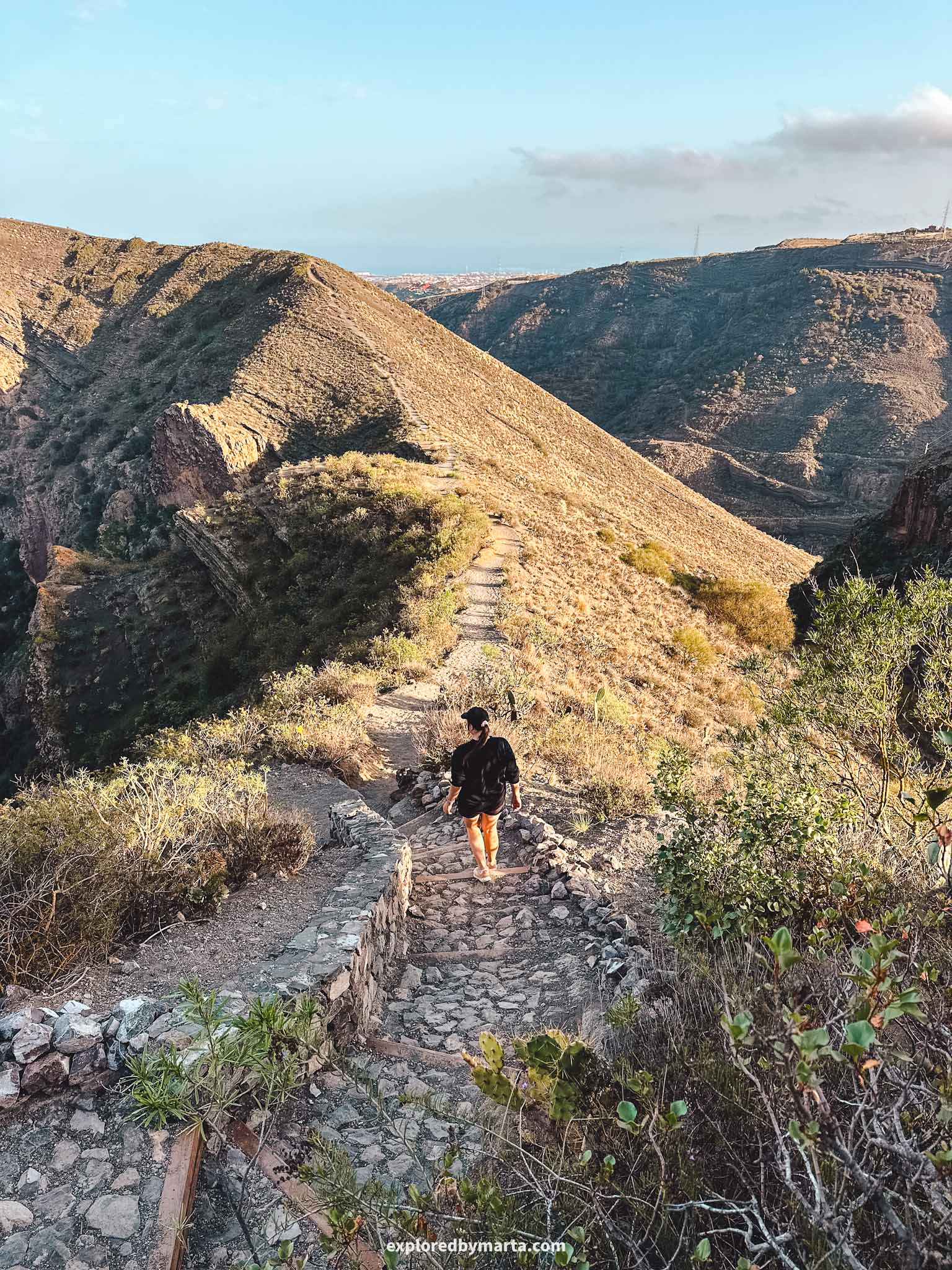
3. Hike around the rim of Caldera de Bandama
Distance: 3.5 km (circular)
Difficulty: easy
Elevation gain: 200 m
Duration: 1h to 1.5h
Located near Las Palmas, the capital of Gran Canaria, Caldera de Bandama is a beautiful 1,000-meter-wide and 200-meter-deep crater of a volcano that formed during the island’s most recent volcanic activity.
This circular trail around the Bandama Crater is one of the most beautiful hiking trails in Gran Canaria! Just look at the photos – we did this hike shortly before sunset! This hike is quite easy and should definitely be on your Gran Canaria bucket list!
Plenty of travelers think about hiking as something that is only done in the mountains and requires many hours of hard effort, but hiking isn’t like that. Enjoying trails for 1 hour is hiking, too!
That’s why this is one of my favorite hiking trails in Gran Canaria – it is relatively easy (okay, there are some small hills to climb!), it is relatively short, it is very unique (who doesn’t love hiking around a volcano crater?), and it is very beautiful (look at those views!).
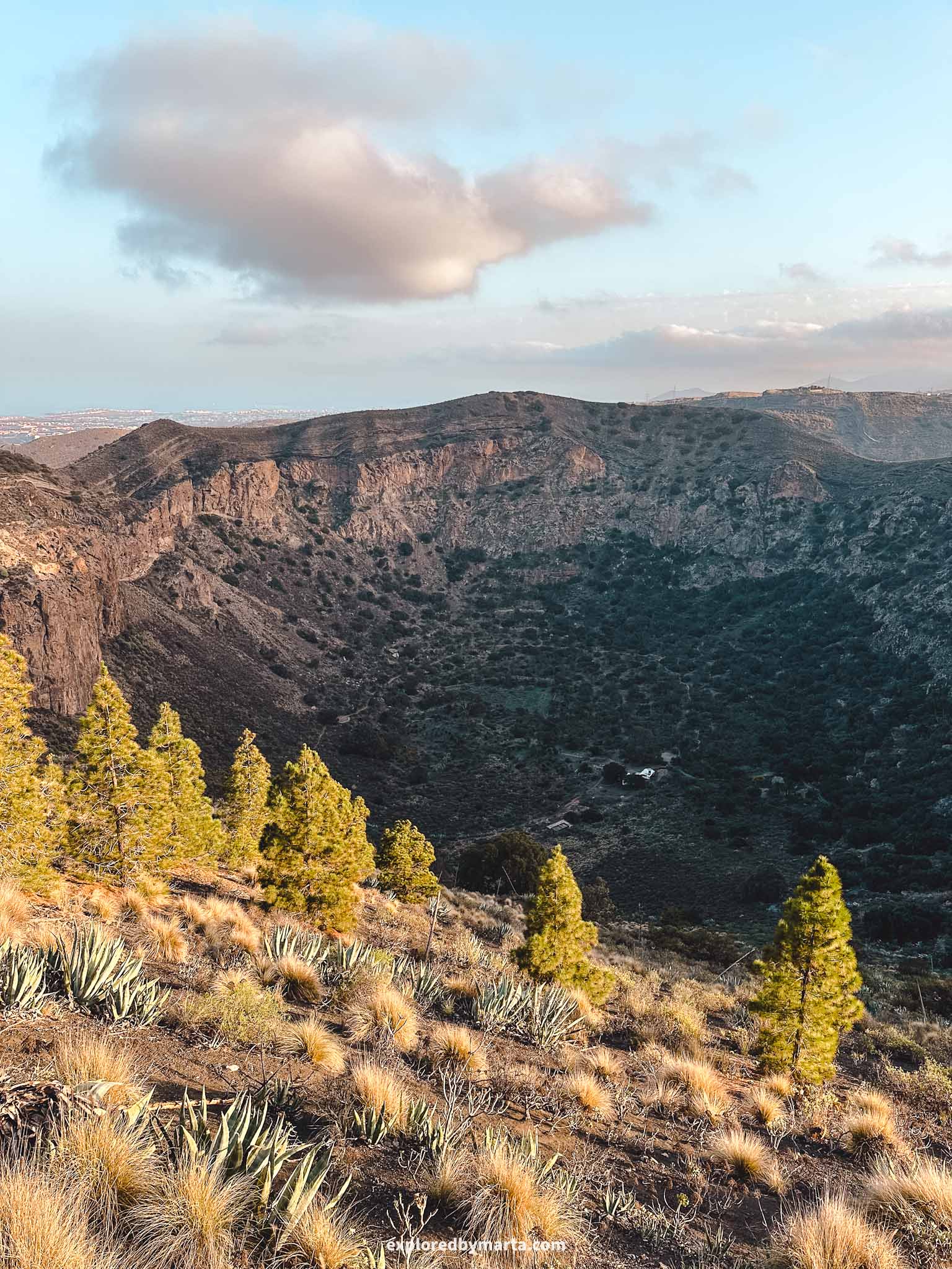

The crater is super easy to access. You can drive all the way to the top of the crater and even to the summit of Pico de Bandama. Standing at 569 meters, Pico de Bandama is the highest point on the rim of the crater.
There is a parking lot near the summit. From there, you can see the perfectly circular shape of the Bandama Crater, as well as the views of the surrounding area, including Las Palmas de Gran Canaria, the island’s capital.


To hike around the crater, you can park your car at the summit of Pico de Bandama (though that adds some extra elevation gain) or along the northern side of the crater. We parked our car next to the road and started the hike there.
The hike passes a golf club and then simply follows the rim of the crater. You can’t go wrong here.
If you only hike around it (just like we did), it’s a 3.5-kilometer route. We completed the circular hike in about an hour. But it is also possible to hike inside the crater or climb up to the Pico de Bandama summit – both detours will add some extra meters and elevation gain.
Location: Caldera de Bandama
4. Hike to Roque Nublo, the sacred symbol of the island
Distance: 2.80 km (out and back)
Difficulty: easy to moderate
Elevation gain: 160 m
Duration: 2h
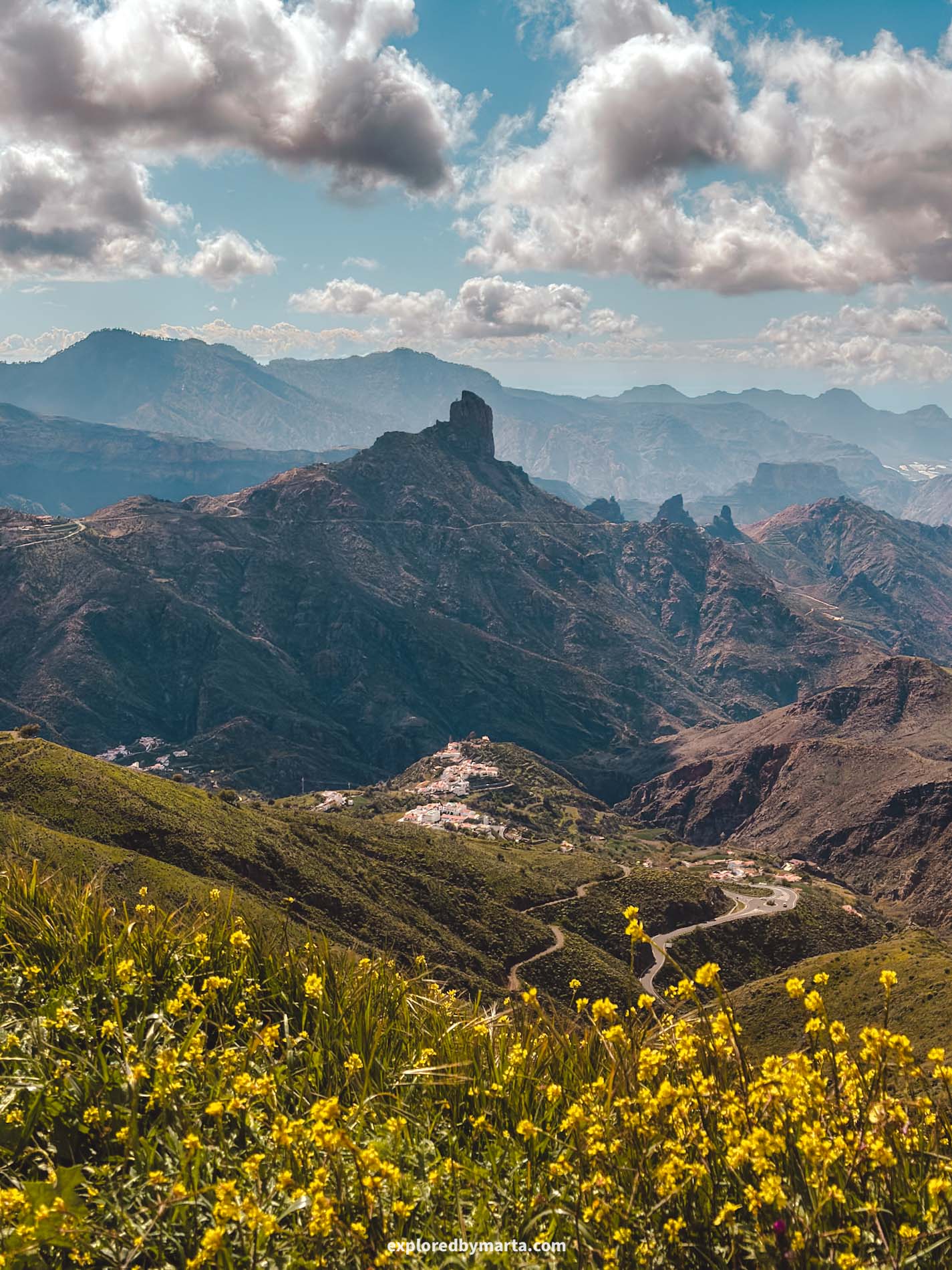
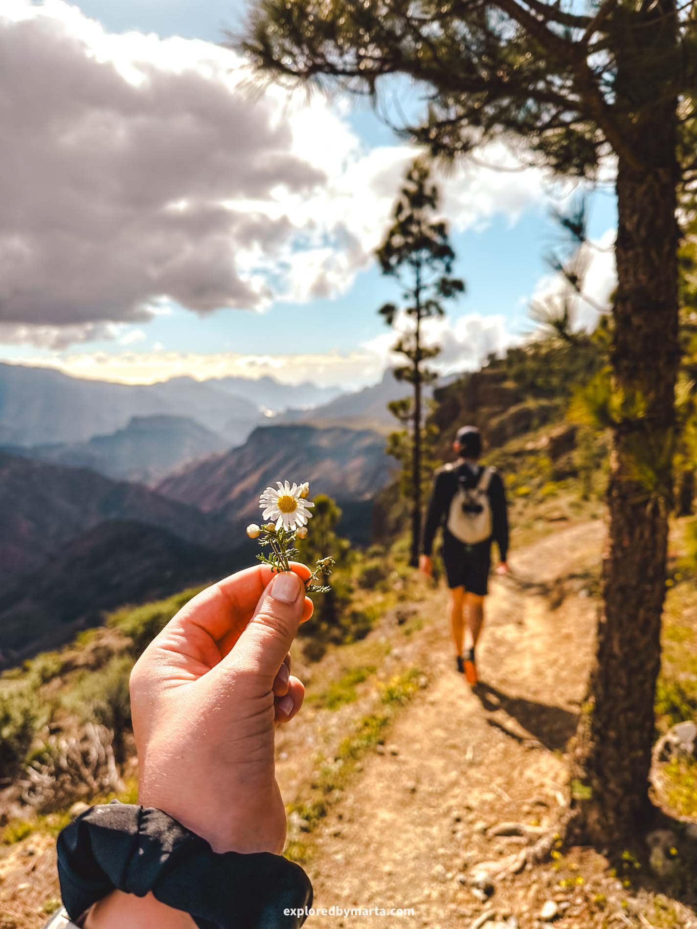
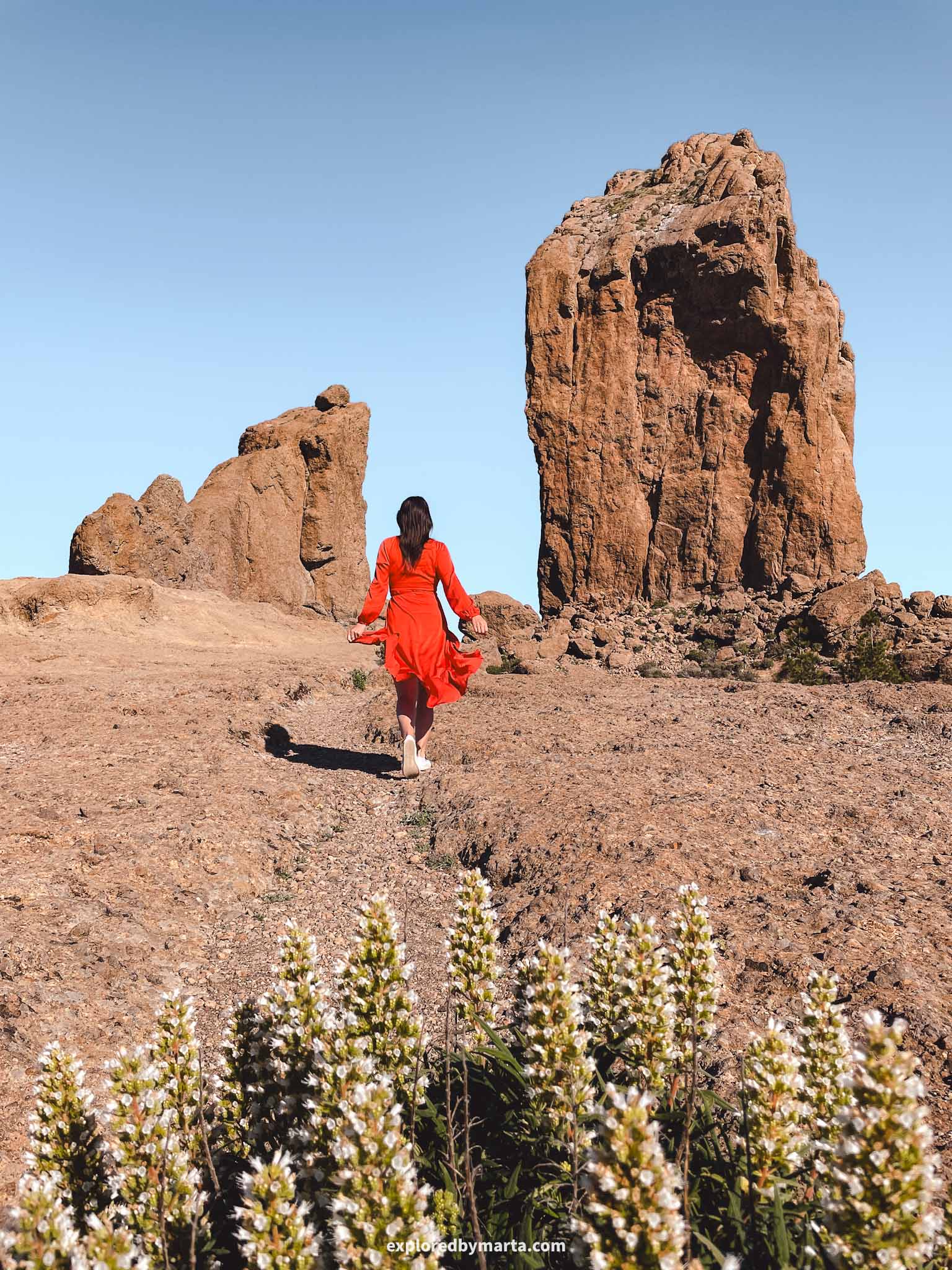
A hike to Roque Nublo is one of the must-do hiking trails in Gran Canaria! Almost every visitor to the island visits this unique place, but you can only reach it by hiking.
Roque Nublo is a massive volcanic rock formation in Gran Canaria that formed during an eruption millions of years ago. It is a symbol of the island and was a sacred place for the island’s early settlers: the Guanches.
The name Roque Nublo translates to “Cloud Rock” in Spanish. The rock itself is 80 meters tall and sits at 1,803 meters above sea level, making it the third-highest peak in Gran Canaria. And those views! This is definitely one of the best viewpoints on the island!
I have visited Roque Nublo many times – in the morning, during the day, and at sunset. Each time of day offers a unique perspective and view of the entire island. On a clear day, you can even see Teide volcano on the island of Tenerife!


How to hike to Roque Nublo?
The shortest and most popular hike (1.3 km one way) starts from Road GC-600, but you need to obtain a free permit to walk to Roque Nublo from this checkpoint during the day (from 9:00 to 17:00). No permit is needed outside these hours.
Also, you can’t park your car at the starting point. Instead, you can leave it at one of the nearby campsites (Bailico or Llanos de la Pez) and add a few extra kilometers to your hike, or take a public bus (see ‘Guaguas’), which will take you directly to the starting point.
For other hiking options to Roque Nublo, I recommend a 3-kilometer hike (one way) from Presa de Elba. There are a few parking spots next to the bus stop, and the trail takes you along the water reservoir and up to Roque Nublo.
If you choose to hike the second option, you can then take a small detour during this hike to visit one of my favorite hidden gems in Gran Canaria – Ventana de Bentayga (see the next hike below!).
Location: Roque Nublo
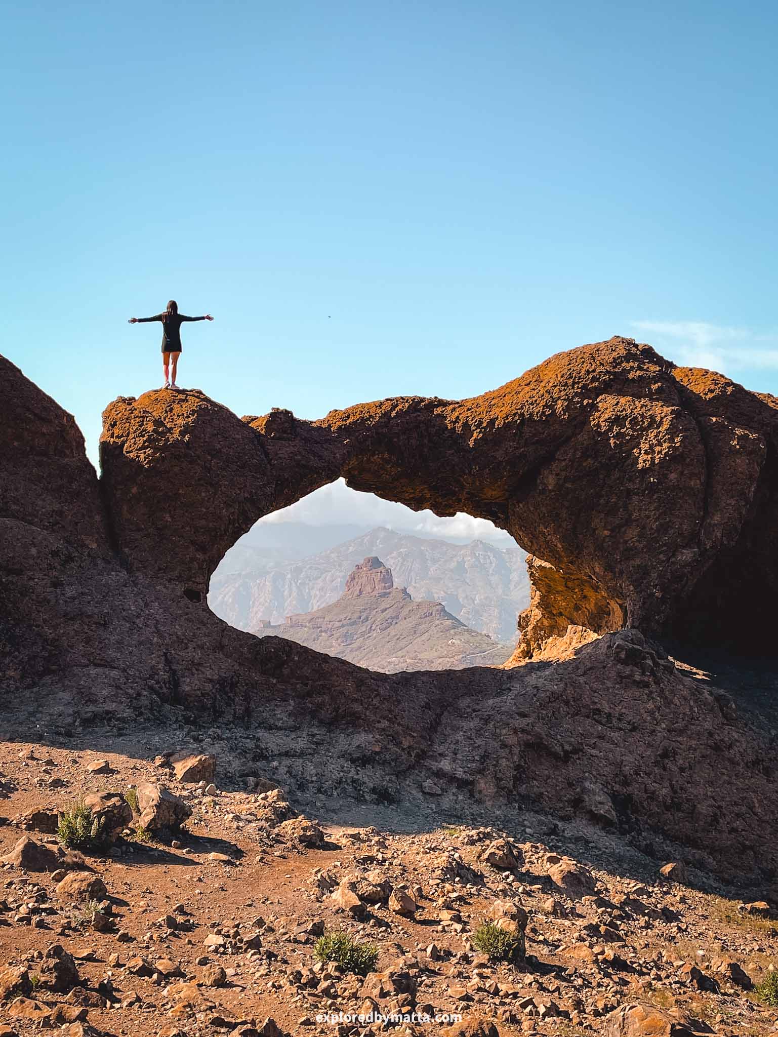
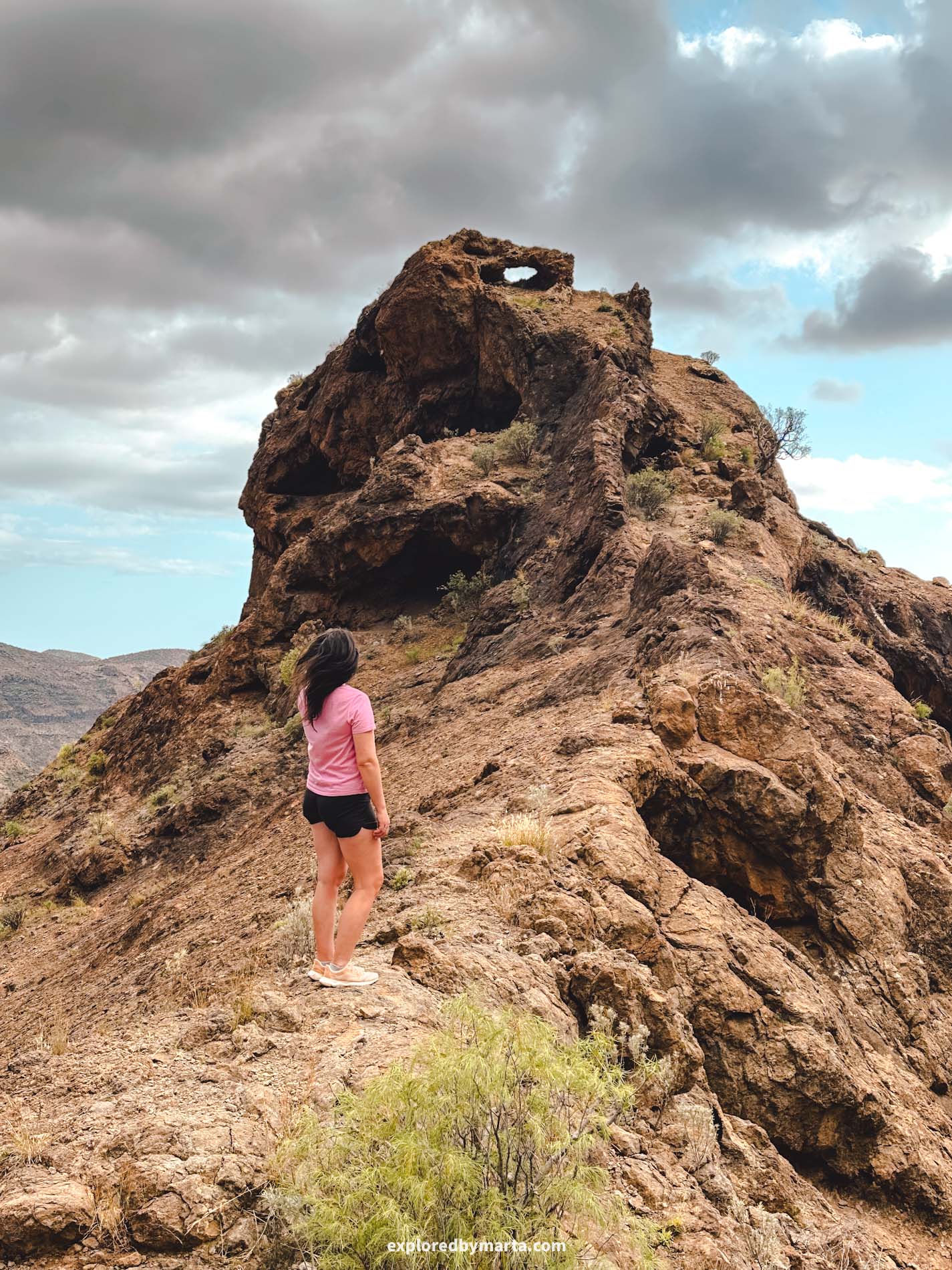
5. Hike to Ventana del Bentayga
Distance: 3.60 km (out and back)
Difficulty: moderate
Elevation gain: 360 m
Duration: 2h
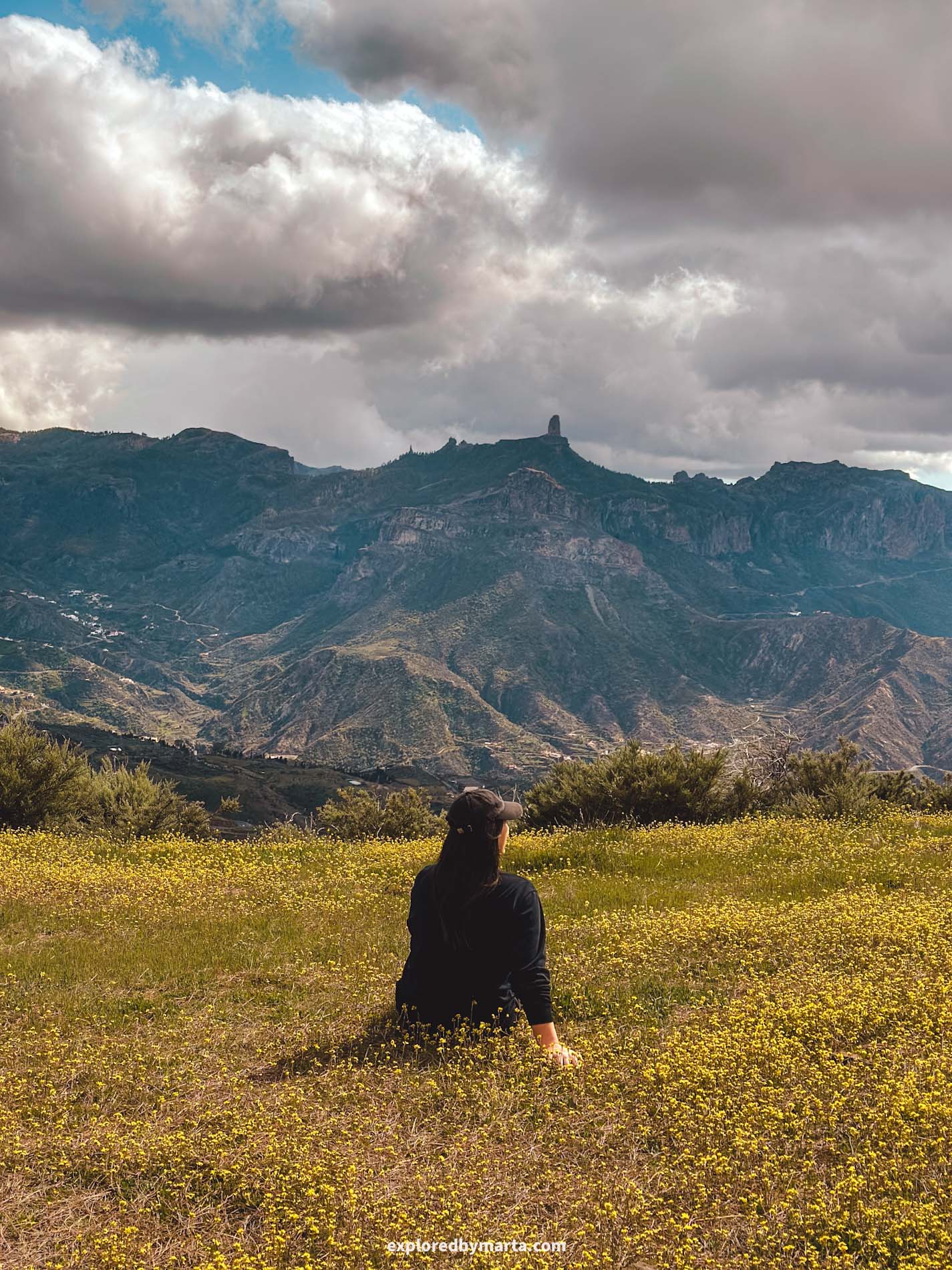
If you are anything like me and you like to hike to beautiful places, then a hike to Ventana del Bentayga is for you.
Ventana del Bentayga, or Window of Bentayga, is a unique rock formation in the mountains of Gran Canaria. It is a scenic volcanic arch where you can see Roque Bentayga rock framed in the middle. It is one of my favorite secret spots in Gran Canaria!
You can reach this rock arch via a 45-minute hike starting from a bus stop on GC-60 Road, and then following a path to Presa de Roque Elba water reservoir.
After you reach the water reservoir, you have to turn left and follow a path up to the mountain. There isn’t a distinct path but rather many smaller paths marked by stone pyramids leading uphill.
It is a short but steep climb and the most difficult part of the hike, but nothing too dangerous. But watch out for this steep descent when you’re coming back down the mountain!
After you reach the mountaintop, the trail is again quite easy to follow. Just open your map and check that you are going in the right direction. Those views from Ventana del Bentayga are unbeatable!
Location: Ventana del Bentayga
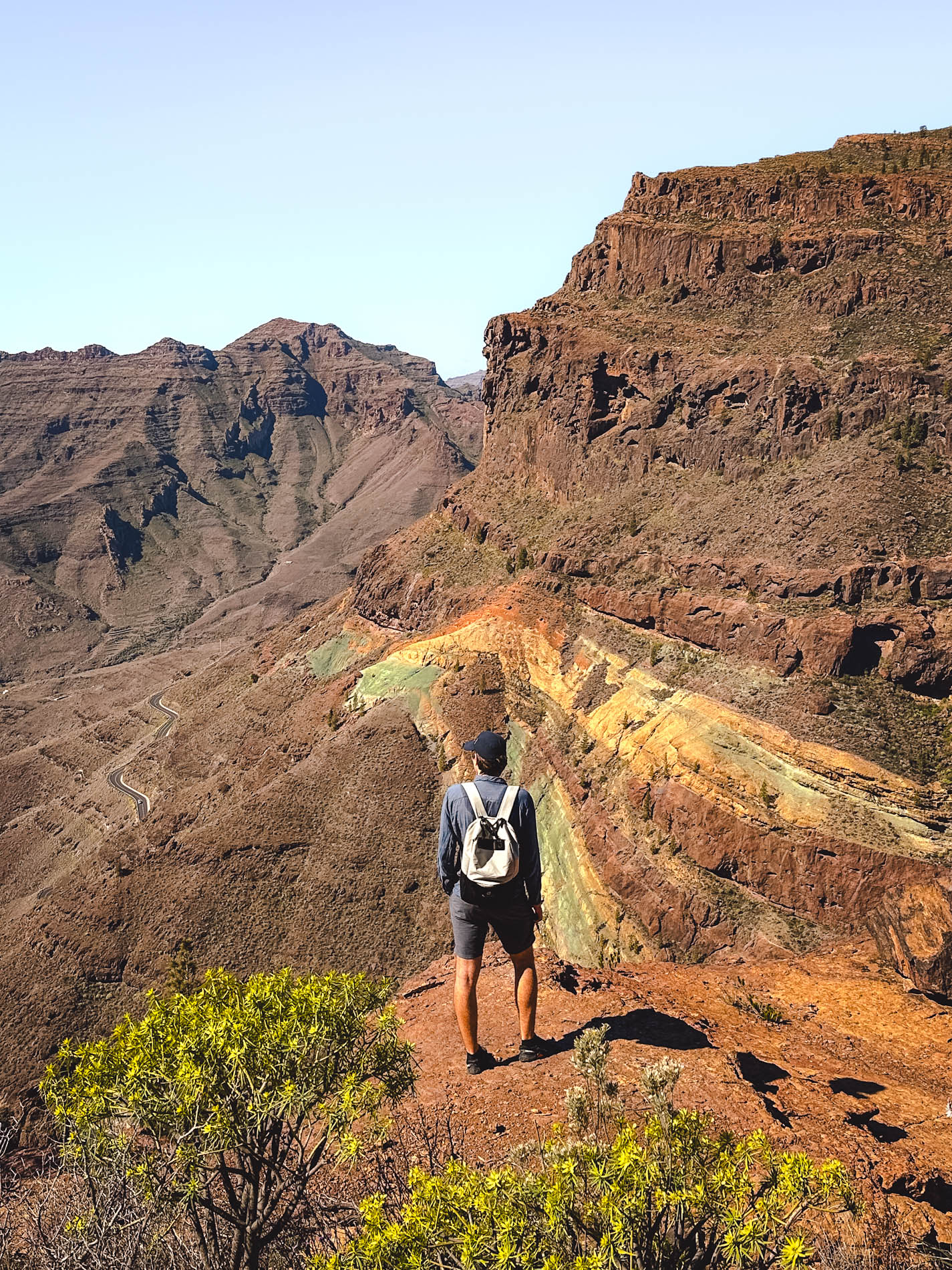
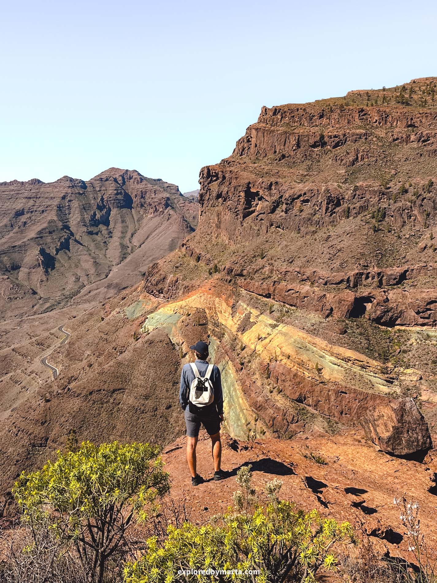
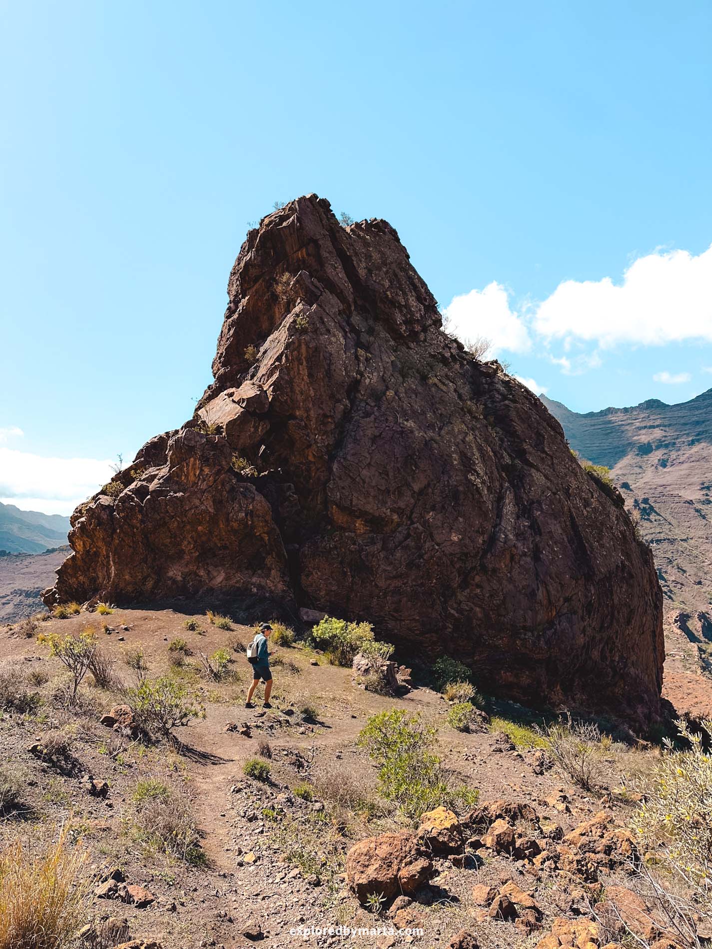
6. Hike around Los Azulejos de Veneguera


Distance: 7.50 km (circular)
Difficulty: moderate to difficult
Elevation gain: 550 m
Duration: 2h 30min
Los Azulejos de Veneguera, often referred to as Gran Canaria’s Rainbow Rocks, is one of the most beautiful places in Gran Canaria, where you can admire a large multicolored mountain proudly displaying its vibrant colors.
Why are the rocks colorful? The mountains were formed millions of years ago during volcanic eruptions, and the area is composed of various minerals. As a result of oxidation and other chemical reactions, these minerals each have a different color.
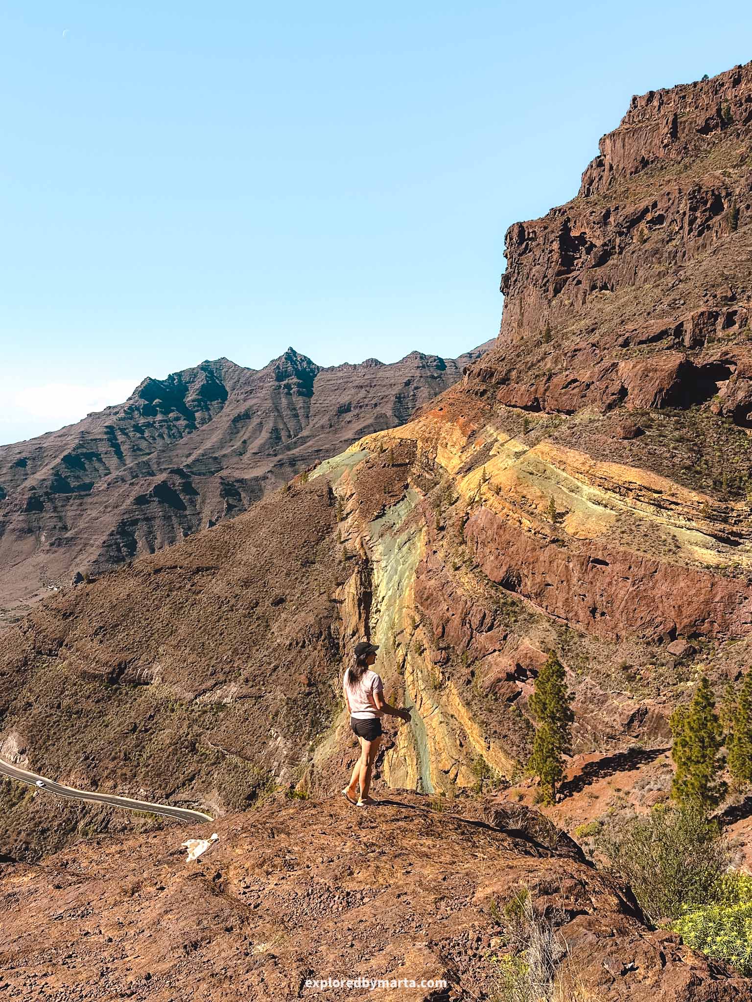
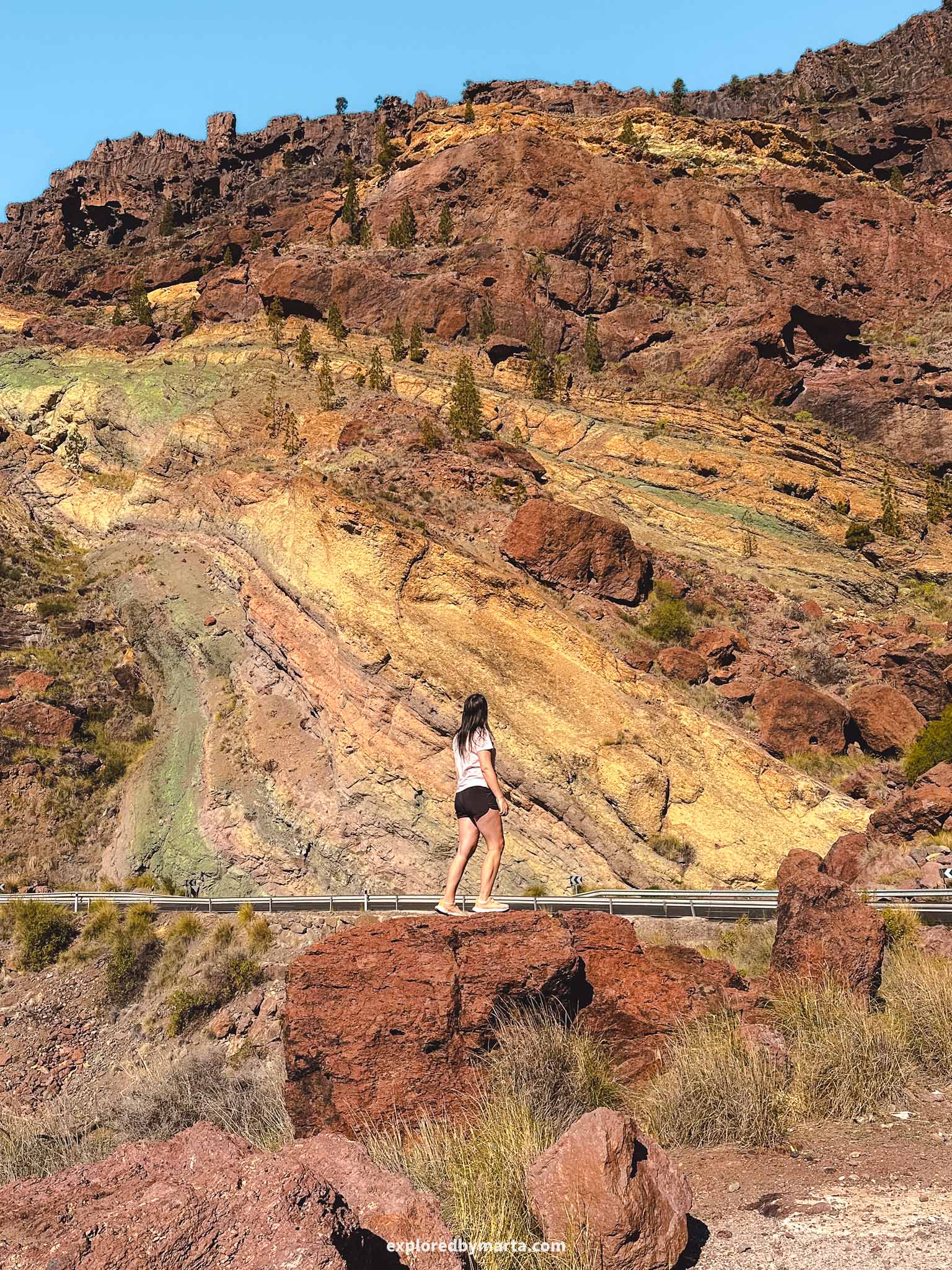
The rocks are located in the southwest of Gran Canaria, and you can easily reach this place by car or by bus. There are many parking places along the road where you can leave your car and go admire the rainbow rocks up close.
Many people don’t even know it, but there is a beautiful and scenic hike around the Rainbow Rocks. It’s not an easy one, as you have to climb all the way up a mountain and then back down again. Just take your time and enjoy the views!


The Los Azulejos de Veneguera hike is 7.5 kilometers long and took us about 2 hours and 30 minutes. We started in the morning and managed to finish before the midday heat.
The start of the trail has a signpost indicating the direction for ‘Ruta 2’. However, the trail itself is not marked at all. We saw multiple hikers go the wrong way and then scramble back down the steep slopes, so make sure to check your offline maps! There are some tricky spots!

Luckily, my husband does orienteering and is very good with maps, but even I double-checked with him if he found the right trail (he did!). It just isn’t very straightforward in some parts.
The hike is a circular route and starts and finishes at the same spot, meaning, where you park your car. We left it at a parking spot by the main road and started the hike right there by climbing up the mountain.

Some say you should do the hike in the opposite direction, but I liked that we did the steepest climb first. I wouldn’t want to scramble down there – it’s pretty steep!
At the beginning of the trail, we also saw some rock ‘swimming pools’ called charcos, pits in the rocks that fill with rainwater. They didn’t look too great for swimming when we were there, but if you come shortly after a few rainy days, you might want to check them out.
Overall, I really liked this trail. It was one of my favorite hiking trails in Gran Canaria, and if you have half a day to spare, I highly recommend it. Plus, you get amazing views of the valley and the rainbow-colored mountains below!
Location: Los Azulejos de Veneguera
7. Hike through Barranco del Álamo

Distance: 5.50 km
Difficulty: easy
Elevation gain: 250 m
Duration: 1h 30min
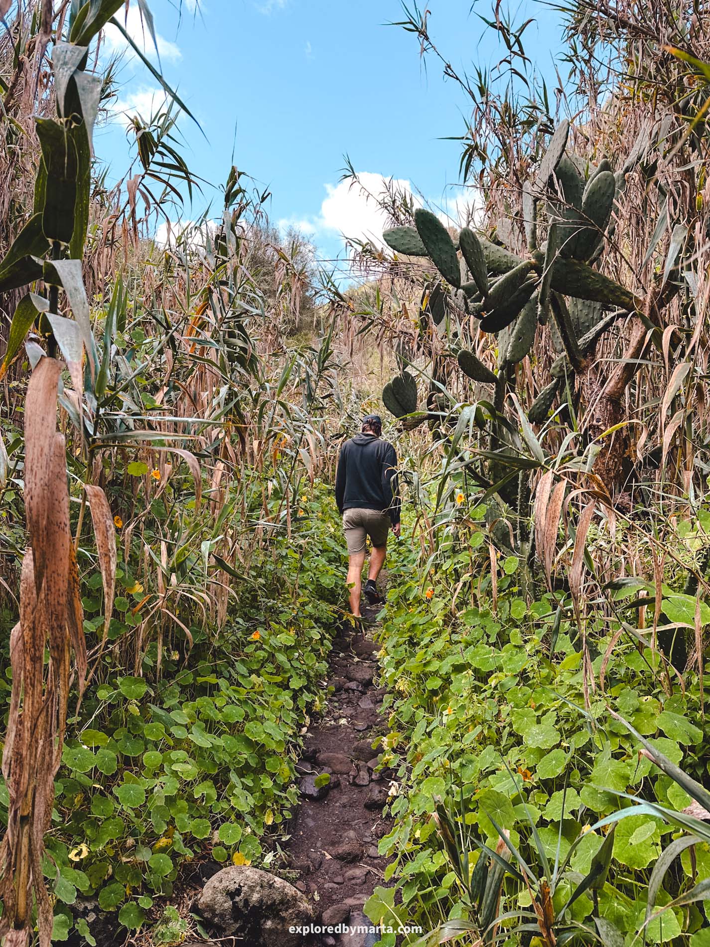
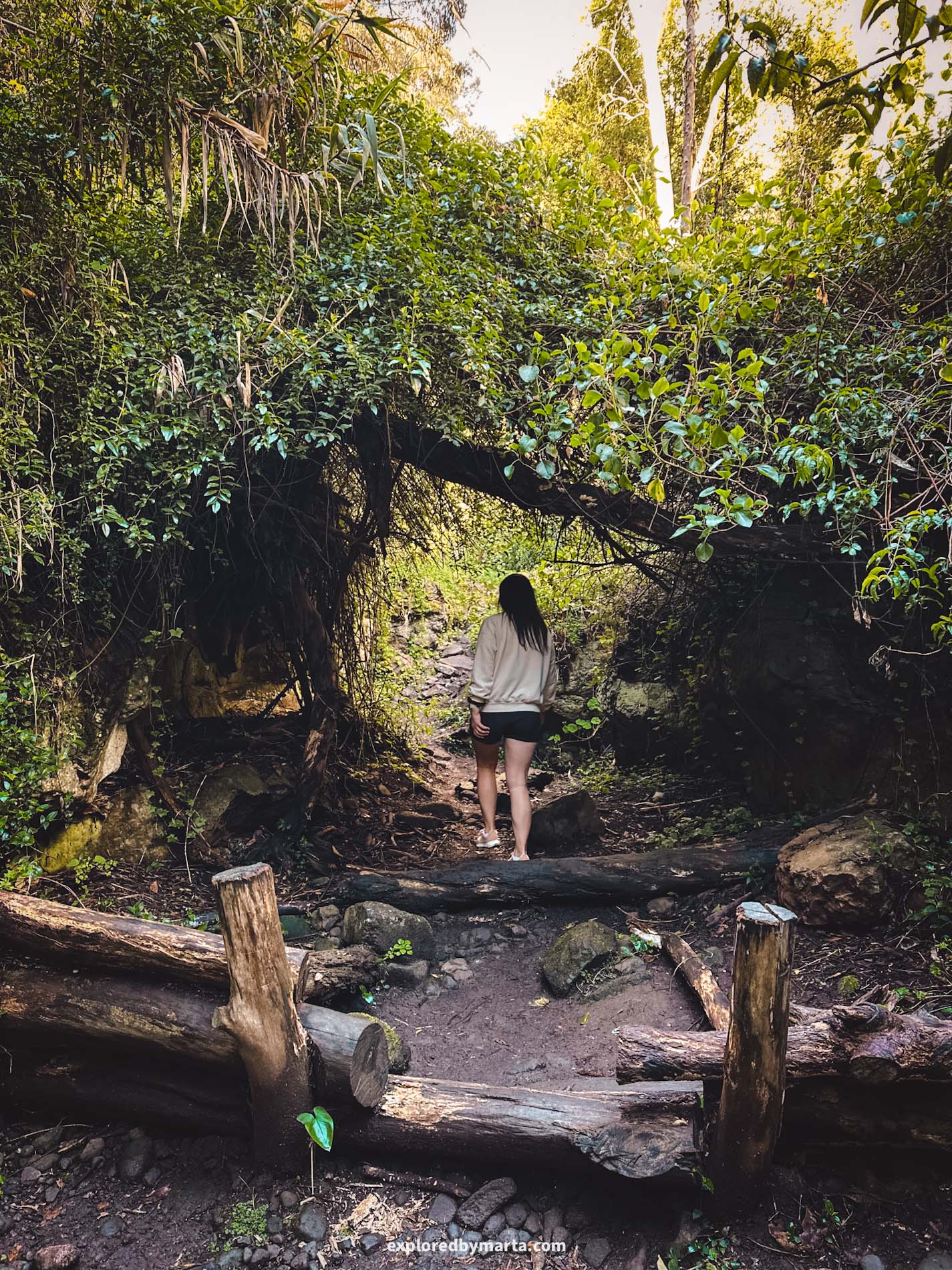
Gran Canaria isn’t just about volcanoes and rugged mountains – it’s also home to lush vegetation and rainforest-like areas. And Barranco del Álamo is one of the most popular hiking trails in Gran Canaria that proves it!
The Barranco del Álamo hike is easy to follow. The hike starts in Teror village and simply follows the bottom of the ravine, where you can get to know the different flora that grows on this island.


The ravine can be muddy at times, but it isn’t a riverbed (unless it’s been raining for days!), so you can safely hike it with dry feet.
Sunny and clear days would be perfect for hiking this trail because large trees and overgrown bushes cover the sky and give you pleasant shade.

Although I’ve given you our version of this trail, it can be hiked in many different ways. We parked our car at a free parking lot in the village and started from there, but you can start from any other place in the village where you can park your car.
The main trail markers you should know are the location where the stairs lead down from the street to the ravine and the spot where you enter the ravine. After that, you just follow the bottom of the ravine.


The hike along the bottom of the ravine lasts about 2 kilometers when it exits the ravine. At this point, you should choose a route back to your car.
One option is to hike all the way back through the ravine, and why not? If you liked it, then go for it. The other option is walking back along the streets by whichever side of the ravine you choose.
We chose to walk back by the east side of the ravine and hiked halfway up a mountain and followed a route along the mountainside. We got some nice views over Teror village and the ravine, but I can’t say it was the best view on the island. The choice is yours!
Location: Barranco del Álamo
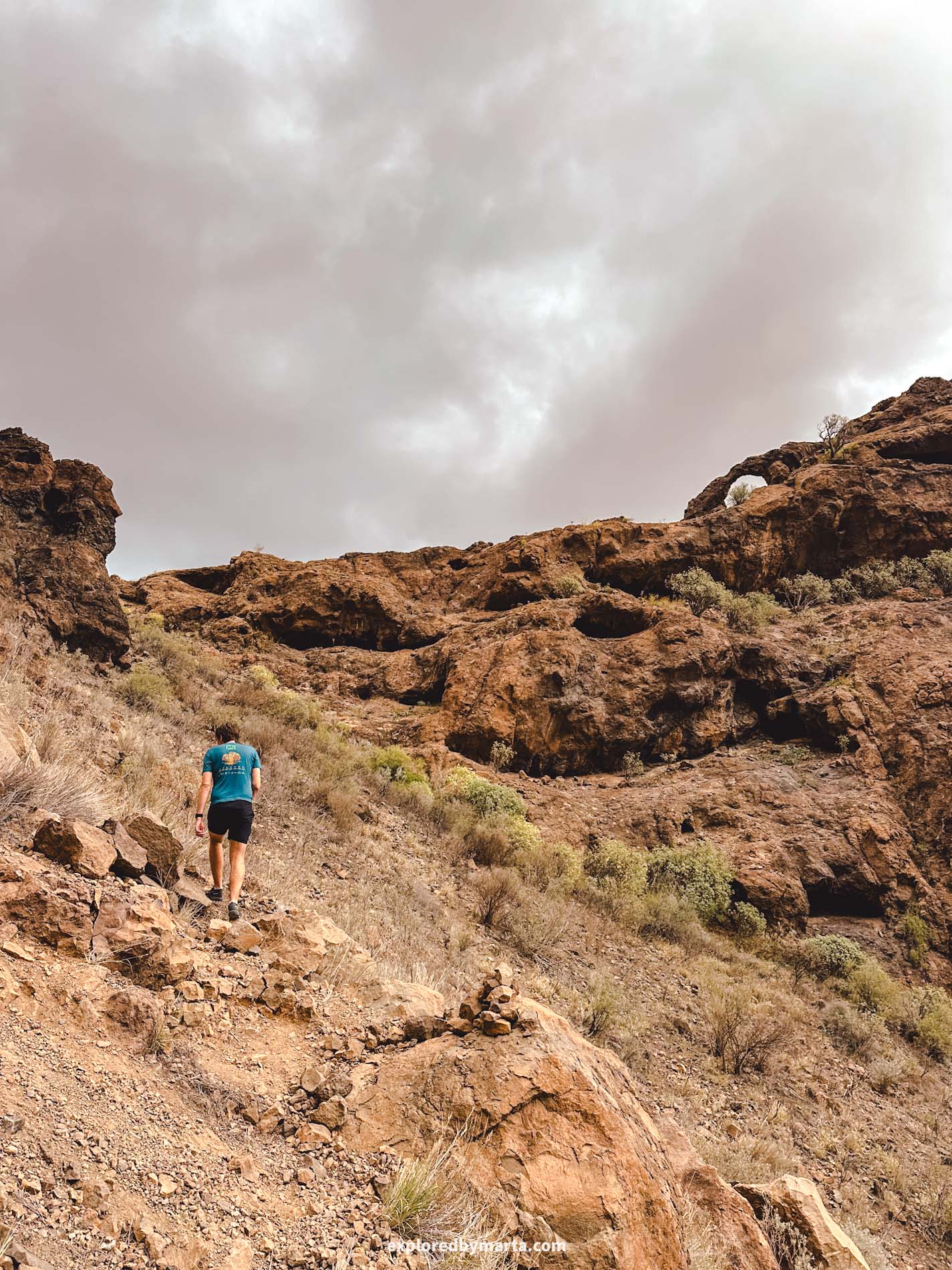
8. Hike to Ventana del Nublo


Distance: 3 km (out and back)
Difficulty: easy
Elevation gain: 130 m
Duration: 1h
I love hikes with a goal, and this little beautiful hike has exactly that!
This short and sweet hike leads through pine forest to a beautiful volcanic rock arch (yes, another one!) called Ventana del Nublo. Why the name? Because you can see the iconic Roque Nublo rock formation through its hole.
The hike starts at Bailico Campsite, where you can park your car in the forest (for free) and then do the hike. This is one of the easiest hikes on this list, so if you have kids, this short walk is a great option for the whole family.
With a couple of signposts and trail markers, this hike is easy to follow. The rock arch sits on a rocky outcrop where you can stay for a while, sit down on the rocks, enjoy the views, and eat some snacks.
Location: Start of the trail – Ventana del Nublo
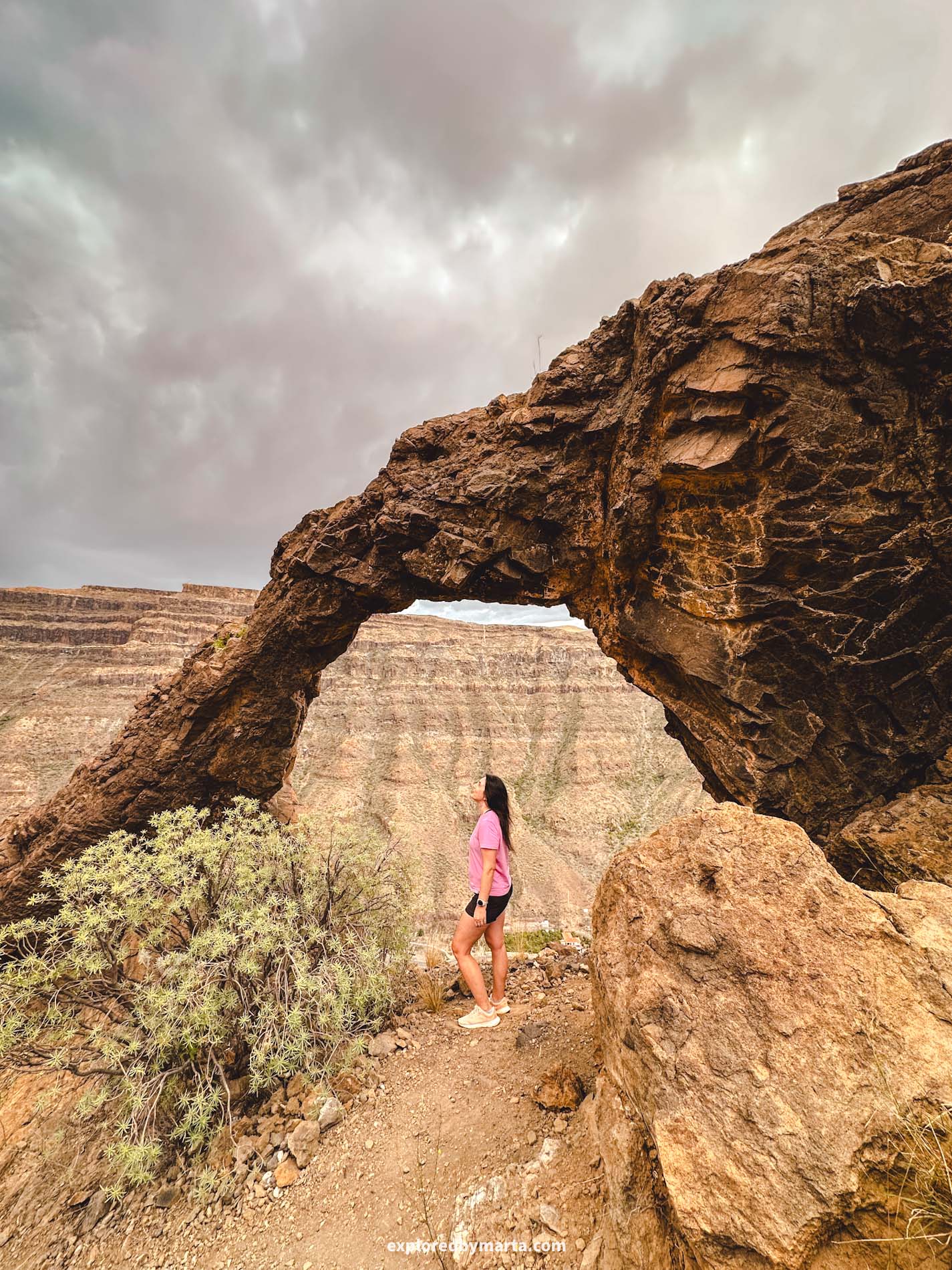
9. Hike to Arco del Elefante
Distance: 2.60 km (out and back)
Difficulty: moderate
Elevation gain: 250 m
Duration: 1h
Okay, so this one isn’t the easiest hike in Gran Canaria, but it certainly is short and beautiful!
If you’re into hiking, chasing epic views, and have brought some hiking gear with you, then you might enjoy this hidden gem in Gran Canaria. I love volcanic rock arches, and this is one of my favorites on the island!
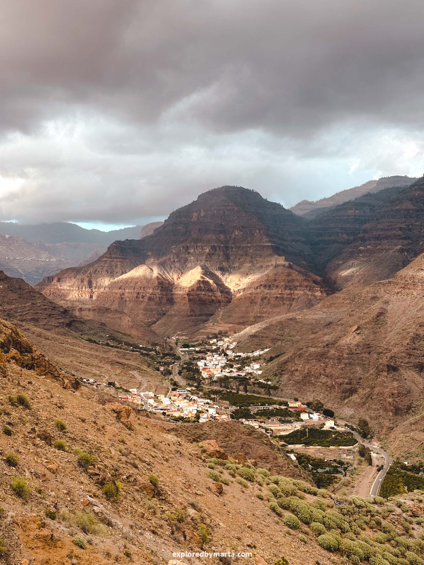
Arco del Elefante is a stunning volcanic rock arch that is shaped like an elephant’s head and trunk, sitting on top of a cliff in southern Gran Canaria, not too far from Puerto de Mogán.
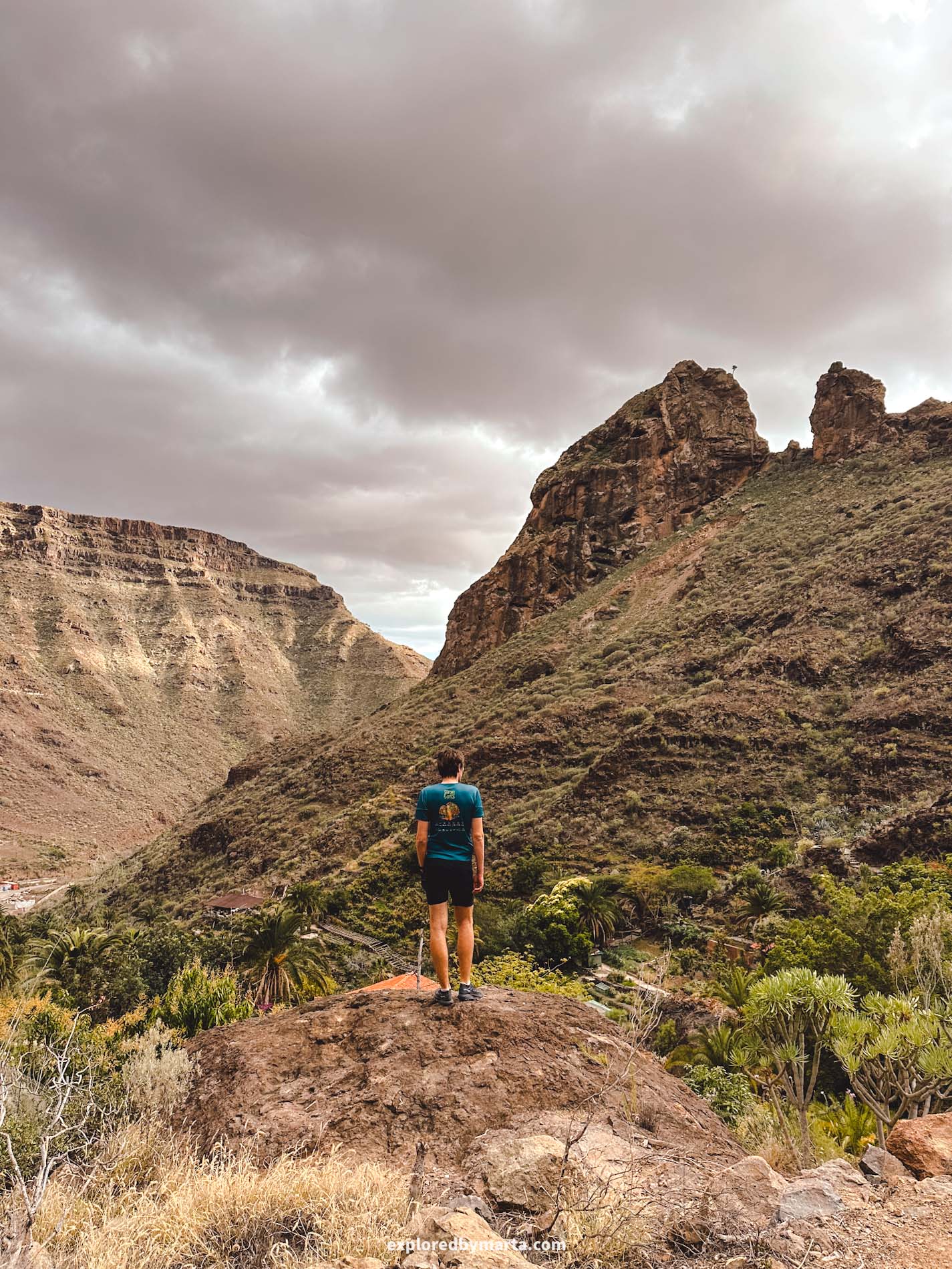
If you’re staying somewhere in the south of the island, you should consider doing this hike. It only took us about 1 hour to hike all the way up and down the mountain.
To reach the arch, you’ll need to drive to the village of El Sao, located inside the Barranco de Arguineguín ravine. From there, park your car by the roadside and hike your way up through the village and then up the cliff.
At first, you’ll follow the village streets. After about 500 meters, you’ll come to a staircase that leads to a path through gardens and along water canals. From there, the trail continues above the houses and up toward the cliff.
Apart from some occasional spray paint and a few stone pyramids, the trail isn’t marked, so make sure to check your map and follow the directions! It’s not too hard, as you can clearly see the arch on top of the mountain from afar.
The path is relatively short – 1.3 kilometers one way – but it’s full of loose stones, which makes it quite unstable and slippery.


Going uphill was fine, but on the way back down, I was literally descending on all fours. I didn’t fall, but I slipped several times – this is exactly why you need good hiking shoes (I had road running shoes, woops!)!
The arch sits on a rocky outcrop at the top of the cliff. There’s very little space next to it, but I managed to get a cool photo with a wide-angle lens. The views over the valley are absolutely spectacular and worth the climb!
Location: Arco del Elefante
Happy exploring!
Gran Canaria, the third-largest of Spain’s Canary Islands, is often called a ‘miniature continent’ thanks to its diverse landscapes – everything from golden sand dunes and volcanic cliffs to lush forests and dramatic mountains.
Gran Canaria is the perfect place to catch some sun during the winter months. We’ve visited this island in the Atlantic Ocean numerous times, often staying for months at a time, yet there are still many more hikes to do and places to discover on the island!
What I love most about Gran Canaria is that it offers exactly what you desire – relaxing on sandy beaches, hiking epic mountain trails, exploring charming villages, or embarking on exciting road trips along the rugged coastline of this iconic Spanish island.
I do hope you enjoy this island as much as we did!
PIN FOR LATER!

